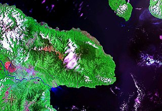
Huon Peninsula is a large rugged peninsula on the island of New Guinea in Morobe Province, eastern Papua New Guinea. It is named after French explorer Jean-Michel Huon de Kermadec. The peninsula is dominated by the steep Saruwaged and Finisterre and Cromwell Mountains. The nearest large town is the Morobe provincial capital Lae to the south, while settlements on the north coast include the former German town of Finschhafen, the district capital of Wasu, Malalamai and Saidor with its World War II era Saidor Airport.

Sakar Island is a volcanic island north-west of New Britain in the Bismarck Sea, at 5.416667°S 148.1°E. It is a stratovolcano with a summit crater lake. No recorded eruptions are known.
Ambres is one of 54 parishes in Cangas del Narcea, a municipality within the province and autonomous community of Asturias, in northern Spain.
San Martín de Sierra is one of 54 parish councils in Cangas del Narcea, a municipality within the province and autonomous community of Asturias, in northern Spain.
Caleao is one of ten parishes in Caso, a municipality within the province and autonomous community of Asturias, in northern Spain.
Porrúa is one of 28 parishes in Llanes, a municipality within the province and autonomous community of Asturias, in northern Spain.
Celles (variant: is one of three parishes in Noreña, a municipality within the province and autonomous community of Asturias, in northern Spain.
Cofiño is one of 17 parishes in Parres, a municipality within the province and autonomous community of Asturias, in northern Spain.
Collía is one of 17 parishes in Parres, a municipality within the province and autonomous community of Asturias, in northern Spain.

Santullano is one of six parishes in Las Regueras, a municipality within the province and autonomous community of Asturias, in northern Spain.
Camuño is one of 28 parishes in Salas, a municipality within the province and autonomous community of Asturias, in northern Spain.

Cornellana is one of 28 parishes in Salas, a municipality within the province and autonomous community of Asturias, in northern Spain.
San Esteban de la Dóriga is one of 28 parishes in Salas, a municipality within the province and autonomous community of Asturias, in northern Spain.
Villamar is one of 28 parishes in Salas, a municipality within the province and autonomous community of Asturias, in northern Spain.
Villazón is one of 28 parishes in Salas, a municipality within the province and autonomous community of Asturias, in northern Spain.
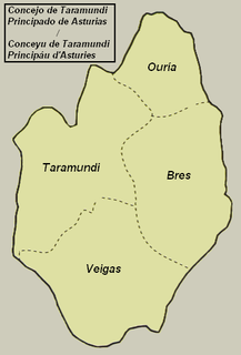
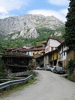
Ouría is one of four parishes in Taramundi, a municipality within the province and autonomous community of Asturias, in northern Spain.
Calleras (Caeras) is one of 44 parishes in Tineo, a municipality within the province and autonomous community of Asturias, in northern Spain.
Carda is one of 41 parishes in Villaviciosa, a municipality within the province and autonomous community of Asturias, in northern Spain.
Argo Island is an island of the Nile in Sudan. The island contains a town of the same name and the Nubian archaeology site of Tabo.

Abra Channel is one of the three channels which connects Magellan Strait with the Pacific Ocean. It is located between the Santa Inés Island and the Jacques Island and ends at the Otway Bay. An incomplete examination by the Sylvia showed it to be a fine navigable passage, but no anchorages were found. It may possibly be of service to a vessel embayed in Otway Bay, enabling her to run into the strait. Abra Island, which stands in the center of the eastern entrance, is 300 feet high and covered with vegetation. The entrance is 2 miles wide, but it soon narrows to 1 mile.