Traspando

Last updated

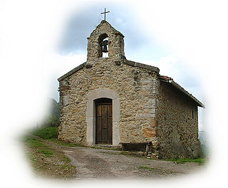
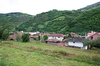
Traspando (variant: Trespando; meaning "transfer") is a parish (administrative division) in Siero, a municipality within the province and autonomous community of Asturias, in northern Spain. It is 4 km (2.5 mi) from the municipality's capital Pola de Siero and is in the heart of the Asturian mining region.

A parish is an administrative division used by several countries. In Ireland and all parts of the British Isles except Scotland and Wales it is known as a civil parish to distinguish it from the ecclesiastical parish.

Siero Municipality in Asturias, Spain

Siero is a municipality of the province and autonomous community of Asturias, in northern Spain. Its capital is Pola de Siero.

Municipality An administrative division having corporate status and usually some powers of self-government or jurisdiction

A municipality is usually a single administrative division having corporate status and powers of self-government or jurisdiction as granted by national and regional laws to which it is subordinate. It is to be distinguished (usually) from the county, which may encompass rural territory or numerous small communities such as towns, villages and hamlets.

Situated at 230 m (750 ft) above sea level, it is 4.10 km2 (1.58 sq mi) in size, with a population of 250 (INE 2006). The postal code is 33518.

Instituto Nacional de Estadística (Spain) Spains principal government institution in charge of statistics and census data

The National Statistics Institute is the official agency in Spain that collects statistics about demography, economy, and Spanish society. It is an autonomous organization in Spain responsible for overall coordination of statistical services of the General State Administration in monitoring, control and supervision of technical procedures. Every 10 years, this organisation conducts a national census. The last census took place in 2011.

Related Research Articles

Tiñana is a parish in Siero, a municipality within the province and autonomous community of Asturias, in northern Spain. It has a surface area of 6.89 km2 (2.66 sq mi) and a population of 1,001 people.

Santa Eulalia de Vigil is a parish in Siero, a municipality within the province and autonomous community of Asturias, in northern Spain. The center is about 3 km (1.9 mi) from the capital, Pola de Siero.

Lugones is a parish in Siero, a municipality within the province and autonomous community of Asturias, in northern Spain.

Feleches is a parish in Siero, a municipality within the province and autonomous community of Asturias, in northern Spain.

Collado (Siero)

Collado (Collao) is a parish in Siero, a municipality within the province and autonomous community of Asturias, in northern Spain. The parish is located on Highway AS-113.

La Collada, Siero

La Collada is a parish in Siero, a municipality within the province and autonomous community of Asturias, in northern Spain.

La Borbolla is one of 28 parishes in Llanes, a municipality within the province and autonomous community of Asturias, in northern Spain. It has a population of 155 inhabitants, and its parish church is dedicated to St. Sebastian.

La Piñera Parish in Asturias, Spain

La Piñera is one of seven parishes in Morcín, a municipality within the province and autonomous community of Asturias, in northern Spain.

Tresali is one of six parishes in Nava, a municipality within the province and autonomous community of Asturias, in northern Spain.

Colombres is one of three parishes in Ribadedeva, a municipality within the province and autonomous community of Asturias, in northern Spain.

Noriega is one of three parishes in Ribadedeva, a municipality within the province and autonomous community of Asturias, in northern Spain.

Alava is one of 28 parishes in Salas, a municipality within the province and autonomous community of Asturias, in northern Spain.

Idarga is one of 28 parishes in Salas, a municipality within the province and autonomous community of Asturias, in northern Spain.

Laneo

Laneo is one of 28 parishes in Salas, a municipality within the province and autonomous community of Asturias, in northern Spain.

Santiago de la Barca is one of 28 parishes in Salas, a municipality within the province and autonomous community of Asturias, in northern Spain.

Soto de los Infantes is one of 28 parishes in Salas, a municipality within the province and autonomous community of Asturias, in northern Spain.

Viescas is one of 28 parishes in Salas, a municipality within the province and autonomous community of Asturias, in northern Spain.

Anes (Samartindianes) is a parish in Siero, a municipality within the province and autonomous community of Asturias, in northern Spain.

Bres (Taramundi)

Bres is one of four parishes in Taramundi, a municipality within the province and autonomous community of Asturias, in northern Spain.

Tuña

Tuña is one of 44 parishes in Tineo, a municipality within the province and autonomous community of Asturias, in northern Spain.

References

Coordinates: 43°22′00″N5°36′00″W / 43.366667°N 5.6°W / 43.366667; -5.6

Geographic coordinate system Coordinate system

A geographic coordinate system is a coordinate system that enables every location on Earth to be specified by a set of numbers, letters or symbols. The coordinates are often chosen such that one of the numbers represents a vertical position and two or three of the numbers represent a horizontal position; alternatively, a geographic position may be expressed in a combined three-dimensional Cartesian vector. A common choice of coordinates is latitude, longitude and elevation. To specify a location on a plane requires a map projection.