Westwood is a commercial and residential neighborhood in the northern central portion of the Westside region of Los Angeles, California. It is the home of the University of California, Los Angeles (UCLA). Bordering the campus on the south is Westwood Village, a major regional district for shopping, dining, movie theaters, and other entertainment.

Pacoima is a neighborhood in Los Angeles, California. It is one of the oldest neighborhoods in the San Fernando Valley region of LA.
Hunts Point is a neighborhood located on a peninsula in the South Bronx of New York City. It is the location of one of the largest food distribution facilities in the world, the Hunts Point Cooperative Market. Its boundaries are the Bruckner Expressway to the west and north, the Bronx River to the east, and the East River to the south. Hunts Point Avenue is the primary street through Hunts Point.

Humboldt Park, one of 77 designated community areas, is on the West Side of Chicago, Illinois. The Humboldt Park neighborhood is known for its dynamic social and ethnic demographic change over the years. The Puerto Rican community has identified strongly with the area since the 1970s. Humboldt Park is also the name of the Chicago Park District's historic 207-acre (0.8 km2) park or public garden adjacent to the community area.

Woodlawn Heights, also known as Woodlawn, is a predominantly Irish-American working class neighborhood at the very north end of the borough of the Bronx in New York City. It is bounded by McLean Avenue to the north, the Bronx River to the east, Woodlawn Cemetery to the south, and Van Cortlandt Park to the west. Woodlawn Heights remains one of the few areas in New York City that still has young Irish immigrants still arriving to the area en masse.
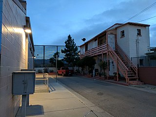
City Heights is a dense urban community in central San Diego, California, known for its ethnic diversity. The area was previously known as East San Diego. City Heights is located south of Mission Valley and northeast of Balboa Park.

Bedford Park is a residential neighborhood in the northwest Bronx, New York City, adjacent to the New York Botanical Garden. Its boundaries, starting from the north and moving clockwise, are: Mosholu Parkway to the north, Webster Avenue to the east, East 196th Street to the south, and Jerome Avenue to the west.

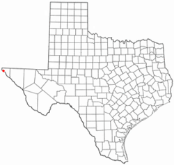
Northeast El Paso is part of the city of El Paso, Texas and is located north of Central El Paso, and east of the Franklin Mountains. Its southern boundary is variously given as Fred Wilson Boulevard or Cassidy Road and Van Buren Avenue, and it extends northward to the New Mexico state line; some portions of this region lie outside the city limits, including parts of Franklin Mountains State Park and areas of Fort Bliss: the Logan Heights area of Fort Bliss around Chapin High School and Castner Range National Monument, an old firing range northwest of Hondo Pass Drive and Gateway South Boulevard. Development of Northeast El Paso, which had begun before the Second World War around the Logan Heights area, started in earnest during the 1950s, when many homes were demolished in the process of the construction of Interstate 10. It is one of the more ethnically diverse areas of town due to a high concentration of military families. Northeast El Paso has historically not developed at a rate comparable to East El Paso and Northwest El Paso, but in recent years, it has seen an increase in development. It is expected that the population in Northeast El Paso will grow more rapidly as a result of the troop increase for Fort Bliss in the coming years. Northeast El Paso has gained recognition throughout the city for schools like Parkland, Irvin, Andress and Chapin because of their outstanding athletic programs.

Chapin High School is a public high school in El Paso, Texas. Chapin is located at the intersection of Dyer Street and Ellerthorpe Avenue. This land is reserved for the United States Government and is a part of the El Paso Independent School District. It is the only high school in the continental United States that is on government property but not owned by the government. The school enrolls over 1,800 students in grades 9 to 12. Nearly half of the students are military dependents from nearby Fort Bliss. The school also accepts students from throughout the city of El Paso as part of its pre-engineering magnet program.

Castle Hill is a neighborhood located in the southeast section of the borough of the Bronx in New York City. Its boundaries are Waterbury Avenue and Westchester Avenue to the north, Westchester Creek to the east, the East River to the south, and White Plains Road to the west. Unionport is a subsection of Castle Hill, typically considered north of Lafayette Avenue.

Park Foothills is a neighborhood in Northeast El Paso. It is located west of U.S. 54 to the Franklin Mountains, and from Mountain Ridge Drive and Atlas Avenue north to the boundary of Castner Range at Hondo Pass Avenue, mainly on a hill known as Wingate Point down which Hondo Pass and Hercules Avenue run, which forms part of the eastern foothills of the Franklin Mountains. It encompasses the officially recognized neighborhoods of Park Foothills and Sunrise Acres West, which includes the area east of Echo Street to the Patriot Freeway. Park Foothills is mainly residential and developed piecemeal as part of a slow ongoing process, consisting of apartment complexes of varying sizes and houses of varying styles built either individually or as part of small developments constructed beginning in the early 1950s, with a commercial area along Gateway South Boulevard at its eastern edge and smaller business districts around the intersections of Hercules Avenue and Leo Street, Magnetic Street and Hondo Pass Avenue, and Zion Drive with Alabama Street. Many of Park Foothills' streets are named for minerals or gemstones or have names with an astronomical theme. Sunrise Park at the center of Park Foothills is its only park of any size.

Sunset Heights is a historic area in El Paso, Texas that has existed since the latter part of the 1890s. Many wealthy residents have had their houses and mansions built on this hill. Although some buildings have been renovated to their former glory, many have been neglected and have deteriorated. An organization, the Sunset Heights Improvement Association, helps neighbors on a fixed income to manage home maintenance and also sponsors an annual tour.
Near Northside is a historic neighborhood located in Northside, Houston, Texas. Near Northside is primarily occupied by people of Hispanic descent.
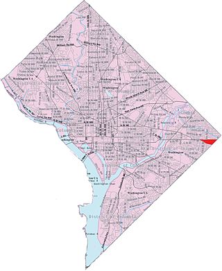
Capitol View is a neighborhood located in southeast Washington, D.C., in the United States. It is bounded by East Capitol Street to the north, Central Avenue SE to the southwest and south, and Southern Avenue SE to the southeast.
North Sacramento is a well-established community that is part of the city of Sacramento, California, United States. It was a city from its incorporation in 1924 until it was merged in 1964 into the City of Sacramento. Incorporation was led by the North Sacramento Chamber of Commerce, incorporated the year before, in 1923.
North Hills is a residential neighborhood in the Northeast section of El Paso, Texas.
Mountain View is a neighborhood in Northeast El Paso, in the city of El Paso, Texas. Its boundaries are commonly considered to be Dyer Street on the west, Railroad Drive on the east, Hondo Pass Avenue on the north, and on the south, Hercules Avenue and the intersection of Diana Drive and Railroad Drive; this includes the city-designated neighborhoods of Las Sierras and Restlawn as well as Mountain View North and South, which lie east of Diana Drive.
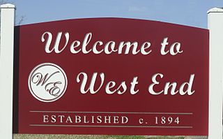
West End is a neighborhood in Houston, Texas, United States located along the Washington Avenue Corridor.

Irvin High School is an El Paso Independent School District (EPISD) high school in El Paso, Texas, United States. It opened in September 1959. It is named for Dr. O.C. Irvin, Dr. E.H. Irvin, and Mr. C. M. Irvin. All three of these men were well-known contributors to the El Paso public schools.
Chihuahuita is a neighborhood in El Paso, Texas. It has also been known as the "First Ward." It is considered the oldest neighborhood in the city. It has also suffered through extreme poverty in its history. It is currently on the Most Endangered Historic Places list as compiled by the National Trust for Historic Preservation. It is located on the border of the Rio Grande at the Mexico–United States border. For most of the twentieth century, the name Chihuahuita was used to refer to all of southern El Paso, often including El Segundo Barrio. In 1991, Chihuahuita was designated as a historic district by the city of El Paso.