
Anglo-Saxon architecture was a period in the history of architecture in England from the mid-5th century until the Norman Conquest of 1066. Anglo-Saxon secular buildings in Britain were generally simple, constructed mainly using timber with thatch for roofing. No universally accepted example survives above ground. Generally preferring not to settle within the old Roman cities, the Anglo-Saxons built small towns near their centres of agriculture, at fords in rivers or sited to serve as ports. In each town, a main hall was in the centre, provided with a central hearth.
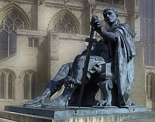
Eboracum was a fort and later a city in the Roman province of Britannia. In its prime it was the largest town in northern Britain and a provincial capital. The site remained occupied after the decline of the Western Roman Empire and ultimately developed into the present-day city of York, in North Yorkshire, England.

The Abbey of St Mary is a ruined Benedictine abbey in York, England and a scheduled monument.

York has, since Roman times, been defended by walls of one form or another. To this day, substantial portions of the walls remain, and York has more miles of intact wall than any other city in England. They are known variously as York City Walls, the Bar Walls and the Roman walls. The walls are generally 13 feet (4m) high and 6 feet (1.8m) wide. They are the longest town walls in England.

Stanwick Iron Age Fortifications, a huge Iron Age hill fort, sometimes but not always considered an oppidum, comprising over 9 kilometres (5.6 mi) of ditches and ramparts enclosing approximately 300 hectares of land, are situated in Richmondshire, North Yorkshire, England. Whether Stanwick was the stronghold of Venutius or Cartimandua, or perhaps of them both for a brief time before their acrimonious split some time after 51 AD, it is certain that this settlement was one of the most important in Brigantia, the Brigantes kingdom during the early stages of the Roman occupation of Britain. The site is a scheduled monument.

The York Archaeological Trust for Excavation and Research Limited (YAT) is an educational charity, established in 1972 in the city of York, England, and trading under the York Archaeology brand. The charity presents archaeology to the public through visitor attractions and events, and its commercial arm carries out archaeological investigations, fieldwork, excavation and research in York and throughout Britain and beyond.

The history of York, England, as a city dates to the beginning of the first millennium AD but archaeological evidence for the presence of people in the region of York dates back much further to between 8000 and 7000 BC. As York was a town in Roman times, its Celtic name is recorded in Roman sources ; after 400, Angles took over the area and adapted the name by folk etymology to Old English Eoforwīc or Eoforīc, which means "wild-boar town" or "rich in wild-boar". The Vikings, who took over the area later, in turn adapted the name by folk etymology to Norse Jórvík meaning "wild-boar bay", 'jór' being a contraction of the Old Norse word for wild boar, 'jǫfurr'. The modern Welsh name is Efrog.
York had around 45 parish churches in 1300. Twenty survive, in whole or in part, a number surpassed in England only by Norwich, and 12 are used for worship. This article consists of a list of medieval churches which still exist in whole or in part, and a list of medieval churches which are known to have existed in the past but have been completely demolished.
The York Museum Gardens are botanic gardens in the centre of York, England, beside the River Ouse. They cover an area of 10 acres (4.0 ha) of the former grounds of St Mary's Abbey, and were created in the 1830s by the Yorkshire Philosophical Society along with the Yorkshire Museum which they contain.

Kamianets-Podilskyi Castle is a former Ruthenian-Lithuanian castle and a later three-part Polish fortress located in the historic city of Kamianets-Podilskyi, Ukraine, in the historic region of Podilia in the western part of the country. Its name is attributed to the root word 'kamin', from the Slavic word for 'stone'.

Coppergate Shopping Centre is a shopping centre in York in North Yorkshire, England. It is named after Coppergate, one of York's medieval streets.

Caerleon Roman Fortress and Baths encompass the archaeological ruins and sites of the Legionary Fortress of Isca Augusta spread across the town of Caerleon, near the city of Newport, South Wales. Notable for being one of only three permanent legionary fortresses from Roman Britain, Caerleon has provided a unique opportunity to study the archaeology of a Roman Legionary fortress, less affected by the medieval and subsequent urban activity of most such fortresses. Having attracted the attention of eminent archaeologists throughout the 20th century it now has four major public archaeological venues, including the museum run by Cadw, called 'Caerleon Roman Fortress and Baths', featuring the excavated fortress bath-house. Also open to the public is the most complete excavated amphitheatre in Britain, a series of barracks and the National Roman Legion Museum. The fortress and its surrounding civil settlement have been the subject of continuing major archaeological investigations into the 21st century.
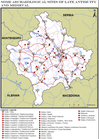
Part of series of articles upon Archaeology of Kosovo

Kurvingrad or Koprijan (Копријан), is a ruined fortress which sits above the town of Doljevac on the South Morava river, 11 km south of the town of Niš. The ruins are all that remain of the medieval town of Koprijan from the time of Classical antiquity; the fortress is over a thousand years old. Today, fortifications remain, but have not been substantially studied.
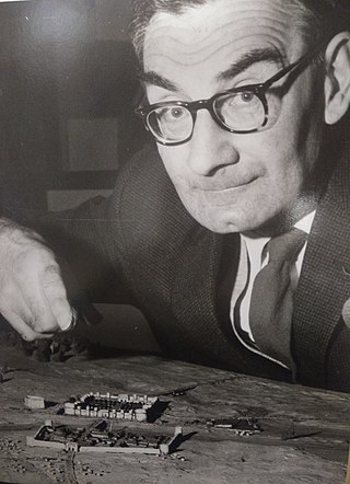
Leslie Peter Wenham FSA was a British archaeologist, historian, and professor who excavated in York, on Hadrian's Wall and Malton. He was the first to produce a comprehensive report of a Romano-British Cemetery.

Nebet Tepe is one of the hills of Plovdiv where the ancient town was founded. The earliest settlements on Nebet Tepe are dated back to 4000 BC. The site was first settled by Thracians, later expanded by Philip II of Macedon and the Roman empire. As the town expanded, Nebet Tepe became the citadel of the town's acropolis. There are remains of the city's walls, towers, and a postern from the time of Justinian leading down to the Maritsa river. Today, the archaeological complex on the hill is one of the most popular tourist sights in Plovdiv and a cultural monument of national significance.
Jeffrey Radley was a British archaeologist and poet.
Ailsa Jean Mainman is a British archaeologist and pottery specialist.
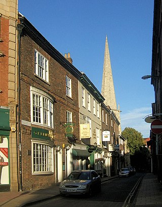
Castlegate is a historic street in York, England, which leads to York Castle.
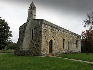
The Chapel of St Mary Magdalen, Ripon, is an active Anglican church on Magdalens Road in the city of Ripon, North Yorkshire, England. The chapel, which is dedicated to Jesus' companion Mary Magdalene, is quite close to Ripon Cathedral, and belongs to the cathedral's benefice, deanery and archdeaconry. The chapels' origins lie in the 12th century when it was built at the behest of Archbishop Thurstan. It was situated opposite the St Mary Magdalen Hospital grounds, becoming the chapel to the hospital and the church for lepers initially, and then later, blind priests.

