Aniwa Airport

Last updated
Aniwa Airport
Summary
Airport type Public
Serves Aniwa, Taféa, Vanuatu
Elevation  AMSL 69 ft / 21 m
Coordinates 19°14′04″S169°36′02″E / 19.23444°S 169.60056°E / -19.23444; 169.60056 Coordinates: 19°14′04″S169°36′02″E / 19.23444°S 169.60056°E / -19.23444; 169.60056
Map
Vanuatu relief location map.jpg
Airplane silhouette.svg
AWD
Location of airport in Vanuatu
Runways
Direction Length Surface
m ft
940 3,084
Source: [1] [2]

Aniwa Airport( IATA : AWD, ICAO : NVVB) is an airfield on the island of Aniwa, in the Taféa province in Vanuatu. [1]

An IATA airport code, also known as an IATA location identifier, IATA station code or simply a location identifier, is a three-letter code designating many airports around the world, defined by the International Air Transport Association (IATA). The characters prominently displayed on baggage tags attached at airport check-in desks are an example of a way these codes are used.

ICAO airport code four-letter code designating many airports around the world

The ICAOairport code or location indicator is a four-letter code designating aerodromes around the world. These codes, as defined by the International Civil Aviation Organization and published in ICAO Document 7910: Location Indicators, are used by air traffic control and airline operations such as flight planning.

Aniwa Island Island in Tafea Province, Vanuatu

Aniwa is a small island in the southernmost province of Tafea, Vanuatu.

Contents

Facilities

The airport resides at an elevation of 69 feet (21 m) above mean sea level. It has one runway which is 940 metres (3,084 ft) in length. [1]

Elevation Height of a geographic location above a fixed reference point

The elevation of a geographic location is its height above or below a fixed reference point, most commonly a reference geoid, a mathematical model of the Earth's sea level as an equipotential gravitational surface . The term elevation is mainly used when referring to points on the Earth's surface, while altitude or geopotential height is used for points above the surface, such as an aircraft in flight or a spacecraft in orbit, and depth is used for points below the surface.

Runway Area of surface used by aircraft to takeoff from and land on

According to the International Civil Aviation Organization (ICAO), a runway is a "defined rectangular area on a land aerodrome prepared for the landing and takeoff of aircraft". Runways may be a man-made surface or a natural surface.

Airlines and destinations

AirlinesDestinations
Air Vanuatu Dillon's Bay, Futuna, Ipota, Tanna

Related Research Articles

Air Vanuatu national airline of Vanuatu, founded in 1981

Air Vanuatu is an airline with its head office in the Air Vanuatu House, Port Vila, Vanuatu. It is Vanuatu's national flag carrier, operating to Australia, New Zealand and points in the South Pacific. Its main base is Bauerfield International Airport, Port Vila.

Tafea Province province of Vanuatu

Tafea is the southernmost of the six provinces of Vanuatu.

Tanna (island) island

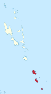
Tanna is an island in Tafea Province of Vanuatu.

The nine South Vanuatu languages form a family of the Southern Oceanic languages, spoken in Tafea Province of Vanuatu.

Fut or FUT may refer to:

Futuna-Aniwa is a language spoken in the Tafea Province of Vanuatu on the outlier islands of Futuna and Aniwa. The language has approximately 1,500 speakers. It is a Polynesian language, part of the Austronesian language family.

Tafea F.C. association football club

Tafea Football Club is a soccer team from Port Vila in Vanuatu.

Futuna Airport

Futuna Airport is an airfield on the island of Futuna, in the Taféa province in Vanuatu.

Anatom Airport

Anatom Airport, also known as Aneityum Airport, is an airfield serving the island of Aneityum, in the Taféa province in Vanuatu. The airfield is actually located on the smaller Inyeug island.

Dillons Bay Airport

Dillon's Bay Airport is an airfield near Dillon's Bay on the island of Erromango, in the Taféa province in Vanuatu.

Ipota Airport

Ipota Airport is an airfield near Ipota on the island of Erromango, in the Taféa province in Vanuatu. It is one of two airfields in the island, the other being Dillon's Bay Airport in the west.

Whitegrass Airport

Whitegrass Airport, also known as White Grass Airport or Tanna Airport, is an airport on the island Tanna, in the Taféa province in Vanuatu.

Moise Poida is a Vanuatuan football manager and former player. He manages the Vanuatu men's national team and he has been a former manager of club side Tafea. Poida has also managed the Vanuatu men's under-20 national team and Vanuatu men's under-23 national team. As a player, Poida made 21 appearances for the national team and scored three goals as a winger and midfielder. At club level, he played for Tafea F.C. for his entire career. In 2008 Poida played for an Oceanian representative side against a team that included members of France's 1998 FIFA World Cup winning team. The game included players such as Zinedine Zidane, Christian Karembeu and Robert Pires.

Vanuatu, officially known as the Republic of Vanuatu, is an island nation located in the South Pacific Ocean. The archipelago, which is of volcanic origin, is some 1,750 kilometres (1,090 mi) east of northern Australia, 500 kilometres (310 mi) north-east of New Caledonia, west of Fiji, and southeast of the Solomon Islands, near New Guinea. The nation's largest town and the capital Port Vila is situated on Efate Island.

Richard Iwai is a former Vanuatuan international footballer who played most of his career for Tafea as a forward. He's currently assistant coach of Ifira Black Bird and the head coach of the Vanuatu under-23 team.

A by-election was held in the constituency of the Southern Islands in Vanuatu in December 2009.

Inyeug island

Inyeug Island is a small uninhabited island in Tafea Province of Vanuatu in the Pacific Ocean. "Inyeug" means "Small Island" in a local language. Inyueg is also called Mystery Island by the cruise ships that regularly visit the island.

References

  1. 1 2 3 Airport information for Aniwa, Taféa, Vanuatu (NVVB / AWD) at Great Circle Mapper.
  2. Aniwa Airfield coordinates from WikiMapia

The Aviation Safety Network (ASN) is a website that keeps track of aviation accidents, incidents, and hijackings. Their database contains details of over 10,700 reports. The ASN includes an aviation database with aviation investigations, news, photos, and statistics.