Anola

Last updated

Anola
Anola sign.jpg
Motto: 
"Share in our Future... Invest in your Community..."
Canada Manitoba location map 2.svg
Red pog.svg
Anola
Location of Anola in Manitoba
Coordinates: 49°53′06″N96°38′08″W / 49.88500°N 96.63556°W / 49.88500; -96.63556
Country Canada
Province Manitoba
Region Eastman
Rural Municipality Springfield
Established1907
Government
  MayorTiffany Fell [1]
  CouncillorValerie Ralke
   MP ProvencherTed Falk
Elevation
255 m (838 ft)
Population
 (2016)
  Total3,829 [2]
 RM of Springfield Ward 4
Time zone UTC-6 (Central (CST))
  Summer (DST) UTC-5 (Central (CDT))
Postal code
FSA
R5L
Area code(s) 204, 431, 584
Website anola.mb.ca

Anola is an unincorporated community in the Canadian province of Manitoba. It is located 24 kilometres (15 miles) east of Winnipeg and 40 kilometres (25 miles) north of Steinbach in the Rural Municipality of Springfield. The community has a population of approximately 200 people. [3]

Contents

History

The Anola area is part of the traditional territory of Anishnaabe and Swampy Cree First Nations. In 1870, the area became part of the new province of Manitoba. In 1871, the area was covered under Treaty 1 between the British Crown and the First Nations. The treaty facilitated the settlement of southern Manitoba including agricultural settlements in the Anola area.

In 1907, when the Grand Trunk Pacific Railway expressed an interest in the district, the land was sold, and the village of Free Port was born. The name changed in 1912 to Anola. [4]

Etymology

According to the Department of the Interior, the name Anola is an "invented name," and the place was formerly known as Richland Post Office. [5] A 1905 letter from M. Holloway, who ran the Richland Post Office which served the area, may have prompted this conclusion. In his correspondence to the Geographic Board of Canada, it was indicated that residents were unaware of why it was so named except "as a more convenient means of referring to it than Township 10-7E." [4]

Ted Stone states in his book The Story behind Manitoba Names:

Locals sometimes ascribe the name to the rise in elevation there. The area is on a slight but perceptible, ridge. According to this theory it's on "a knoll," which gave rise to the name Anola. Others have suggested that Anola is named after the wife of a railway official. This theory has some credence since Anola comes at the end of a series of rail points (Elma, Hazel, Vivian) using women's first names. It's likely that the same official named at least two of these towns after one or more daughters. Since all four towns received their names at about the same time, Elma, Hazel, Vivian and Anola may have been sisters. Or perhaps the local legend is correct and Anola was the mother of the other three. [6]

Amenities

Anola has a K-8 school. Anola school offers a wide array of programming including French, band, music, choir, grade 6-8 life options, resource, counselling, inter/intra-school athletics, and school-wide talent development program.

Anola is home to The 10 Acre Woods, a petting farm and animal rescue centre. [7]

In mid 2019, Canada Post began the process of "Urbanizing" the Anola and surrounding area's postal system, thus transitioning Anola addresses from the rural Postal Code R0E 0A0 to the new Forward Sortation Area of R5L.[ citation needed ]

Notable people

Related Research Articles

<span class="mw-page-title-main">Corey Koskie</span> Canadian baseball player (born 1973)

Cordel Leonard "Corey" Koskie is a Canadian former professional baseball third baseman, who played in Major League Baseball for the Minnesota Twins, Toronto Blue Jays, and Milwaukee Brewers. On February 4, 2015, Koskie was elected to the Canadian Baseball Hall of Fame.

<span class="mw-page-title-main">Transcona, Winnipeg</span> Suburb of Winnipeg

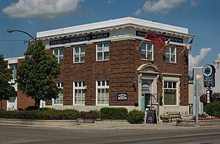
Transcona is a ward and suburb of Winnipeg, Manitoba, located about 10 kilometres (6.2 mi) east of the downtown area.

<span class="mw-page-title-main">Rural Municipality of Hanover</span> Rural municipality in Manitoba, Canada

The Rural Municipality of Hanover is a rural municipality (RM) in southeastern Manitoba, Canada, located southeast of Winnipeg in Division No. 2.

The name Elmwood Giants has been used since 1905 by various Canadian baseball teams based in the Elmwood community of Winnipeg, Manitoba.

The Sagkeeng First Nation is a Treaty-1 First Nation in the Eastman Region of Manitoba, Canada, that is composed of the Anishinaabe people indigenous to the area at or near the Fort Alexander Indian Reserve #3 located along the Winnipeg River and Traverse Bay. Today, Sagkeeng holds territory in the southern part of Lake Winnipeg, 120 kilometres (75 mi) north of the city of Winnipeg, and on the mainland.

Provincial Trunk Highway 15 is a provincial highway in the Canadian province of Manitoba. It runs from Winnipeg's Perimeter Highway east to Elma where it ends at PTH 11. PTH 15 and the portion of Route 115 east of PTH 59 are collectively known as Dugald Road.

Old Kildonan is the northernmost city ward of Winnipeg, Manitoba. Before the City of Winnipeg Act of 1972, it was an independent unincorporated municipality called the Municipality of Old Kildonan; prior to that, from 1914, it was a subdivision of the Rural Municipality of Kildonan.

St. Vital is a ward and neighbourhood of Winnipeg, Manitoba, Canada.

North Kildonan is a city ward in northern Winnipeg, and a former municipality in Manitoba, Canada. Its population was of 2016 was 44,664.

<span class="mw-page-title-main">St. James-Assiniboia, Winnipeg</span> Suburb in Winnipeg, Manitoba, Canada

St. James-Assiniboia is a major community area in Winnipeg, Manitoba, Canada. As it encapsulates most of the city ward of St. James, which includes the major St. James Street, the area itself is often simply referred to "St. James."

<span class="mw-page-title-main">Carberry, Manitoba</span> Town in Manitoba, Canada

Carberry is a town in southwestern Manitoba, Canada. It is situated 3 kilometres (1.9 mi) south of the Trans-Canada Highway on Highway 5 in the Municipality of North Cypress – Langford, and has a population of 1,818 people.

<span class="mw-page-title-main">Rural Municipality of Springfield</span> Rural municipality in Manitoba, Canada

Springfield is a rural municipality (RM) in Manitoba, Canada. It stretches from urban industrial development on the eastern boundary of the city of Winnipeg, through urban, rural residential, agricultural and natural landscapes, to the Agassiz Provincial Forest on the municipality's eastern boundary. Birds Hill Provincial Park nestles into the north-western corner of Springfield.

<span class="mw-page-title-main">Elma, Manitoba</span> Place in Manitoba, Canada

Elma, Manitoba, is an unincorporated community of approximately 100 people in southeast Manitoba. It is located on the Whitemouth River, at the junction of Highway 15 and Highway 11 in the Rural Municipality of Whitemouth.

Île-des-Chênes is an unincorporated community in Manitoba, Canada, within the Rural Municipality of Ritchot. The community is located 13 kilometres south-east of the provincial capital Winnipeg, just east of Highway 59. Île-des-Chênes is a French name, translating to Island of the Oaks, coming from a nearby stand of oaks on higher ground, where early settlers sought refuge from the annual spring floodwaters.

<span class="mw-page-title-main">St. Adolphe, Manitoba</span> Place in Manitoba, Canada

St. Adolphe, or Saint Adolphe, originally called Pointe-Coupée, is a community in the Rural Municipality of Ritchot, Manitoba, Canada. It is located along the east bank of the Red River, approximately 12 kilometres south of Winnipeg.

<span class="mw-page-title-main">Manitoba Highway 12</span> Highway in Manitoba

Provincial Trunk Highway 12 is a provincial primary highway located in the Canadian province of Manitoba. Lying entirely in the Eastman Region, it runs from the U.S. border to a dead end in Grand Beach. PTH 12 forms the Manitoba section of MOM's Way, a tourist route from Thunder Bay to Winnipeg. PTH 12 is primarily a two-lane highway except for two four-lane stretch between Steinbach and PTH 1 and a ten-kilometre concurrency with PTH 44.

Ste. Rita is an unincorporated community in the Rural Municipality of Reynolds, Manitoba, located on Manitoba Highway 15 and east of Winnipeg.

Grande Pointe is a place in the province of Manitoba, Canada, that is designated as both an unincorporated community and a settlement. It is located 15 km (9.3 mi) southeast of downtown Winnipeg within the Rural Municipality of Ritchot.

Glenlea is a hamlet in Manitoba, Canada. It is named for the farm of C. H. McWatt, the first postmaster of the community, which in turn was presumably named for his home in Scotland.

References

  1. "Mayor & Council".
  2. RM of Springfield website "Ward Boundary Survey" https://www.rmofspringfield.ca/p/ward-boundary-survey
  3. McKean, Mark. "Anola Community Website".
  4. 1 2 "About Anola". anola.mb.ca. Retrieved August 8, 2021.
  5. Place Names of Manitoba, Department of the Interior, for the Geographic Board of Canada (1933)
  6. Stone, Ted (September 11, 2006). The Story behind Manitoba Names: How Cities, Towns, Villages and Whistle Stops got their Names . Red Deer Press. ISBN   978-0889953413.
  7. Olson, Matthew (April 24, 2017). "They're not kidding: goats add to yoga experience". Winnipeg Free Press. p. B3.
  8. "Corey Koskie Stats, Fantasy & News". MLB.com. Retrieved July 22, 2019.