Lauricocha is a lake in the Cordillera Blanca in the Andes of Peru. It is located in the Ancash Region, Asunción Province, Chacas District. Lauricocha lies south-west of the lake Yanacocha, south of Paqarisha Lake and north-east of the mountain Pomabamba.

Huacracocha is a lake in Peru located in the Junín Region, Yauli Province, Morococha District. It lies southeast of the mountain Anticona and south of the mountain Yanashinga, near the Ticlio (Anticona) mountain pass.

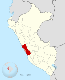
Putka is a mountain in the Cordillera Central in the Andes of Peru, about 5,100 metres (16,732 ft) high. It is slocated in the Lima Region, Huarochirí Province, Chicla District.
Qullqi is a 5,038-metre-high (16,529 ft) mountain in the Andes of Peru. It is situated in the Lima Region, Huarochirí Province, Huanza District. Qullqi lies east of the Qiwlla River (Quiula) and west of the Qullqi valley (Collque). One of the nearest places is Qullqi (Collque) southeast of the mountain.
Suyruqucha is a 5,252-metre-high (17,231 ft) mountain in the Cordillera Central in the Andes of Peru and the name of a little lake near the mountain. The peak of the mountain lies in the Lima Region, Huarochirí Province, on the border of the districts of Huarochirí, San Damian and San Mateo. It is situated southeast of Uqhu.
Uqhu or Ukhu is a 5,262-metre-high (17,264 ft) mountain in the Cordillera Central in the Andes of Peru. It is located in the Lima Region, Huarochirí Province, on the border of the districts of San Damian and San Mateo. Uqhu is situated northwest of the mountain named Suyruqucha. A little lake called Suyruqucha lies at its feet.
Wararayuq is a 5,354-metre-high (17,566 ft) mountain in the Paryaqaqa mountain range in the Andes of Peru. It is located in the Lima Region, Huarochirí Province, Quinti District. Wararayuq lies northwest of Qullqi P'ukru.
Inka Kancha is a 5,146-metre-high (16,883 ft) mountain in the Andes of Peru. It is situated in the Lima Region, Huarochiri Province, Chicla District. Inka Kancha lies near the Antikuna mountain pass, south of Sillaqaqa.
P'iti is a 5,117-metre-high (16,788 ft) mountain in the Andes of Peru. It is situated in the Lima Region, Huarochirí Province, Huanza District. P'iti lies northeast of a lake named P'itiqucha.
Yawriq is a 5,235-metre-high (17,175 ft) mountain in the Cordillera Central in the Andes of Peru. It lies in the Lima Region, Huarochirí Province, on the border of the districts of Huarochirí and San Mateo. Yawriq is situated northeast of Suyruqucha.
Utush Mikhunan is a 5,228-metre-high (17,152 ft) mountain in the Cordillera Central in the Andes of Peru. It lies in the Lima Region, Huarochirí Province, on the border of the districts of San Damian and San Mateo. Utush Mikhunan is situated northwest of Uqhu and Suyruqucha.
Mulli is a mountain in the Cordillera Central in the Andes of Peru, about 5,000-metre (16,404 ft) high. It lies in the Lima Region, Huarochirí Province, San Damian District. It is situated on a ridge southwest of Utush Mikhunan is situated northwest of Uqhu and Suyruqucha.
Ukrupata is a mountain in the Andes of Peru, about 5,300 m (17,388 ft) high. It is situated in the Lima Region, Huarochirí Province, on the border of the districts of Chicla and Carampoma. Ukrupata lies northwest of Millpu and east of Wamp'ar and the two lakes named Wamp'arqucha and Wachwaqucha.
Wamp'ar is a mountain in the Andes of Peru, about 4,800 m (15,748 ft) high. It is situated in the Lima Region, Huarochirí Province, Carampoma District. Wamp'ar lies west of Ukrupata and northeast and east of the two lakes named Wachwaqucha and Wamp'arqucha.
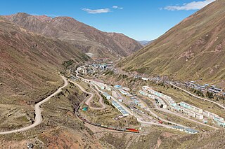
Chuqi Chukchu is a 5,154-metre-high (16,909 ft) mountain in the Cordillera Central in the Andes of Peru. It is situated in the Lima Region, Huarochiri Province, Chicla District. Chuqi Chukchu lies near the Antikuna mountain pass, northwest of Wayrakancha and northeast of Quñuq P'ukru. The mining village of Q'asa P'allqa (Casapalca) lies at its feet.
Nina Ukru is a mountain in the Paryaqaqa or Waruchiri mountain range in the Andes of Peru, about 5,400 metres (17,717 ft) high. It is situated in the Lima Region, Huarochirí Province, Quinti District. Nina Ukru lies southwest of Qullqip'ukru and west of Paryaqaqa.
Wiqu is a mountain in the Paryaqaqa or Waruchiri mountain range in the Andes of Peru, about 5,200 m (17,060 ft) high. It is located in the Lima Region, Huarochirí Province, Quinti District, and in the Yauyos Province, Tanta District. Wiqu lies southwest of Paryaqaqa and northeast of Parya Chaka.
Qarwa Ranra is a mountain in the La Viuda mountain range in the Andes of Peru, about 5,000 metres (16,404 ft) high. It is situated in the Lima Region, Huarochirí Province, on the border of the districts of Carampoma and Matucana. It lies northwest of Yana Yana.
Rukutu is a mountain in the Cordillera Central in the Andes of Peru, about 4,800 metres (15,748 ft) high. It is situated in the Lima Region, Huarochirí Province, on the border of the districts of Huarochirí and San Damian. It lies south of Suyruqucha and Suqlla, and northeast of Wamanripa.
Kunkus Yantaq is a 5,354-metre-high (17,566 ft) mountain in the Paryaqaqa mountain range in the Andes of Peru. It is located in the Lima Region, Huarochirí Province, San Mateo District. Kunkus Yantaq lies southeast of Qullqayuq.