The Purus River is a tributary of the Amazon River in South America. Its drainage basin is 371,042 km2 (143,260 sq mi), and the mean annual discharge is 11,207 m3/s (395,800 cu ft/s). The river shares its name with the Alto Purús National Park as well as the Purús Province, one of the four provinces of Peru in the Ucayali Region.

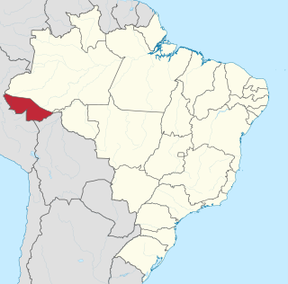
Acre is a state located in the west of the North Region of Brazil and the Amazonia Legal. Located in the westernmost part of the country, at a two-hour time difference from Brasília, Acre is bordered clockwise by the Brazilian states of Amazonas and Rondônia to the north and northeast, the Bolivian department of Pando to the southeast, and the Peruvian regions of Madre de Dios, Ucayali and Loreto to the south and west.

Manaus is the capital and largest city of the Brazilian state of Amazonas. It is the seventh-largest city in Brazil, with an estimated 2020 population of 2,219,580 distributed over a land area of about 11,401 km2 (4,402 sq mi). Located at the east center of the state, the city is the center of the Manaus metropolitan area and the largest metropolitan area in the North Region of Brazil by urban landmass. It is situated near the confluence of the Negro and Solimões rivers.

The Araguaia River is one of the major rivers of Brazil though it is almost equal in volume at its confluence with the Tocantins. It has a total length of approximately 2,627 km.

The Acre River is a 680 kilometres (420 mi) long river in central South America.

Porto Acre is a municipality located in the northeast of the Brazilian state of Acre. The economy is mainly based on agriculture. As of 2020 the municipality had an estimated population of 18,824.

Novo Aripuanã is a municipality located in the Brazilian state of Amazonas.

The Acurauá River (Portuguese: Rio Acurauá is a river of Acre and Amazonas states in western Brazil. It is a tributary of the Tarauacá River.

The Gregório River (Portuguese: Rio Gregório is a river of Amazonas and Acre states in western Brazil. It is a tributary of Juruá River.

Aripuanã River is a river in the Mato Grosso and Amazonas states in north-western Brazil. It is a tributary of the Madeira River in the Amazon Basin. The town of Novo Aripuanã is located on its banks where it merges into the Madeira River. The town of Aripuanã is also on its banks, but on the upper (southern) section of the river.

Madeirinha River is a river of Mato Grosso and Amazonas states in north-western Brazil, a left tributary of the Roosevelt River.

Urubu River is a river in Amazonas state in north-western Brazil. It is a tributary of the Amazon River, and it branches to the north near the town of Itacoatiara. It is a blackwater river.

The Cuminapanema River is a river of Pará state in north-central Brazil, a tributary of the Curuá River.

The Jari River is a river in the state of Amazonas, Brazil, a tributary of the Purus River.

The Rio Gregório State Forest is a state forest in the state of Acre, Brazil. The main economic activity is latex (rubber) extraction.

The Antimary State Forest is a state forest in the state of Acre, Brazil. It was the first state forest in Acre, established with the goal of understanding and implementing sustainable forest exploitation, including extraction of nuts and rubber as well as selective extraction of timber. It has been extensively studied and discussed internationally as a model of sustainable forest management.

The Manicoré State Forest is a state forest in the state of Amazonas, Brazil.

The Cujubim Sustainable Development Reserve is a sustainable development reserve in the state of Amazonas, Brazil.

The Ituxi Extractive Reserve is an extractive reserve in the state of Amazonas, Brazil.

The Rio Doce State Park is a state park in the state of Minas Gerais, Brazil. It protects a large remnant of Atlantic Forest, and includes a system of lagoons rich in species of native fish.


