Antrim, Nova Scotia

Last updated
Antrim, Nova Scotia
Rural Community
Antrim, Nova Scotia.png
Canada Nova Scotia location map 2.svg
Red pog.svg
Coordinates: 44°58′17″N63°22′57″W / 44.97139°N 63.38250°W / 44.97139; -63.38250
CountryFlag of Canada (Pantone).svg  Canada
ProvinceFlag of Nova Scotia.svg  Nova Scotia
Municipality Halifax Regional Municipality
Time zone UTC-4 (AST)
  Summer (DST) UTC-3 (ADT)
Canadian Postal Code
B0N 2H0
Area code 902
Telephone Exchange 384

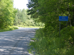
Antrim is a rural community in the Northwestern part of the Halifax Regional Municipality in the Musquodoboit Valley on the Antrim Road off Route 212.

According to the majority of residents, Antrim borders Carroll's Corner where the pavement on Antrim Road meets the gravel section. It was first settled by the Kerrs, McMichael and McMullin families who came from Antrim in Northern Ireland. The community's early name was New Antrim. [1]

Antrim is home to the 69 hectare Antrim Demonstration Woodlot, a woodlot under the management of Nova Forest Alliance. It was developed in 1998 as part of Canada's Model Forest Program. [2]

Antrim Farms Ltd. is a large dairy farming operation run by the Schuurmans family.

Antrim was hit by a tornado on July 22, 2021.

Related Research Articles

<span class="mw-page-title-main">Newtownabbey Borough Council</span> Local authority in Northern Ireland

Newtownabbey Borough Council was a Local Authority in County Antrim in Northern Ireland, on the north shore of Belfast Lough just immediately north of Belfast. The Council merged with Antrim Borough Council in April 2015 under local government reform in Northern Ireland to form Antrim and Newtownabbey Borough Council.

<span class="mw-page-title-main">David Ford (politician)</span> Former Leader of the Alliance Party of Northern Ireland

David Ford is a former Northern Irish politician, who was leader of the Alliance Party of Northern Ireland from October 2001 until October 2016 and was Northern Ireland Minister of Justice from April 2010 until May 2016. He was a Member of the Northern Ireland Assembly (MLA) for South Antrim from 1998 to 2018.

<span class="mw-page-title-main">Spryfield</span> Suburban Community in Halifax, Nova Scotia, Canada

Spryfield is community within the urban area of Halifax, Nova Scotia, Canada.

<span class="mw-page-title-main">Kemptville</span> Unincorporated community in Ontario, Canada

Kemptville is a community located in the Municipality of North Grenville in Eastern Ontario, Canada in the northernmost part of the United Counties of Leeds and Grenville. It is located approximately 56 km (35 mi) south of the downtown core of Ottawa and 2.5 to 3 km south of the Rideau River.

Mount Albert is a village located within the Town of East Gwillimbury and is part of York Region. It is located 65 km north-east of Toronto, 21 km south of Sutton, 45 km west-southwest of Beaverton and 30 km north of Markham. Mount Albert is accessible by Highway 404 and Highway 48.

<span class="mw-page-title-main">Glens of Antrim</span> Series of valleys in County Antrim, Northern Ireland

The Glens of Antrim, known locally as simply The Glens, is a region of County Antrim, Northern Ireland. It comprises nine glens (valleys), that radiate from the Antrim Plateau to the coast. The Glens are an area of outstanding natural beauty and are a major tourist attraction in north Antrim.

<span class="mw-page-title-main">Cushendall</span> Village in County Antrim, Northern Ireland

Cushendall, formerly known as Newtownglens, is a coastal village and townland in County Antrim, Northern Ireland. It is located in the historic barony of Glenarm Lower and the civil parish of Layd, and is part of Causeway Coast and Glens district.

The Battle of Glentaisie, was an Irish battle fought in the north of Ulster on 2 May 1565. The result was a victory for Shane O'Neill over the Clan MacDonald of Dunnyveg. The conflict was a part of the political and military struggle, involving the English and occasionally the Scots, for control of northern Ireland. Although the MacDonalds were a Scottish family, based principally on the island of Islay in the Hebrides, they had long been associated with the Gaelic polity rather than the Kingdom of Scotland.

Windsor, Ontario, has a very diverse population, and this diversity is shown in its many neighbourhoods. Windsor has twenty in all, ranging from rural farmland to densely built-up areas.

<span class="mw-page-title-main">Carroll's Corner, Nova Scotia</span> Rural Community in Nova Scotia, Canada

Carroll's Corner is a rural community in the northwestern part of the Halifax Regional Municipality in the Musquodoboit Valley of Nova Scotia, Canada. The community is located along Highway 277 and extends to the North and South along the Milford Road and Antrim Road, respectively. The community was named after its first settler, John Carroll.

<span class="mw-page-title-main">Woodlot</span>

A woodlot is a parcel of a woodland or forest capable of small-scale production of forest products as well as recreational uses like bird watching, bushwalking, and wildflower appreciation. The term woodlot is chiefly North American; in Britain, a woodlot would be called a wood, woodland, or copse.

<span class="mw-page-title-main">Berczy Village</span> Neighbourhood in York, Ontario, Canada

Berczy Village is a residential neighbourhood in Markham, Ontario, Canada. It is bounded to the north by Major Mackenzie Drive, to the east by McCowan Road, to the south by 16th Avenue, and to the west by Kennedy Road. This area is north of Unionville. The community is named after William Berczy, Markham's founder. The name is shown on limestone plaques throughout the community's arterial road entrances.

<span class="mw-page-title-main">Raymerville – Markville East</span> Community in Ontario, Canada

Raymerville - Markville East(Census Tract No. 5350400.03 and 5350400.12) is a community in Markham, Ontario, Canada. The name "Raymerville" came from the community's major collector road, Raymerville Drive. The name "Markville" came from the local major shopping mall, Markville Shopping Centre. The community is referred to as "Markville East" because it is located immediately east of Markville Shopping Centre.

Round Hill is an historic community on the Annapolis River in Nova Scotia’s verdant Annapolis Valley halfway between the Valley market towns of Bridgetown and Annapolis Royal. It is 10 kilometres east of Annapolis Royal on Route 201 and the same distance west of Bridgetown.

There are various Black Lakes in Nova Scotia, Canada. They vary widely in size, depth and usability. Many counties, such as Cumberland, Halifax, Inverness, and Pictou Counties have more than one Black Lake so named, while other counties mentioned in this article have only one named Black Lake.

<span class="mw-page-title-main">Toumey Woods</span> Natural area in the U.S. state of Michigan

Toumey Woods, also called the Toumey Woodlot, is a 24-acre (9.7 ha) tract of beech-maple forest on the campus of Michigan State University in East Lansing, Michigan. 13.5 acres (5.5 ha) of the property are classified as old-growth woodland, and were listed as a United States National Natural Landmark in 1976.

<span class="mw-page-title-main">Shore Road, Belfast</span> Road in Belfast, Northern Ireland

The Shore Road is a major arterial route and area of housing and commerce that runs through north Belfast and Newtownabbey in Northern Ireland. It forms part of the A2 road, a traffic route which links Belfast to the County Antrim coast.

The Antrim Road is a major arterial route and area of housing and commerce that runs from inner city north Belfast to Dunadry, passing through Newtownabbey and Templepatrick. It forms part of the A6 road, a traffic route which links Belfast to Derry. It passes through the New Lodge, Newington and Glengormley areas of Northern Ireland amongst others.

<span class="mw-page-title-main">Ramble Inn attack</span> Shooting carried out by the UVF near Antrim

The Ramble Inn attack was a mass shooting at a rural pub on 2 July 1976 near Antrim, Northern Ireland. It is believed to have been carried out by the Ulster Volunteer Force (UVF), a loyalist paramilitary organisation. Six civilians were killed in the attack—five Protestants and one Catholic—and three others were wounded.

The Ontario Woodlot Association is a non-profit organization based in Kemptville, Ontario to support woodlot owners with sustainable woodlot management practices. The OWA and its chapters also engage in provincial and municipal governance, both through advocacy on behalf of their membership and contributions to government publications.

References