
Porur is a neighbourhood of Chennai, India. It is situated in the Maduravoyal taluk of Chennai district in the southern part of the city. Since 2011, it has been a part of the Chennai Corporation and included in zone number 11.
Betul-Bazar is a town and a nagar panchayat in Betul district in the state of Madhya Pradesh, India. During the rule of the Maratha Empire Betul-Bazar was the district headquarters of the current Betul district. In 1822 the district administration shifted to the current Betul town. Hence the Betul district and Betul-Bazar is rich in Marathi people and culture.
Bhavanisagar is a panchayat town in Erode district in the state of Tamil Nadu, India. It is the main town in Bhavanisagar block.
Kanjikoil is a panchayat town in Erode district in the Indian state of Tamil Nadu. The ancient name of the town is "Kanji Kooval" and it is called by the Name Kanji koil or Kanji Kovil.
Karumathampatti is a Municipality in the Coimbatore district in the state of Tamil Nadu, India. It is one of the prominent developing suburb in Coimbatore metropolitan area, about 25 km away from the city centre. It is situated in between NH544 which connects the city of Coimbatore with Salem – Erode – Tirupur and also in between the State Highway 165 connects Annur – Kamanaikenpalayam. Nearby places are Somanur-3 km, Avinashi-10 km, Tirupur-20 km, Sulur-15 km, Annur-16 km. Coimbatore -27,Mettupalayam-38,Palladam-19. Karumathampatti lies near the junction of two major roads, NH544(Coimbatore – Salem) and Karumathampatti – Annur road.

Kottaiyur is a suburb of Karaikudi located in northern part of Karaikudi town in Sivaganga district of the Indian state of Tamil Nadu. The village is famous for Kottaiyur Sivan Temple which is one of the master pieces in the Chettinadu region & old lime stone heritage buildings which are the unique identity’s of chettinadu region & its infrastructure. Kottaiyur is well developed & famous for its reputed educational institution in its surroundings. It’s Kottaiyur panchayat administration includes two more villages within it Velangudi & Alagapuri.
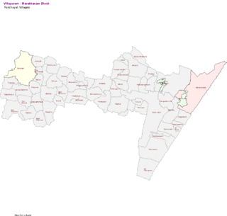
Marakkanam is a coastal panchayat town & Taluk in Viluppuram district in the Indian state of Tamil Nadu. It is well connected to the state capital Chennai and the nearby union territory of Puducherry by the East Coast Road. To the west, Marakkanam is connected to the town of Tindivanam by the SH-134. Marakkanam is situated on the declared National Waterways NW-4. On materialisation of National Waterways NW-4, Marakkanam will be connected to two states Andhra Pradesh (Kakinada) and Puducherry through north and south of Buckingham Canal.
Moolakaraipatti is a Panchayat town in Tirunelveli district in the Indian state of Tamil Nadu.

Muthur is a panchayat town in Kangeyam taluk in Tirupur district, Tamil Nadu, India.
Narasimhanaickenpalayam is a part of Coimbatore city. It is about 14 km from Coimbatore city junction in the northern direction. Narasimhanaickenpalayam is on the stretch of National Highway NH 67 Extn (NH-181) Mettupalayam Road, one of the arterial roads of Coimbatore city. Neighbouring places are Thudiyalur, NGGO Colony, and Periyanaickenpalayam
Nilakkottai is a town in the Dindigul district of the Indian state of Tamil Nadu. The town was established in 1958, as 1st Grade Town Panchayat. In 1970, it was changed to Selection Grade. The Town Panchayat has been under the municipal act since 1996. In 2004, it was called Special Village Panchayat, and in 2006, Selection Grade Town Panchayat.
Pudupalayam is a panchayat town in Chengam taluk of Tiruvanamalai district in the Indian state of Tamil Nadu. Its pincode number is 606 705.It is well connected with Tiruvannamalai and Bangalore. This is at Bangalore Road at 33 km away from the famous Annamalaiyar Temple located in Thiruvannamalai.
Sembakkam is a residential locality in Tambaram City in Tamil Nadu State, India. It is located between Tambaram and Medavakkam and belongs to Tambaram Taluk Region.

Tharamangalam is a Municipality in Salem district in the Indian state of Tamil Nadu.
Thingalnagar is the town panchayat, located in Kanniyakumari district in the Indian state of Tamil Nadu.
Unnamalaikadai is a panchayat town in Kanya Kumari district in the Indian state of Tamil Nadu.
Veeravanallur is a selection grade special panchayat town in the Tirunelveli district in the Indian state of Tamil Nadu.

Athani is a panchayat town located about 13 km from Gobichettipalayam in Anthiyur taluk of Erode district in the state of Tamil Nadu, India.
Nerkundram or Nerkunram is a census town located in Chennai City, Chennai district in the Indian state of Tamil Nadu. It falls under Maduravoyal constituency in Tiruvallur district in the Indian state of Tamil Nadu. It consists of a portion of Ambattur taluk and part of Chennai Corporation. It falls under Sriperumbudur.
