Arak | |
|---|---|
Village | |
 | |
 Arak | |
| Coordinates: 25°16′0″N3°43′54″E / 25.26667°N 3.73167°E | |
| Country | |
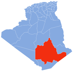
| Province | Tamanrasset Province |
| District | Tamanrasset District |
| Commune | In Amguel [1] |
| Elevation | 550 m (1,800 ft) |
| Time zone | UTC+1 (CET) |
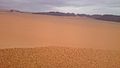
Arak is a village in the commune of In Amguel, [1] in Tamanrasset District, Tamanrasset Province, Algeria. It is located on the N1 national highway about halfway between In Salah and Tamanrasset, near the Arak gorges. [2]