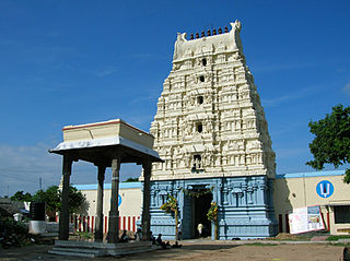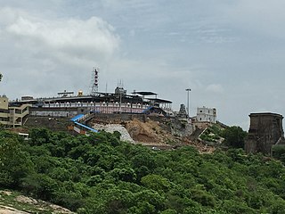
Nellore is a city located on the banks of Penna River, in Nellore district of the Indian state of Andhra Pradesh. It serves as the headquarters of the district, as well as Nellore mandal and Nellore revenue division. It is the fourth most populous city in the state. It is at a distance of 279 kilometres (173 mi) from Vijayawada and about 170 km (110 mi) north of Chennai, Tamil Nadu and also about 380 km (240 mi) east-northeast of Bangalore, Karnataka.

Dharmapuri is a city in the north western part of Tamil Nadu, India. It serves as the administrative headquarters of Dharmapuri district which is the first district created in Tamil Nadu after the independence of India by splitting it from then Salem district on 2 October 1965. The city is located 50 km from Krishnagiri, 69 km from Salem, 60 km from Tirupattur, 90 km from Hosur, 117 km from Thiruvannamalai, 126 km from Bangalore and Erode, 181 km from Tiruppur, 200 km from Coimbatore and Tiruchirappalli, 300 km from Madurai and the state capital Chennai. It is located between latitudes N 11 47’ and 12 33’ and longitudes E 77 02’ and 78 40’. It is one of the major leading cultivators and producers of mangoes in the state along with Krishnagiri, and is often referred as Mango Capital of India.

Rajapalayam is a town in the Indian state of Tamil Nadu. It is the largest municipality in the Virudhunagar district. Rajapalayam is located on the Madurai to Quilon National Highway at a distance of 562 km south of the state capital Chennai. The economy is primarily industrial with several mills for spinning and weaving. The town is known for its mango and the Rajapalayam breed of dogs.
Veppampattu is one of the fastest developing suburban areas in Chennai City. It is Western part of the suburbs of the Metropolitan city Chennai in the Indian state of Tamil Nadu between Chennai and Arakkonam on the Chennai - Arakkonam railway line. It is fast-growing with a number of schools and colleges. Electric trains and NH 205 road provide transportation to Chennai. Veppampatu can be approached by both train and bus. Bus stop is a very nearby railway station. Veppampattu comes under Chennai Metropolitan Area.
Alandur is a zone of Chennai corporation, and an urban node in Chennai district in Guindy division in the state of Tamil Nadu, India. It is surrounded by Guindy in the north and east, Adambakkam in the south, Pazhavanthangal in the south-west and Parangimalai in the north-west. As of 2011, Alandur had a population of 164,430. The town agglomeration of Alandur will have an estimated population of 300,000 by 2030. Alandur neighbours the St. Thomas Mount Cantontment, the Officers Training Academy of the Indian army and the nearby towns of Guindy and Adambakkam. M. G. Ramachandran, a former chief minister of Tamil Nadu started his political career by winning his first legislative election from Alandur in 1967. Alandur also holds famous landmarks of Chennai namely Nehru Statue and Kathipara Junction.

Thirunindravur is a neighbourhood situated in the western part of Chennai district, Tamil Nadu, India, around 29 km from Chennai Central railway station. Thirunindravur comes under Chennai Metropolitan Area. The neighbourhood is served by Thirunindravur railway station. Thiruninravur lake provides the neighbourhood with water. It serves as the connecting hub between Chennai and Tirupati.

Tiruttani is a historic temple town situated in the Tiruvallur district and serves as a suburb of Chennai within the Chennai Metropolitan Area in the southern Indian state of Tamil Nadu. The town is famous for the Tiruttani Murugan Temple, an ancient Hindu temple dedicated to Kartikeya, also known as Murugan, the Hindu god of war. This temple is one of the Arupadaiveedu, a group of six significant abodes of Murugan. Tiruttani was officially incorporated into the Chennai Metropolitan Area in October 2022, signifying its growing importance and influence within the region..

Gummidipoondi is an industrial town in Chennai Metropolitan Region of Thiruvallur district in the Indian state of Tamil Nadu. Notably, it is the northernmost assembly constituency and settlement in the state of Tamil Nadu.
Mannachanallur is a neighbourhood in the city of Tiruchirapalli in the Indian state of Tamil Nadu. It was merged with the Tiruchirappalli Corporation in 2023. Mannachanallur is famous for rice mills
Manavalakurichi is a panchayat town in Kanniyakumari district in the Indian state of Tamil Nadu. It is hardly 60 km from Thiruvananthapuram, the capital city of Kerala. Tamil and Malayalam are the common languages of people living here.

Perungalathur is a neighborhood in the city of Tambaram, situated within the Chennai Metropolitan Area, Tamil Nadu, India.
Valavanur is a panchayat town in Viluppuram district in the Indian state of Tamil Nadu. It is situated near to the Tamil Nadu–Puducherry border on NH 45A.
Adirampattinam is a newly established Municipality in the Pattukottai taluk of the Thanjavur district in the Indian state of Tamil Nadu. It is also short known by Adirai. It is the largest coastal town in the district and fourth largest town in the Thanjavur district.
Manellore is a village in the Tiruvallur district of Tamil Nadu, India. It is located in the Gummidipoondi taluk.
Mathur is a residential area located north of Chennai, a metropolitan city in Tamil Nadu, India. Mathur is administered by the Greater Chennai Corporation and belongs to Madhavaram taluk of Chennai district.
Gerugambakkam is a residential-industrial neighborhood in the South-Western part of Chennai, a metropolitan city in Tamil Nadu, India.It belongs to the Kundrathur taluk of Kanchipuram District, Tamil Nadu, India. It forms a suburb of Chennai city.
Ulundurpettai or Ulundurpet is a municipality in Ulundurpet taluka of Kallakurichi district of Tamil Nadu, India. It is at the intersection of NH 68 and NH 45 located 205 km from Chennai and 129 km from Tiruchirappalli. Ulundurpettai itself is a Constituency for Tamil Nadu State Assembly, and is the Taluk headquarters for Ulundurpet taluka in the eastern region of Kallakurichi district, and is in Ulundurpet revenue block.
Narasingapuram is a village in the Tiruvallur district of Tamil Nadu, India. It is located in the Gummidipoondi taluk. Elavur is the closest railway station.
Elavur is a village in the Tiruvallur district of Tamil Nadu, India. It is located in the Gummidipoondi taluk border between Tamil Nadu and Andhra pradesh. NH16 Chennai-Kolkata Highway. India's First modern Integrated Check post opened by Tamil Nadu chief minister and also located frontline medical village. ELR is and railway station code for Elavur.Farming land can be found in this place.
Kethureddipatti is a Village Panchayat in Dharmapuri district of Tamil Nadu, India. It is located at 30 km (19 mi) from Dharmapuri town. It comes under Pappireddipatti taluk and Kadathur Block. It belongs to Pappireddipatti State Legislative Assembly Constituency and Dharmapuri Loksabha Constituency. It consists of nine panchayat wards. As per the 2011 Census, the total population of this village is 4,808.


