
Bhavani is a Municipality in Erode District, Tamil Nadu, India. It is located at the northern periphery of Erode City Municipal Corporation and is around 105 km (65 mi) from Coimbatore and 60 km (37 mi) from Tiruppur and Salem. Bhavani is also known as "Carpet City" as it is known for its carpet industry; blankets and carpets manufactured in the town are known as Bhavani Jamakkalam. As of 2011, the town covers an area of 2.17 square kilometres (0.84 sq mi) and has a population of 39,225. It is a grade II municipality.
Tiruvallur district, also spelled as Thiruvallur district, is one of the 38 districts in the Indian state of Tamil Nadu. The fast developing city of Tiruvallur is the district headquarters. The district has a mixture of urban and rural characteristics. The eastern part of Tiruvallur district is dominated by urban characteristics while the Northern part of the district has influence of Andhra culture due to its position. In 2011, the district had a population of 3,728,104 with a sex-ratio of 987 females for every 1,000 males.

Tiruvallur is a Grade I municipality in the Indian state of Tamil Nadu. It is located on the banks of Coovum river about 46 km (29 mi) from downtown Chennai (Madras) and just 5 km from megacity border, in the western part of the Chennai Metropolitan Area (CMA). It is a satellite town of Chennai and is the administrative headquarters of Tiruvallur District. The town is known for the Veeraraghava Swamy Temple, one of the 108 sacred shrines of Vaishnavites. The tank festival is held at a pond near this temple. A Shiva temple near this shrine which is popular among the locals. There is also a 40-foot (12 m) tall Viswaroopa Panchamukha Hanuman temple, where the murti is made of a single green granite stone.

Kanyakumari district, officially Kanniyakumari district, is one of the 39 districts of Tamil Nadu state and the southern most district in mainland India. It stands second in terms of population density among the districts of Tamil Nadu. It is also the richest district in Tamil Nadu in terms of per capita income, and also tops the state in Human Development Index (HDI), literacy, and education. The district's headquarters is Nagercoil.

Sholinghur is a municipality under Sholinghur taluk in Ranipet District of Tamil Nadu, India. The town is famous in Tamil Nadu and other neighboring states for the Lakshmi Narasimha Swamy temple.

Tiruttani is a historic temple town situated in the Tiruvallur district and serves as a suburb of Chennai within the Chennai Metropolitan Area in the southern Indian state of Tamil Nadu. The town is famous for the Tiruttani Murugan Temple, an ancient Hindu temple dedicated to Kartikeya, also known as Murugan, the Hindu god of war. This temple is one of the Arupadaiveedu, a group of six significant abodes of Murugan. Tiruttani was officially incorporated into the Chennai Metropolitan Area in October 2022, signifying its growing importance and influence within the region..
Ayyampalayam is a panchayat town in Nilakottai Taluk in Dindigul district in the state of Tamil Nadu, India. There also exists another village by the same name, in the Dindigul district in Tamil Nadu. For the Ayyampalayam in Dindigul district.
Kalambur is a selection grade town panchayat in Polur taluk, Tiruvanamalai district in the Indian state of Tamil Nadu, famous for its rice production. As of the 2011 census, the town had a population of 31,751. K.T.R.Palani is a Chairman of Kalambur selection grade Town panchyat.
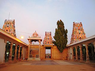
Kodumudi is a panchayat town and taluk headquarters of Kodumudi taluk in Erode district at state of Tamil Nadu, India. Kodumudi has an average elevation of 144 metres (472 feet). Also Kodumudi is an tourism spot. The holy Kaveri river and Magudeswarar temple in Kodumudi attracts thousands of pilgrims daily across South India.
Padianallur is a village in Sholavaram Block in Thiruvallur district of Indian state Tamil Nadu. It is located 34 km towards East from District headquarters Tiruvallur. 4 km from Sholavaram. 20 km from State capital Chennai.

Vellimalai is a panchayat town in Kanniyakumari district in the Indian state of Tamil Nadu.
Sivagiri is a panchayat town in Erode district in the Indian state of Tamil Nadu.
Kulasekharam is a town located in the district of Kanyakumari, Tamil Nadu, India. It is one of the most important business centres in the district, after Marthandam.
Arambakkam is a village in the Tiruvallur district of Tamil Nadu, India. It is located in the Gummidipoondi taluk.
Vadamanappakkam is a village located in the Tiruvannamalai district of Tamil Nadu, South India.
Thennamanadu is a village panchayat in Orattanadu Block of Thanjavur district in Tamil Nadu, South India. It is located between the cities of Thanjavur and Pattukkottai, 20 km (12 mi) from Thanjavur, 2 km (1.2 mi) from Orathanadu and 339 km (211 mi) from the state capital Chennai.
Mannankadu is a village in the Pattukkottai taluk of Thanjavur district, Tamil Nadu, India. It is one of the 32 villages falls under the Musugundan Nadu in the district. Mannangadu is one of the revenue village in its taluk. It is located on state highway Adirampattinam-Mannargudi-Kumbakonam, between Adirampattinam and Madukkur. It is the fourth largest village in Pattukkottai taluk, after Thamarankottai, Thambikottai and Aalathur. Total geographical area of the Village is 1002.02 hectares. The main income source of this village is Agriculture.
Elavur is a village in the Tiruvallur district of Tamil Nadu, India. It is located in the Gummidipoondi taluk border between Tamil Nadu and Andhra pradesh. NH16 Chennai-Kolkata Highway. India's First modern Integrated Check post opened by Tamil Nadu chief minister and also located frontline medical village. ELR is and railway station code for Elavur.Farming land can be found in this place.
Madharpakkam is a village in the Tiruvallur district of Tamil Nadu, India. Part of it is located in the Gummidipoondi taluk. This village is located near Andhra Pradesh border. The villagers main source of employment depends on Gummidipoondi sipcot. This village consists of four panchayats namely Madharpakkam, Padirivedu, Manellore and Nemallur. The Government higher secondary school is one of the oldest school in the district. Telugu and Tamil are major languages spoken by people.
Kadambathur, also spelt Kadambattur, is a town located in Tiruvallur district in the Indian state of Tamil Nadu. It is a census town in Tiruvallur taluk. According to the 2011 census, the town has a population of 11,235.


