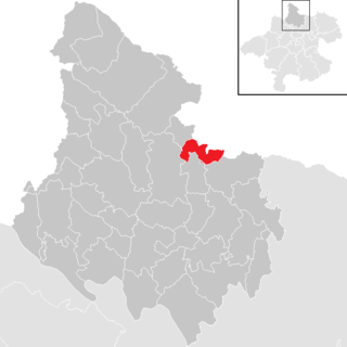
Arbing

Last updated
Arbing
Arbing - Kirche (2).JPG
AUT Arbing COA.jpg
Coat of arms
Austria adm location map.svg
Red pog.svg
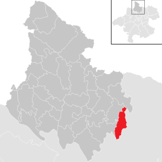
Arbing
Location within Austria
Coordinates: 48°13′39″N14°42′27″E / 48.22750°N 14.70750°E / 48.22750; 14.70750 Coordinates: 48°13′39″N14°42′27″E / 48.22750°N 14.70750°E / 48.22750; 14.70750
Country Austria
State Upper Austria
District Perg
Government
   Mayor Josef Hiesböck (ÖVP)
Area
[1]
  Total12.02 km2 (4.64 sq mi)
Elevation
278 m (912 ft)
Population
(2018-01-01) [2]
  Total1,446
  Density120/km2 (310/sq mi)
Time zone UTC+1 (CET)
  Summer (DST) UTC+2 (CEST)
Postal code
4341
Area code 07269
Vehicle registration PE
Website www.arbing.at

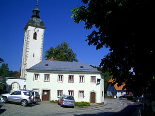
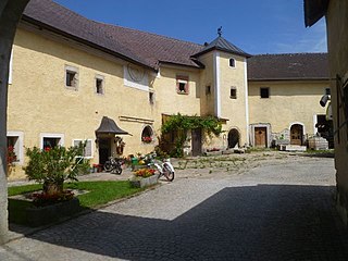
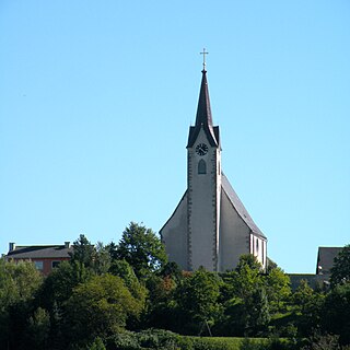
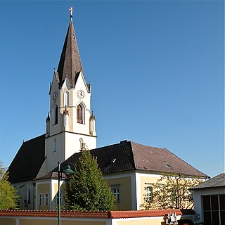
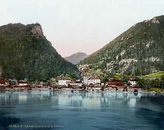
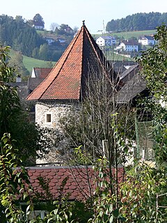
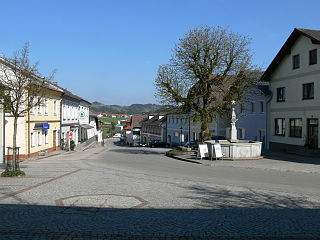
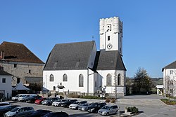
Arbing is a municipality in the district Perg in the Austrian state of Upper Austria.

Austria Federal republic in Central Europe

Austria, officially the Republic of Austria, is a country in Central Europe comprising 9 federated states. Its capital, largest city and one of nine states is Vienna. Austria has an area of 83,879 km2 (32,386 sq mi), a population of nearly 9 million people and a nominal GDP of $477 billion. It is bordered by the Czech Republic and Germany to the north, Hungary and Slovakia to the east, Slovenia and Italy to the south, and Switzerland and Liechtenstein to the west. The terrain is highly mountainous, lying within the Alps; only 32% of the country is below 500 m (1,640 ft), and its highest point is 3,798 m (12,461 ft). The majority of the population speaks local Bavarian dialects as their native language, and German in its standard form is the country's official language. Other regional languages are Hungarian, Burgenland Croatian, and Slovene.

Upper Austria State of Austria

Upper Austria is one of the nine states or Bundesländer of Austria. Its capital is Linz. Upper Austria borders on Germany and the Czech Republic, as well as on the other Austrian states of Lower Austria, Styria, and Salzburg. With an area of 11,982 km2 (4,626 sq mi) and 1.437 million inhabitants, Upper Austria is the fourth-largest Austrian state by land area and the third-largest by population.

Contents

Geography

Arbing is located in the lower Mühlviertel at the transition from the fertile hills of the Mühlviertel Machlande level of the Danube. The extension is 4.4 kilometers from north to south, from west to east is also 4.4 kilometers. The total area is 12 square kilometers. 17.5 percent of the area is forested, 71.7 percent of the area are used for agriculture. Quarters are: Arbing, Frühstorf, Groißing, Hummelberg, Puchberg in Machland, Roisenberg. Some parts of other villages also belong to the municipality Arbing (Mollnegg, Hehenberger)

Danube River in Central Europe

The Danube is Europe's second longest river, after the Volga. It is located in Central and Eastern Europe.

Population

Historical population
YearPop.±%
1869950    
1880983+3.5%
1890997+1.4%
1900943−5.4%
1910948+0.5%
1923941−0.7%
1934896−4.8%
19391,082+20.8%
1951910−15.9%
1961987+8.5%
19711,073+8.7%
19811,149+7.1%
19911,269+10.4%
20011,284+1.2%
20091,374+7.0%
20151,397+1.7%

Related Research Articles

Schwertberg Place in Upper Austria, Austria

Schwertberg is a market town in the district of Perg in the Austrian state of Upper Austria.

Pierbach Place in Upper Austria, Austria

Pierbach is a municipality in the district of Freistadt in the Austrian state of Upper Austria.

Katsdorf Place in Upper Austria, Austria

Katsdorf is a municipality in the district Perg in the Austrian state of Upper Austria.

Langenstein, Austria Place in Upper Austria, Austria

Langenstein is a municipality in the district of Perg in the Austrian state of Upper Austria.

Pabneukirchen Place in Upper Austria, Austria

Pabneukirchen is a municipality in the district of Perg in the Austrian state of Upper Austria.

Ried in der Riedmark Place in Upper Austria, Austria

Ried in der Riedmark is a municipality in the district of Perg in the Austrian state of Upper Austria.

Sankt Georgen am Walde Place in Upper Austria, Austria

Sankt Georgen am Walde is a municipality in the district of Perg in the Austrian state of Upper Austria.

Sankt Nikola an der Donau Place in Upper Austria, Austria

Sankt Nikola an der Donau is a municipality in the district of Perg in the Austrian state of Upper Austria.

Waldhausen im Strudengau Place in Upper Austria, Austria

Waldhausen im Strudengau is a municipality in the district of Perg in the Austrian state of Upper Austria.

Auberg Place in Upper Austria, Austria

Auberg is a municipality in the district of Rohrbach in the Austrian state of Upper Austria.

Haslach an der Mühl Place in Upper Austria, Austria

Haslach an der Mühl is a municipality in the district of Rohrbach in the Austrian state of Upper Austria.

Schwarzenberg am Böhmerwald Place in Upper Austria, Austria

Schwarzenberg am Böhmerwald is a municipality in the district of Rohrbach in the Austrian state of Upper Austria.

Klaffer am Hochficht Place in Upper Austria, Austria

Klaffer am Hochficht is a municipality in the district of Rohrbach in the Austrian state of Upper Austria.

Sarleinsbach Place in Upper Austria, Austria

Sarleinsbach is a municipality in the district of Rohrbach in the Austrian state of Upper Austria.

Sankt Veit im Mühlkreis Place in Upper Austria, Austria

Sankt Veit im Mühlkreis is a municipality in the district of Rohrbach in the Austrian state of Upper Austria.

Sankt Ulrich im Mühlkreis Place in Upper Austria, Austria

Sankt Ulrich im Mühlkreis is a municipality in the district of Rohrbach in the Austrian state of Upper Austria.

Sankt Peter am Wimberg Place in Upper Austria, Austria

Sankt Peter am Wimberg is a municipality in the district of Rohrbach in the Austrian state of Upper Austria. It is located 173 km from Austria's capital city, Vienna. The municipality also observes Daylight saving time (DST).

Sankt Johann am Wimberg Place in Upper Austria, Austria

Sankt Johann am Wimberg is a municipality in the district of Rohrbach in the Austrian state of Upper Austria.

Oepping Place in Upper Austria, Austria

Oepping is a municipality in the district of Rohrbach in the Austrian state of Upper Austria.

Lichtenau im Mühlkreis Place in Upper Austria, Austria

Lichtenau im Mühlkreis is a municipality in the district of Rohrbach in the Austrian state of Upper Austria.

References

  1. "Dauersiedlungsraum der Gemeinden Politischen Bezirke und Bundesländer - Gebietsstand 1.1.2018". Statistics Austria. Retrieved 10 March 2019.
  2. "Einwohnerzahl 1.1.2018 nach Gemeinden mit Status, Gebietsstand 1.1.2018". Statistics Austria. Retrieved 9 March 2019.