Klam

Last updated

Klam
Marktbrunnen am Marktplatz in Klam.jpg
Wappen at klam.png
Coat of arms
Austria adm location map.svg
Red pog.svg
Klam
Location within Austria
Coordinates: 48°13′29″N14°47′00″E / 48.22472°N 14.78333°E / 48.22472; 14.78333 Coordinates: 48°13′29″N14°47′00″E / 48.22472°N 14.78333°E / 48.22472; 14.78333
Country Austria
State Upper Austria
District Perg
Government
   Mayor Johannes Achleitner (ÖVP)
Area
[1]
  Total8.36 km2 (3.23 sq mi)
Elevation
284 m (932 ft)
Population
 (2018-01-01) [2]
  Total918
  Density110/km2 (280/sq mi)
Time zone UTC+1 (CET)
  Summer (DST) UTC+2 (CEST)
Postal code
4352
Area code 07269
Vehicle registration PE
Website www.klam.at

Klam is a municipality in the district Perg in the Austrian state of Upper Austria.

Population

Historical population
YearPop.±%
1869739    
1880770+4.2%
1890770+0.0%
1900705−8.4%
1910645−8.5%
1923681+5.6%
1934663−2.6%
1939628−5.3%
1951614−2.2%
1961633+3.1%
1971644+1.7%
1981662+2.8%
1991736+11.2%
2001789+7.2%
2011931+18.0%
2015892−4.2%

Related Research Articles

Alberschwende Place in Vorarlberg, Austria

Alberschwende is a municipality in the district of Bregenz in the Austrian state of Vorarlberg.

Wolfurt Place in Vorarlberg, Austria

Wolfurt is a municipality in the western Austrian state of Vorarlberg.

Schwarzach, Vorarlberg Place in Vorarlberg, Austria

Schwarzach is a municipality in the Austrian state of Vorarlberg.

Eichenberg, Austria Place in Vorarlberg, Austria

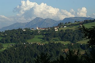
Eichenberg is a municipality in the district of Bregenz in the Austrian state of Vorarlberg.

Satteins Place in Vorarlberg, Austria

Satteins is a town in the Austrian state of Vorarlberg.

Warth, Vorarlberg Place in Vorarlberg, Austria

Warth is a municipality in the district of Bregenz in the Austrian state of Vorarlberg.

Bürserberg Place in Vorarlberg, Austria

Bürserberg is a municipality in Austria in Vorarlberg in the Bludenz district with 549 inhabitants.

Lorüns Place in Vorarlberg, Austria

Lorüns is a municipality in the district of Bludenz in the Austrian state of Vorarlberg.

Silbertal Place in Vorarlberg, Austria

Silbertal is a municipality in the district of Bludenz in the Austrian state of Vorarlberg.

Stallehr Place in Vorarlberg, Austria

Stallehr is a municipality in the district of Bludenz in the Austrian state of Vorarlberg.

Buch, Austria Place in Vorarlberg, Austria

Buch is a municipality in the district of Bregenz in the Austrian state of Vorarlberg.

Fußach Place in Vorarlberg, Austria

Fußach is a municipality in the district of Bregenz in the Austrian state of Vorarlberg.

Gaißau Place in Vorarlberg, Austria

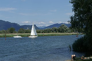
Gaißau is a municipality in the district of Bregenz in the Austrian state of Vorarlberg.

Göfis Place in Vorarlberg, Austria

Göfis is a municipality in the district of Feldkirch in the Austrian state of Vorarlberg.

Klaus, Vorarlberg Place in Vorarlberg, Austria

Klaus is a municipality in the district of Feldkirch in the Austrian state of Vorarlberg.

Röthis Place in Vorarlberg, Austria

Röthis is a municipality in the district of Feldkirch in the Austrian state of Vorarlberg.

Sulz, Vorarlberg Place in Vorarlberg, Austria

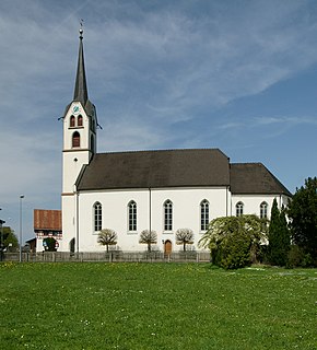
Sulz is a municipality in the district of Feldkirch in the Austrian state of Vorarlberg.

Altschwendt Place in Upper Austria, Austria

Altschwendt is a municipality in the district of Schärding in the Austrian state of Upper Austria.

Schwanenstadt Place in Upper Austria, Austria

Schwanenstadt is a town in the district of Vöcklabruck in the Austrian state of Upper Austria.

Bad Waltersdorf Place in Styria, Austria

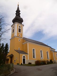
Bad Waltersdorf is a municipality in the district of Hartberg-Fürstenfeld in Styria, Austria.

References

  1. "Dauersiedlungsraum der Gemeinden Politischen Bezirke und Bundesländer - Gebietsstand 1.1.2018". Statistics Austria. Retrieved 10 March 2019.
  2. "Einwohnerzahl 1.1.2018 nach Gemeinden mit Status, Gebietsstand 1.1.2018". Statistics Austria. Retrieved 9 March 2019.