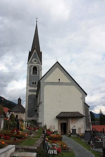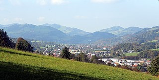
Fiss is a municipality in the Landeck district in the Austrian state of Tyrol located 10.5 kilometers (6.5 mi) south of Landeck on the upper course of the Inn River. The main source of income is tourism.

Ernstbrunn is a town in the district of Korneuburg in Lower Austria in Austria. Ernstbrunn takes up about 80.69 square kilometers, 26.99 percent of which is forest.

Pyhra is a town with 3286 inhabitants in the district of Sankt Pölten-Land in Lower Austria, Austria.

Gitschtal is a town in the district of Hermagor in the Austrian state of Carinthia.

Berg im Drautal is a village and municipality in the district of Spittal an der Drau in the Austrian state of Carinthia.

Mitterndorf an der Fischa is a town in the district of Baden in Lower Austria in Austria. It is located 20 kilometers (12 mi) southeast of Vienna.

Angern an der March is a market town in the district of Gänserndorf in the Austrian state of Lower Austria. The municipality consists of the Katastralgemeinden Angern, Grub, Mannersdorf, Ollersdorf and Stillfried.

Hauskirchen is a town in the district of Gänserndorf in the Austrian state of Lower Austria.

Spitz an der Donau is a market town in the district of Krems-Land in the Austrian state of Lower Austria, in the midst of the UNESCO World Heritage area Wachau, further down from Willendorf on the left bank of the Danube. The ferry across the Danube here is interesting in that it has no motor or sail: it is powered by rudder set against the river current, anchored to a cable above the river. The ferry carries passengers, bicycles, motorcycles, and automobiles.

Sankt Veit an der Gölsen is a town in the district of Lilienfeld in the Austrian federal state of Lower Austria.

Brand is a municipality in the district of Bludenz in the Austrian state of Vorarlberg.

Mariastein is the smallest municipality in the Kufstein district in the Austrian state of Tyrol located 4 kilometers north of Wörgl and 11.5 kilometers southwest of Kufstein. Already a fifteenth century pilgrimage destination, it became more popular after a local statue of Mary, which had been removed to Bavaria in the late seventeenth century, was said to have returned to the church in Mariastein on its own.

Unterperfuss is a municipality in the district of Innsbruck-Land in the Austrian state of Tyrol located 15 km west of Innsbruck and is one of the smallest villages of Tyrol. The area is restricted in the north by the Inn River and in the east by the Melach River. Unterperfuss has many facilities for horse-riding.

Häselgehr is a municipality with 686 inhabitants in the district of Reutte in the Austrian state of Tyrol. The municipality is located in the district court Reutte. Since 2010, the community is a member of the Climate Alliance Tyrol.

Riefensberg is a municipality in the district of Bregenz in the westernmost Austrian state of Vorarlberg. The community of Riefensberg covers an area of 14.85 square kilometers. Riefensberg is located within the Nagelfluhkette Nature Park.

Hargelsberg is a municipality in the district Linz-Land in the Austrian state of Upper Austria.

Arbing is a municipality in the district Perg in the Austrian state of Upper Austria.

Dimbach is a municipality in the district Perg in Upper Austria, Austria. It had a population of 1015 according to the 2015 census.

Freinberg is a municipality in the district of Schärding in Upper Austria, Austria. The municipality has an area of 20 square kilometers and population of 1494.

Passail is a municipality in the district of Weiz in the Austrian state of Styria. It is situated approximately 30 kilometers north-east of the state capital Graz.


