Related Research Articles
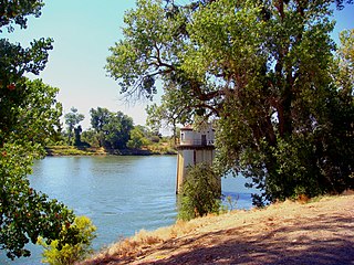
The Sacramento River is the principal river of Northern California in the United States and is the largest river in California. Rising in the Klamath Mountains, the river flows south for 400 miles (640 km) before reaching the Sacramento–San Joaquin River Delta and San Francisco Bay. The river drains about 26,500 square miles (69,000 km2) in 19 California counties, mostly within the fertile agricultural region bounded by the Coast Ranges and Sierra Nevada known as the Sacramento Valley, but also extending as far as the volcanic plateaus of Northeastern California. Historically, its watershed has reached as far north as south-central Oregon where the now, primarily, endorheic (closed) Goose Lake rarely experiences southerly outflow into the Pit River, the most northerly tributary of the Sacramento.
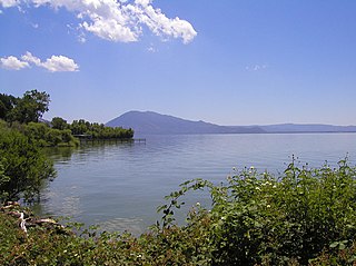
Clear Lake is a natural freshwater lake in Lake County in the U.S. state of California, north of Napa County and San Francisco. It is the largest natural freshwater lake wholly within the state, with 68 square miles (180 km2) of surface area. It has an age of nearly 500,000 years. It is the latest lake to occupy a site with a history of lakes stretching back at least 2,500,000 years.

The Sacramento–San Joaquin River Delta, or California Delta, is an expansive inland river delta and estuary in Northern California. The Delta is formed at the western edge of the Central Valley by the confluence of the Sacramento and San Joaquin rivers and lies just east of where the rivers enter Suisun Bay, which flows into San Francisco Bay, then the Pacific Ocean via San Pablo Bay. The Delta is recognized for protection by the California Bays and Estuaries Policy. Sacramento–San Joaquin Delta was designated a National Heritage Area on March 12, 2019. The city of Stockton is located on the San Joaquin River at the eastern edge of the delta. The total area of the Delta, including both land and water, is about 1,100 square miles (2,800 km2). Its population is around 500,000.

The Pit River is a major river draining from northeastern California into the state's Central Valley. The Pit, the Klamath and the Columbia are the only three rivers in the U.S. that cross the Cascade Range.
Freshwater ecosystems are a subset of Earth's aquatic ecosystems. They include lakes, ponds, rivers, streams, springs, bogs, and wetlands. They can be contrasted with marine ecosystems, which have a larger salt content. Freshwater habitats can be classified by different factors, including temperature, light penetration, nutrients, and vegetation. There are three basic types of freshwater ecosystems: Lentic, lotic and wetlands. Freshwater ecosystems contain 41% of the world's known fish species.

The Cosumnes River is a river in northern California in the United States. It rises on the western slope of the Sierra Nevada and flows approximately 52.5 miles (84.5 km) into the Central Valley, emptying into the Mokelumne River in the Sacramento-San Joaquin Delta.

A bioindicator is any species or group of species whose function, population, or status can reveal the qualitative status of the environment. The most common indicator species are animals. For example, copepods and other small water crustaceans that are present in many water bodies can be monitored for changes that may indicate a problem within their ecosystem. Bioindicators can tell us about the cumulative effects of different pollutants in the ecosystem and about how long a problem may have been present, which physical and chemical testing cannot.

The Yolo Bypass is one of the two flood bypasses in California's Sacramento Valley located in Yolo and Solano Counties. Through a system of weirs, the bypass diverts floodwaters from the Sacramento River away from the state's capital city of Sacramento and other nearby riverside communities.

Aquatic biomonitoring is the science of inferring the ecological condition of rivers, lakes, streams, and wetlands by examining the organisms that live there. While aquatic biomonitoring is the most common form of biomonitoring, any ecosystem can be studied in this manner.
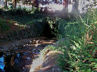
Strawberry Creek is the principal watercourse running through the city of Berkeley, California. Two forks rise in the Berkeley Hills of the California Coast Ranges, and form a confluence at the campus of the University of California, Berkeley. The creek then flows westward across the city to discharge into San Francisco Bay.
Mira Loma High School is a public high school located in Arden-Arcade, California, United States. It is located south of Interstate 80, and east of Watt Avenue. It is a part of the San Juan Unified School District with a student body of approximately 1700 students from northeast Arden-Arcade and western Carmichael.

Daylighting is the opening up and restoration of a previously buried watercourse, one which had at some point been diverted below ground. Typically, the rationale behind returning the riparian environment of a stream, wash, or river to a more natural above-ground state is to reduce runoff, create habitat for species in need of it, or improve an area's aesthetics. In the United Kingdom, the practice is also known as deculverting.

Copeland Creek is a 9.0-mile-long (14.5 km) perennial stream that rises on Sonoma Mountain in Sonoma County, California.

Environmental toxicology is a multidisciplinary field of science concerned with the study of the harmful effects of various chemical, biological and physical agents on living organisms. Ecotoxicology is a subdiscipline of environmental toxicology concerned with studying the harmful effects of toxicants at the population and ecosystem levels.

Uvas Creek is a 29.5-mile-long (47.5 km) mainly southward-flowing stream originating on Loma Prieta peak of the Santa Cruz Mountains, in Santa Clara County, California, United States. The creek descends through Uvas Canyon County Park into Uvas Reservoir near Morgan Hill, and on through Uvas Creek Preserve and Christmas Hill Park in Gilroy. Upon passing U.S. Highway 101 it is known as Carnadero Creek, shortly before the confluence with the Pajaro River at the Santa Clara County - San Benito County boundary.

Battle Creek is a 16.6-mile-long (26.7 km) creek located in Shasta and Tehama counties, California. It is a major tributary to the Sacramento River.
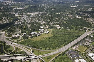
The UW Bothell/Cascadia College Wetland Restoration Project is a 58-acre forested floodplain restoration site at the delta of North Creek in King County, Washington, USA. The State of Washington bought the site in 1994 from the Truly family, and dedicated the land to the construction of the Bothell regional campus of the University of Washington and Cascadia College. Construction began in 1998, as did the stream and floodplain restoration. Two years later, in 2000, classes opened for students, and in 2001 the main phase of the restoration was completed. Today the site is an ongoing area of restoration education.
The Monterey Bay Aquarium Research Institute's (MBARI's) Environmental Sample Processor (ESP) is a "lab in a can" designed for autonomous deployment. The ESP—provides on-site collection and analysis of water samples from the subsurface ocean. The instrument is an electromechanical/fluidic system designed to collect discrete water samples, concentrate microorganisms or particles, and automate application of molecular probes which identify microorganisms and their gene products. The ESP also archives samples so that further analyses may be done after the instrument is recovered.

Rio Alamar or Arroyo de Alamar is a river mainly in northern Baja California, Mexico with a small portion in California, United States. The riparian corridor that is the Alamar has a wooded area home to: riparian, aquatic and migratory birds, abundant species of fish, and amphibians. The wildlife and natural vegetation in the Arroyo Alamar was historically a vital resource for fishing, bathing, and even drinking. The stream is formed by the confluence of Cottonwood Creek and Tecate Creek a short distance north of the Mexico–United States border. It flows generally west for about 25 kilometres (16 mi) through the San Ysidro Mountains and the Tijuana urban area before joining with the Arroyo de las Palmas in central Tijuana, to form the Tijuana River. The Rio Alamar tributary makes up almost one third of the larger bi-national Tijuana River Watershed that spans approximately 1,750 square miles and impacts the lives of more than 1.4 million people. The major tributary as part of the Tijuana River Estuary has been deemed one of the 21 wetlands of international importance by the RAMSAR Convention.
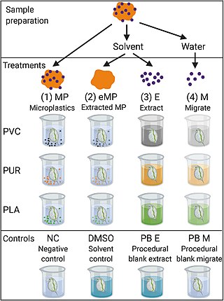
A bioassay is an analytical method to determine the potency or effect of a substance by its effect on living animals or plants, or on living cells or tissues. A bioassay can be either quantal or quantitative, direct or indirect. If the measured response is binary, the assay is quantal; if not, it is quantitative.
References
- ↑ "Arcade Creek Project Webpage". 2010. Archived from the original on 2019-01-06. Retrieved 2010-04-03.
- ↑ "Schwarzenegger.com - News". 2004. Retrieved 2010-04-03.[ permanent dead link ]
- ↑ "Mira Loma High School Awards". 2004. Archived from the original on 2011-07-27. Retrieved 2010-04-03.
- ↑ "Sacramento Bee - Mira Loma High wins recognition, $10,000 for Arcade Creek project". 2010. Retrieved 2010-04-03.[ permanent dead link ]
- ↑ "Urban Creeks Council of Sacramento". 2009. Archived from the original on August 27, 2008. Retrieved 2010-04-03.