Angus is one of the 32 local government council areas of Scotland, a registration county and a lieutenancy area. The council area borders Aberdeenshire, Dundee City and Perth and Kinross. Main industries include agriculture and fishing. Global pharmaceuticals company GSK has a significant presence in Montrose in the north of the county.
Glamis is a small village in Angus, Scotland, located 4 miles (6.4 km) south of Kirriemuir and 5 miles (8.0 km) southwest of Forfar. It is the location of Glamis Castle, the childhood home of Queen Elizabeth the Queen Mother.
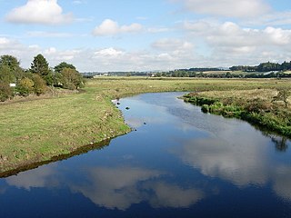
The River Isla is a tributary of the River Tay in Angus and Perthshire, Scotland. It runs for 46 miles (74 km) through the Kirkton of Glenisla and Strathmore.
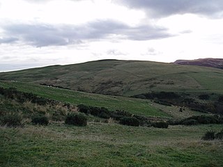
Strathmore is a strath in east central Scotland running from northeast to southwest between the Grampian mountains and the Sidlaws. It is approximately 50 miles (80 km) long and 10 miles (16 km) wide. Strathmore is underlain by Old Red Sandstone but this is largely obscured by glacial till, sands and gravels deposited during the ice age. Its northeast to southwest alignment is influenced by the underlying geological structure of the area which reflects the dominant Caledonian trend of both the central lowlands and the Highlands of Scotland; its northern margin reflects the presence of the Highland Boundary Fault. Strathmore is fertile and has some of Scotland's best arable farmland, producing soft fruits and cereals.

Meigle is a village in Strathmore, Scotland. It lies in the council area of Perth and Kinross in the Coupar Angus and Meigle ward. It lies on the A94 road between Coupar Angus and Forfar. Other smaller settlements nearby are Balkeerie, Kirkinch and Kinloch. Meigle is accessed from the north and south via the B954 road. In 1971 it had a population of 357.
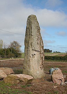
The Stone of Morphie is a standing stone about 700 metres west of the Coast Highway bridge of the River North Esk and 400 metres east of the historic Mill of Morphie in Aberdeenshire, Scotland. The stone is approximately 3.5 metres high and is unshaped and uninscripted; the base of this stone measures approximately 70 by 100 centimetres.

The Eassie Stone is a Class II Pictish stone of about the mid 8th century AD in the village of Eassie, Angus, Scotland. The stone was found in Eassie burn in the late 18th century and now resides in a purpose-built perspex building in the ruined Eassie church.

Eassie is a village located along the A94 road in Angus, Scotland. The church in Eassie is dedicated to Saint Fergus, a monk who worked at nearby Glamis. Eassie is noted for the presence of the Eassie Stone, a carved Pictish stone.
Castleton, officially Castleton Of Eassie, is a village in Angus, Scotland. This settlement is situated along the A94 road between Glamis and Meigle. One mile to the south is the village of Eassie noted for the presence of the Eassie Stone; this carved Pictish stone is dated prior to the Early Middle Ages. Slightly further to the south lies Ark Hill within the Sidlaw Hills.

Wester Denoon is a small settlement in Angus, Scotland. Approximately one mile to the north of Wester Denoon is the village of Eassie, where the Eassie Stone is displayed in a ruined church; this carved Pictish stone is dated prior to the Early Middle Ages. Other nearby settlements are Charleston, Balkeerie and Kirkinch. Two fragments of small Pictish cross-slabs have also been found at Wester Denoon itself. One shows the stylised figure of a woman wearing a long dress or mantle fastened on the breast by a large brooch.
The B954 road is a public highway in Angus, Scotland which generally runs north to south, connecting the settlement of Dykends to the northwestern part of the city of Dundee. The road runs near the Meigle Museum, where a collection of Pictish stones is exhibited, and somewhat to the west of the Eassie Stone, a Pictish stone dating to about 600 AD. The road has been a subject of public controversy, having undergone debate over its speed limit; in particular, a speed limit of 30 to 40 miles per hour was considered to protect pedestrian safety, particularly for children crossing the highway. The proposal was not adopted at the 16 September 2008 meeting.
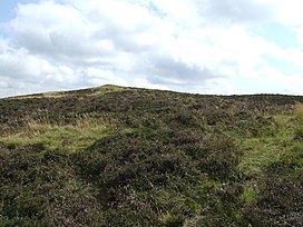
Newtyle Hill is a mountainous landform in the Sidlaw Hills in Angus, Scotland The vicinity has elements of prehistory including presence of the Eassie Stone, a Pictish stone dating to the Dark Ages.
Hatton Hill is a mountain landform in Angus, Scotland and is the most easterly peak of the Sidlaw Hills. Hatton Castle stands on the flanks of Hatton Hill above the village of Newtyle. The general vicinity has elements of prehistory including presence of the Eassie Stone, a Pictish stone dating back to the Dark Ages.
Kilry Glen, in Angus, Scotland, is the glen of the Burn of Kilry, a tributary of the River Isla. It is situated west of the B954 road, approximately four miles north of Alyth.

The Glamis Manse Stone, also known as Glamis 2, is a Class II Pictish stone at the village of Glamis, Angus, Scotland. Dating from the 9th century, it is located outside the Manse, close to the parish church. It is inscribed on one side with a Celtic cross and on the other with a variety of Pictish symbols. It is a scheduled monument.
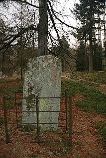
The Hunter's Hill Stone, otherwise known as the Glamis 1 Stone, is a Class II Pictish standing stone at Hunter's Hill to the south east of Glamis village, Angus, Scotland.
Kirkinch railway station served the village of Kirkinch, Angus, Scotland, from 1838 to 1847 on the Newtyle, Eassie and Glamiss Railway.
Leason Hill railway station served the area of Newmill of Inshewan, Angus, Scotland, from 1838 to 1847 on the Newtyle, Eassie and Glamiss Railway.
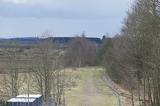
Glamis railway station served the village of Glamis, Angus, Scotland, from 1838 to 1956 on the Newtyle, Eassie and Glamiss Railway.