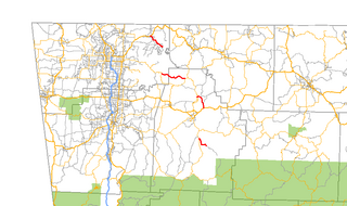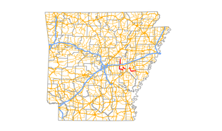
Arkansas Highway 27 is a designation for two north–south state highways in Arkansas. One route begins at US Highway 59 (US 59) and US 71 near Ben Lomond north to Highway 7 in Dardanelle. A second segment begins at Highway 7 in Dover and runs north to Highway 14 at Harriet. An original Arkansas state highway, Highway 27 was created as one continuous route in 1926, but was split around Russellville in 1961.

State Road 2 is a former east–west state highway in the Arkansas Timberlands and Lower Arkansas Delta. The route was approximately 195 miles (314 km), and ran from US Route 67 (US 67) in Texarkana east to cross the Mississippi River near Lake Village, continuing as Mississippi Highway 10. On July 1, 1931, the route was entirely replaced by US Highway 82 (US 82) by the American Association of State Highway Officials (AASHTO). The route was maintained by the Arkansas Highway Department (AHD), now known as the Arkansas Department of Transportation (ArDOT).

Highway 127 is a designation for four state highways in Northwest Arkansas. One route of 4.13 miles (6.65 km) begins at Madison County Road 3345 (CR 3345) and runs northwest to Highway 23 at Aurora. A second route of 4.86 miles (7.82 km) begins at US Highway 412 (US 412) at Old Alabam and runs north to Highway 23 at Forum. A third route of 8.58 miles (13.81 km) begins at Highway 12 and runs north to Highway 12 near Clifty. A fourth route of 5.82 miles (9.37 km) begins at Lost Bridge Village and runs north to US Highway 62 in Garfield. Highway 127 Spur is a spur route of 0.25 miles (0.40 km) near the southern terminus of the Lost Bridge Village route that provides access to Lost Bridge Marina. All routes are maintained by the Arkansas State Highway and Transportation Department (AHTD).
Highway 170 is a designation for two state highways in Washington County, Arkansas. The main segment of 17.31 miles (27.86 km) runs from Devil's Den State Park to West Fork. A shorter segment of 5.44 miles (8.75 km) runs from US Route 62 through Appleby before reconnecting with US 62.

Highway 86 is a mostly north–south highway in central Arkansas. Its southern terminus is at an intersection with U.S. Route 63 2 miles (3.2 km) east of Slovak. 1-mile (1.6 km) west of Slovak, it turns north at Highway 343 and continues north and west until it intersects U.S. Highway 70 4 miles (6.4 km) east of Carlisle. North of U.S. 70, it continues for 4 miles (6.4 km) as Anderson Road before again becoming a state highway continuing east and north for 13 miles (21 km) before ending at Highway 38 5 miles (8.0 km) east of Hickory Plains.

Highway 9 is a designation for two north–south state highways in Arkansas. A southern segment of 51.44 miles (82.78 km) begins at U.S. Route 79 at Eagle Mills and heads north to U.S. Route 67 in Malvern before terminating. The northern segment of 174.17 miles (280.30 km) runs from AR 5 to U.S. Route 63 in Mammoth Spring. The route was created during the 1926 Arkansas state highway numbering, and has seen only minor extensions and realignments since. Pieces of both routes are designated as Arkansas Heritage Trails for use during the Civil War and the Trail of Tears.

Highway 14 is an east–west state highway in north Arkansas. The route of 227.35 miles (365.88 km) begins at Boat Dock Road near Table Rock Lake and runs east to Mississippi County Route W1020 (CR W1020) at Golden Lake. The highway's general alignment between the western terminus and Marked Tree closely follows the original routing as established in the initial 1926 Arkansas state highway numbering plan. The route from Highway 140 in Lepanto east across Interstate 55 to Golden Lake is a later extension.

Highway 131 is a designation for five north–south state highways in northeast Arkansas. One route of 5.51 miles (8.87 km) runs from Highway 1 in Haynes east to Lee County Road 719. A second route of 9.57 miles (15.40 km) begins at US Route 79 (US 79) near Brickeys and runs south to the Mississippi River levee. A third route of 8.74 miles (14.07 km) forms a semicircle around Horseshoe Lake and Porter Lake, connecting to Highway 147 at both ends. A fourth route of 3.11 miles (5.01 km) begins at Highway 147 and runs through Edmondson. A fifth route begins at Interstate 55/US 61/US 64/US 79 in West Memphis and runs north to Martin Luther King Jr. Drive/Mound City Road in West Memphis. All routes are maintained by the Arkansas State Highway and Transportation Department (AHTD).
Highway 118 is a designation for two state highways in the Upper Arkansas Delta. One route of 41.43 miles (66.68 km) begins at US Highway 64 (US 64) and Highway 149 east to Mississippi County Road 495 near the Mississippi River levee. A second route of 4.29 miles (6.90 km) runs from US 70/US 79 in West Memphis to US 64 in Marion. Both routes are maintained by the Arkansas State Highway and Transportation Department (AHTD).
Highway 123 is a designation for two state highways in Arkansas. One route begins at Salmon Lane in Boone County and runs 1.63 miles (2.62 km) north to US Highway 65 Business (US 65B) in Harrison. A second route begins at Highway 103 in Clarksville and runs 67.74 miles (109.02 km) northeast to US 65 and US 65B in Western Grove. A suffixed route, designated Highway 123Y runs near Lurton, giving non-truck travelers access to Highway 7. All three routes are maintained by the Arkansas Department of Transportation (ArDOT).

Highway 58 is an east–west state highway in north central Arkansas. The route of 53.37 miles (85.89 km) begins at Highway 14 and runs east to US Highway 67 in Donaldson. There is also an alternate route of 2.71 miles (4.36 km) designated as Highway 58E near Williford. Both routes are maintained by the Arkansas State Highway and Transportation Department (AHTD).

Highway 148 is a designation for three east–west state highways in the Upper Arkansas Delta. One route of 4.61 miles (7.42 km) begins at Highway 239 and runs east to a Mississippi River levee. A second route of 8.81 miles (14.18 km) begins at Highway 181 and runs east to US Highway 61 in Burdette. A third route of 3.53 miles (5.68 km) begins at Highway 135 in Black Oak and runs east to Highway 139. All routes are maintained by the Arkansas State Highway and Transportation Department (AHTD).

Highway 96 is a designation for two east–west state highways in the Arkansas River Valley. One route of 38.2 miles (61.5 km) begins at Highway 10 in Greenwood and runs north and east to Highway 23 south of Ozark. A second route of 1.84 miles (2.96 km) in Ozark begins at Highway 23 and runs east to Highway 219. Both routes are maintained by the Arkansas State Highway and Transportation Department (AHTD).
Highway 142 is a north–south state highway in Chicot County, Arkansas. The route starts its southern terminus at Levee Road near Lakeport. The road then travels north, passing through the Lakeport Plantation. It ends at its northern terminus at U.S. Route 82 and US 278 in Shives. AR 142 was designated in 1931, from US 61 to the Mississippi River, and part of the route was redesignated as part of US 82 in 1940. The route was paved in asphalt by 1962. The route is maintained by the Arkansas Department of Transportation (ArDOT).

Arkansas Highway 20 is an east–west state highway in Phillips County, Arkansas. The route of 31.76 miles (51.11 km) runs from Lambrook northeast to US 49 in Helena-West Helena. Segments of the route make up the western routing of the Great River Road.

Highway 80 is an east–west state highway in the Ouachita Mountains. The route of 49.87 miles (80.26 km) begins at Highway 28 at Hon and runs east to Arkansas Highway 27 in Danville. The route is maintained by the Arkansas State Highway and Transportation Department (AHTD).

Highway 48 is an east–west state highway in Southwest Arkansas. The route of 14.53 miles (23.38 km) begins at Highway 9 south of Tulip and runs east to US Highway 167 (US 167) at Ferindale. The route is maintained by the Arkansas State Highway and Transportation Department (AHTD).

Highway 97 is a north–south state highway in Cleveland County. The route of 6.45 miles (10.38 km) begins at Highway 8 and runs northwest to US Highway 79 (US 79) in Kingsland. The route is maintained by the Arkansas State Highway and Transportation Department (AHTD).
Highway 81 is a north–south state highways in Jefferson County, Arkansas. The highway begins at an intersection with US Highway 65 (US 65) and US 425 and runs 2.29 miles (3.69 km) to US 63/US 79. The designation also includes a spur route, Highway 81 Spur, created in 2005. Both highways are maintained by the Arkansas State Highway and Transportation Department (AHTD).
Highway 144 is a designation for two state highways in Southeast Arkansas. One route of 7.82 miles (12.59 km) begins at Big Bayou Meto Use Area and runs east to US Highway 165 (US 165), Highway 1, and the Great River Road (GRR). A second route of 20.50 miles (32.99 km) begins at US 165 near Jerome and runs east through Lake Village to a levee near the Mississippi River. Both routes are maintained by the Arkansas Department of Transportation (ArDOT). While overlapping US 65/US 278 in Chicot County, the route is part of the Great River Road, a national scenic byway following the Mississippi River.


