Aksaray Province is a province in central Turkey. Its adjacent provinces are Konya along the west and south, Niğde to the southeast, Nevşehir to the east, and Kırşehir to the north. It covers an area of 7,626 square kilometres (2,944 sq mi). The provincial capital is the city of Aksaray. Aksaray is one of the four provinces in the area of Cappadocia, along with Nevşehir, Niğde and Kayseri. Also the 3,000-metre (9,843 ft) volcano Mount Hasan stands between Aksaray and Niğde. Summers are hot and dry on the plain, but the area is green and covered in flowers in springtime, when water streams off the mountainside. The 2,400 m2 salt lake, Tuz Gölü, lies within the boundaries of Aksaray, a large area of swamp with a maximum depth of 1 metre.
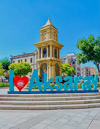
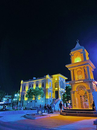
Aksaray is a city in the Central Anatolia region of Turkey. It is the seat of Aksaray Province and Aksaray District. Its population is 247,147 (2021). In 2021 the province had an estimated population of 429,069 distributed over about 7,659 km2 (2,957 sq mi). The average elevation is 980 m (3,215 ft), with the highest point being Mt. Hasan at 3,253 m (10,673 ft).
Eskil is a town in Aksaray Province in the Central Anatolia region of Turkey, situated on the southern shore of Lake Tuz. It is the seat of Eskil District. Its population is 17,929 (2021). The average elevation in the center is 932 m (3,058 ft).
Gülağaç, formerly Ağaçlı, is a town in Aksaray Province in the Central Anatolia region of Turkey. It is the seat of Gülağaç District. Its population is 4,819 (2021). The average elevation is 1,170 m (3,839 ft).

Güzelyurt, formerly Gelveri, is a town in Aksaray Province in the Central Anatolia region of Turkey, at a distance of 45 km (28 mi) from the city of Aksaray. It is the seat of Güzelyurt District. Its population is 2,570 (2021). Its elevation is 1,485 m (4,872 ft).
Sarıyahşi is a town in Aksaray Province in the Central Anatolia region of Turkey, at a distance of 110 km (68 mi) from the province seat of Aksaray. It is the seat of Sarıyahşi District. Its population is 3,543 (2021).
Taşpınar is a town (belde) and municipality in the Aksaray District, Aksaray Province, Turkey. Its population is 2,759 (2021).

Belisırma is a village in Güzelyurt District, Aksaray Province, Turkey. Its population is 502 (2021). The distance to Güzelyurt is 11 kilometres (6.8 mi) and to Aksaray is 42 kilometres (26 mi). Although a small village, Belisırma is well known because of various ruins around it. The church ruins of Ala, Bezirhane, Karagedik and Direkli are Byzantine cave churches.

Sultanhanı is a town in Aksaray Province, Turkey. It is named after the famous han (caravanserai) within the town. It is the seat of Sultanhanı District, created in 2017. Its population is 10,958 (2021).

Yeşilova is a town (belde) and municipality in the Aksaray District, Aksaray Province, Turkey. Its population is 3,917 (2021). At 38°24′N33°50′E it is 18 kilometres (11 mi) to Aksaray. The settlement was founded in 1517 by a small Turkmen clan from Iran. Iran is also known as Acem and the settlement was named accordingly. The mound near the settlement was named as Acemhöyük, which is now thought to be the tumulus of Purushanda an ancient settlement. In 1928 Yeşilova was declared a township.
Karakuyu is a village in the Aksaray District, Aksaray Province, Turkey. Its population is 131 (2021).
Gümüşdüğün is a village in the Eskil District, Aksaray Province, Turkey. Its population is 242 (2021).
Sivrihisar is a village in the Güzelyurt District, Aksaray Province, Turkey. Its population is 145 (2021).
Bekarlar, recently known as Nenizi and in earlier times Nazianzus, is a village in the Gülağaç District, Aksaray Province, Turkey. Its population is 1,040 (2021).
Çatalsu is a village in the Gülağaç District, Aksaray Province, Turkey. Its population is 280 (2021). Its distance to Gülağaç is 17 km and to Aksaray is 35 km.
Gülpınar is a town (belde) and municipality in the Gülağaç District, Aksaray Province, Turkey. Its population is 2,807 (2021).
Saratlı is a town (belde) and municipality in the Gülağaç District, Aksaray Province, Turkey. Its population is 2,084 (2021).
Sofular, formerly known as Sorsovi or Borissós, is a village in the Gülağaç District, Aksaray Province, Turkey. Its population is 936 (2021).
Alanyurt is a village in Güzelyurt District of Aksaray Province, Turkey. Its population is 229 (2021). Its distance to Güzelyurt is 12 kilometres (7.5 mi) and to Aksaray is 35 kilometres (22 mi). The agricultural land around the village is not sufficient to support the village, therefore a part of the village populace works in construction business in big cities.
Bağlı is a village in the Aksaray District, Aksaray Province, Turkey. Its population is 578 (2021).
