Aksaray Province is a province in central Turkey. Its adjacent provinces are Konya along the west and south, Niğde to the southeast, Nevşehir to the east, and Kırşehir to the north. It covers an area of 7,626 square kilometres (2,944 sq mi). The provincial capital is the city of Aksaray. Aksaray is one of the four provinces in the area of Cappadocia, along with Nevşehir, Niğde and Kayseri. Also the 3,000-metre (9,843 ft) volcano Mount Hasan stands between Aksaray and Niğde. Summers are hot and dry on the plain, but the area is green and covered in flowers in springtime, when water streams off the mountainside. The 2,400 m2 salt lake, Tuz Gölü, lies within the boundaries of Aksaray, a large area of swamp with a maximum depth of 1 metre.
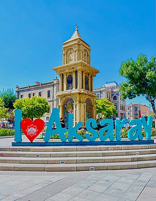
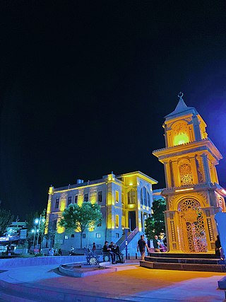
Aksaray is a city in the Central Anatolia region of Turkey. It is the seat of Aksaray Province and Aksaray District. Its population is 247,147 (2021). In 2021 the province had an estimated population of 429,069 distributed over about 7,659 km2 (2,957 sq mi). The average elevation is 980 m (3,215 ft), with the highest point being Mt. Hasan at 3,253 m (10,673 ft).
Ağaçören, formerly Panlı, is a town in Aksaray Province in the Central Anatolia region of Turkey. It is the seat of Ağaçören District. Its population is 2,878 (2021). Its average elevation is 1,100 m (3,609 ft). The town consists of the quarters Camili, Gümüştepe, Kale, Yeni, Yurtsever and Zafer.
Eskil is a town in Aksaray Province in the Central Anatolia region of Turkey, situated on the southern shore of Lake Tuz. It is the seat of Eskil District. Its population is 17,929 (2021). The average elevation in the center is 932 m (3,058 ft).
Gülağaç, formerly Ağaçlı, is a town in Aksaray Province in the Central Anatolia region of Turkey. It is the seat of Gülağaç District. Its population is 4,819 (2021). The average elevation is 1,170 m (3,839 ft).

Güzelyurt, formerly Gelveri, is a town in Aksaray Province in the Central Anatolia region of Turkey, at a distance of 45 km (28 mi) from the city of Aksaray. It is the seat of Güzelyurt District. Its population is 2,570 (2021). Its elevation is 1,485 m (4,872 ft).
Sarıyahşi is a town in Aksaray Province in the Central Anatolia region of Turkey, at a distance of 110 km (68 mi) from the province seat of Aksaray. It is the seat of Sarıyahşi District. Its population is 3,543 (2021).
Ortaköy is a town in Aksaray Province in the Central Anatolia region of Turkey, located north of the city of Aksaray. It is the seat of Ortaköy District. Its population is 20,511 (2021). Its average elevation is 1,140 m (3,740 ft). The town consists of 12 quarters, including Balcı.

Belisırma is a village in Güzelyurt District, Aksaray Province, Turkey. Its population is 502 (2021). The distance to Güzelyurt is 11 kilometres (6.8 mi) and to Aksaray is 42 kilometres (26 mi). Although a small village, Belisırma is well known because of various ruins around it. The church ruins of Ala, Bezirhane, Karagedik and Direkli are Byzantine cave churches.
Bekarlar, recently known as Nenizi and in earlier times Nazianzus, is a village in the Gülağaç District, Aksaray Province, Turkey. Its population is 1,040 (2021).
Çatalsu is a village in the Gülağaç District, Aksaray Province, Turkey. Its population is 280 (2021). Its distance to Gülağaç is 17 km and to Aksaray is 35 km.
Ceceli is a village in the Ortaköy District, Aksaray Province, Turkey. Its population is 196 (2021).
Durhasanlı is a village in the Ortaköy District, Aksaray Province, Turkey. Its population is 214 (2021).
Hıdırlı is a village in the Ortaköy District, Aksaray Province, Turkey. Its population is 146 (2021).
Hocabeyli is a village in the Ortaköy District, Aksaray Province, Turkey. Its population is 200 (2021).
Reşadiye is a village in the Ortaköy District, Aksaray Province, Turkey. Its population is 97 (2021). The village is populated by Kurds.
Sarıkaraman is a village in the Ortaköy District, Aksaray Province, Turkey. Its population is 1,036 (2021). Before the 2013 reorganisation, it was a town (belde).
Seksenuşağı is a village in the Ortaköy District, Aksaray Province, Turkey. Its population is 265 (2021).
Yıldırımlar is a village in the Ortaköy District, Aksaray Province, Turkey. Its population is 231 (2021).
Uzunçayır is a village in the Kozluk District, Batman Province, Turkey. Its population is 389 (2021).
