
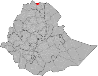
Awsi Rasu, also known as Administrative Zone 1, is a zone in the Afar Region of Ethiopia. This zone is bordered on the south by Gabi Rasu, on the southwest by Hari Rasu, on the west by the Amhara Region, on the northwest by Fantí Rasu, on the north by Kilbet Rasu, on the northeast by Eritrea, and on the east by Djibouti.
Argobba is a special woreda in the Afar Region of Ethiopia. This woreda is named after the Argobba people, whose homeland lies in this district. Located on the eastern escarpment of the Ethiopian highlands, Argobba is bordered on the south, west and north by the Afar Region, and on the east by Dulecha. Settlements in this woreda include Gachine.
Afambo is a woreda in Afar Region, Ethiopia. It is named after Lake Afambo, located at the border of this woreda with Asayita, near the international border with Djibouti. Part of the Administrative Zone 1, Afambo is bordered on the south by the Somali Region, on the west by Dubti, on the north by Asayita, and on the east by Djibouti. The largest town in this woreda is Afambo.
Dubti is a woreda in Afar Region, Ethiopia. Part of the Administrative Zone 1, Dubti is bordered on the south by the Somali Region, on the southwest by Mille, on the west by Chifra, on the northwest by the Administrative Zone 4, on the north by Kori, on the northeast by Elidar, on the east by Asayita, and on the southeast by Afambo. Towns in Dubti include Dubti, Logiya, and Semera.
Amibara is a woreda in Afar Region, Ethiopia. Part of the Administrative Zone 3, Amibara is bordered on the south by Awash Fentale, on the west by the Awash River which separates it from Dulecha, on the northwest by the Administrative Zone 5, on the north by Gewane, on the east by the Somali Region, and on the southeast by Oromia Region. Towns in Amibara include Awash Arba, Awash Sheleko, Melka Sedi and Melka Were.
Awash Fentale is a woreda in Afar Region, Ethiopia. Part of the Administrative Zone 3, Awash Fentale is bordered on the south by the Oromia Region, on the west by the Amhara Region, on the north by Dulecha, and on the east by Amibara. Towns in Awash Fentale include Awash Sebat Kilo and Sabure.

Kafta Humera is a woreda in Tigray Region, Ethiopia. Located in the Western zone of Tigray, Kafta Humera is bordered on the south by Tsegede, on the west by Sudan, by the Tekezé River which separates Kafta Humera from Eritrea on the north, on the east by the North Western zone, and on the southeast by Welkait. Towns in Kafta Humera include Adi Hirdi and Humera.

Tahtay Adiyabo is a woreda in the Tigray Region of Ethiopia. Part of the North Western Zone, Tahtay Adiyabo is bordered on the south by Asigede Tsimbela, on the southwest by the Tekezé River on the north by Eritrea, and on the east by La'ilay Adiyabo; part of the northern border with Eritrea is delineated by the Mareb River. The northernmost point of this woreda is the northernmost point of Ethiopia. Towns in this woreda include Addi Awuala and Addi Hageray. The town of Sheraro is surrounded by Tahtay Adiyabo.

Asgede Tsimbla is a woreda in Tigray Region, Ethiopia. Part of the Semien Mi'irabawi Zone, Asgede Tsimbla is bordered along the south by the Tekeze River which separates the woreda on the south from Tselemti and to the west by the Mi'irabawi Zone, then on the northwest by Tahtay Adyabo, on the north by La'ilay Adiyabo, on the northeast by Tahtay Koraro, and on the east by Medebay Zana. The administrative center of this woreda is Inda Aba Guna; other towns in Asgede Tsimbla include Kisad Gaba, May Hansse, Adi Gebru, Dedebit, Idaga Hibret, Adi Mehameday, Hitsats, and Debre Abai.
Mereb Lehe is a woreda in Tigray Region, Ethiopia. Part of the Maekelay Zone, it is bordered on the south by La'ilay Maychew, on the southwest by Tahtay Maychew, on the west by the Semien Mi'irabawi Zone, on the north by the Mareb River, on the east by Enticho, and on the southeast by Adwa. The administrative center of this woreda is Rama; other towns include La'ilay Merhisenay.
Adwa is a woreda in Tigray Region, Ethiopia. Part of the Maekelay Zone, Adwa is bordered on the south by Werie Lehe, on the west by La'ilay Maychew, on the north by Mereb Lehe, and on the east by Enticho. Town of Adwa is surrounded by Adwa woreda.

La'ilay Maychew is a woreda in Tigray Region, Ethiopia. Part of the Maekelay Zone (central), La'ilay Maychew is bordered on the south by Naeder Adet, on the west by Tahtay Maychew, on the north by Mereb Lehe, and on the east by Adwa. The town of Axum is surrounded by La'ilay Maychew; other towns in La'ilay Maychew include Mahibere Degue.

Tahtay Maychew is a woreda in Tigray Region, Ethiopia. Part of the Mehakelegnaw (Central) Zone, Tahtay Maychew is bordered on the south by Naeder Adet, on the west by the Semien Mi'irabawi Zone, on the north by Mereb Lehe, and on the east by La'ilai Maychew. The administrative center of this woreda is Wukro Marai; other towns in Tahtay Maychew include Chila.

Saesi Tsaedaemba is one of the Districts of Ethiopia, or woredas, in the Tigray Region of Ethiopia. Located in the Misraqawi Zone at the eastern edge of the Ethiopian highlands, Saesi Tsaedaemba is bordered on the south by Kilte Awulaelo, on the southwest by Hawzen, on the west by Ganta Afeshum, on the northwest by Gulomahda, on the north by Irob, on the east by the Afar Region, and on the southeast by Atsbi Wenberta. Towns in Saesi Tsaedaemba include Edaga Hamus and Freweyni also known as Sinkata) where the woreda office is located.

Kilte Awulaelo is one of the Districts of Ethiopia, or woredas, in the Tigray Region of Ethiopia. Part of the Misraqawi Zone, Kilte Awulaelo is bordered on the south by the Debub Misraqawi (Southeastern) Zone, on the west by the Mehakelegnaw (Central) Zone, on the northeast by Hawzen, on the north by Saesi Tsaedaemba, and on the east by Atsbi Wenberta. Towns in the Kilte Awulaelo woreda include Agula, Tsigereda and Maimekden. Town of Wukro is surrounded by Kilte Awulaelo.
Enderta is one of the Districts of Ethiopia or woredas in the Tigray Region of Ethiopia. It was named for the former Enderta province, which was later merged into Tigray Province. Located in the Debub Misraqawi (Southeastern) Zone at the eastern edge of the Ethiopian highlands Enderta is bordered on the south by Hintalo Wajirat, on the west by Samre, on the northwest by the Mehakelegnaw (Central) Zone, on the north by the Misraqawi (Eastern) Zone, and on the east by the Afar Region; the city and special zone of Mek'ele is an enclave within Enderta. Towns in Enderta include Aynalem and Qwiha; the historic village of Chalacot is also located in this woreda.

Endamekoni is one of the Districts of Ethiopia, or woredas, in the Tigray Region of Ethiopia. Part of the Debubawi Zone, Endamehoni is bordered on the south by Ofla, on the west by the Amhara Region, on the north by Alaje, and on the east by Raya Azebo. Towns in Endamehoni include Wedisemro. The town of Maychew is surrounded by Endamehoni.
Alamata is a woreda in Tigray Region, Ethiopia. Part of the Debubawi Zone, Alamata is bordered on the south and west by the Amhara Region, on the northwest by Ofla, and on the northeast by Raya Azebo. Towns in Alamata include Waja. The city of Alamata is a separate entity and is surrounded by Alamata woreda.
Shinile is a woreda in Somali Region, Ethiopia. Part of the Sitti Zone, Shinile is bordered on the south by Dire Dawa, on the west by Erer, on the north by the Afar Region, on the east by Ayesha, and on the southeast by Dembel and Jijiga Zone. Towns in Shinile include Adigale, Harewa, Milo, and Shinile; villages include Jaldessa, Marmaarsa, Toome
Alefa is one of the woredas in the Amhara Region of Ethiopia. Part of the Semien Gondar Zone, Alefa is bordered on the southwest by the Agew Awi Zone, on the west by Qwara, on the north by Takusa, on the east by Lake Tana and on the southeast by the Mirab Gojjam Zone. The administrative center of Alefa is Shawra; other towns include Dengel Ber, Esey Dibir and Gomenge. Rivers include the Dinder. Jawi and Takusa woredas were separated from Alefa.