Aschbach-Markt

Last updated
Aschbach-Markt
AUT Aschbach-Markt COA.png
Coat of arms
Austria adm location map.svg
Red pog.svg
Aschbach-Markt
Location within Austria
Coordinates: 48°4′N14°45′E / 48.067°N 14.750°E / 48.067; 14.750 Coordinates: 48°4′N14°45′E / 48.067°N 14.750°E / 48.067; 14.750
Country Austria
State Lower Austria
District Amstetten
Government
   Mayor Martin Schlöglhofer
Area
[1]
  Total37.27 km2 (14.39 sq mi)
Elevation
309 m (1,014 ft)
Population
(2018-01-01) [2]
  Total3,811
  Density100/km2 (260/sq mi)
Time zone UTC+1 (CET)
  Summer (DST) UTC+2 (CEST)
Postal code
3361
Area code 07476
Website www.aschbach-markt.gv.at

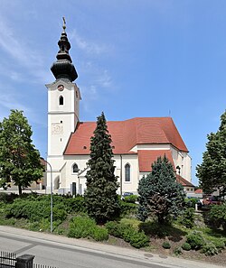
Aschbach-Markt is a town in the district of Amstetten in Lower Austria in Austria.

Lower Austria State of Austria

Lower Austria is the northeasternmost of the nine states of Austria. Since 1986, the capital of Lower Austria has been St. Polten, the most recently designated capital in Austria. Previously, Lower Austria's capital was Vienna, even though Vienna has not officially been part of Lower Austria since 1921. With a land area of 19,186 km2 (7,408 sq mi) and a population of 1.612 million people, Lower Austria is the country's largest state; it is the second most populous after the federal state of Vienna. Other main cities are Amstetten, Krems an der Donau and Wiener Neustadt.

Austria Federal republic in Central Europe

Austria, officially the Republic of Austria, is a country in Central Europe comprising 9 federated states. Its capital, largest city and one of nine states is Vienna. Austria has an area of 83,879 km2 (32,386 sq mi), a population of nearly 9 million people and a nominal GDP of $477 billion. It is bordered by the Czech Republic and Germany to the north, Hungary and Slovakia to the east, Slovenia and Italy to the south, and Switzerland and Liechtenstein to the west. The terrain is highly mountainous, lying within the Alps; only 32% of the country is below 500 m (1,640 ft), and its highest point is 3,798 m (12,461 ft). The majority of the population speaks local Bavarian dialects as their native language, and German in its standard form is the country's official language. Other regional languages are Hungarian, Burgenland Croatian, and Slovene.

Geography

Aschbach-Markt lies in the Mostviertel about 10 km from Amstetten. The Url River flows through the municipality.

Mostviertel southwestern quarter of the four quarters of Lower Austria

Mostviertel is the southwestern quarter of the four quarters of Lower Austria. It is bordered on the north by the Danube and to the south and west by the state borders of Styria and Upper Austria respectively. The Wienerwald forms the natural border to the east and gives the quarter its second name, "The Quarter Over the Wienerwald".

Amstetten, Lower Austria Place in Lower Austria, Austria

Amstetten is a town in Lower Austria. It is the capital of the Amstetten District and the centre of the historical region Mostviertel

Related Research Articles

Amstetten District District in Lower Austria, Austria

Bezirk Amstetten is a district of the state of Lower Austria in Austria.

Strengberg Place in Lower Austria, Austria

Strengberg is a town in the district of Amstetten in Lower Austria in Austria.

Allhartsberg Place in Lower Austria, Austria

Allhartsberg is a town in the district of Amstetten in Lower Austria in Austria.

Ardagger Place in Lower Austria, Austria

Ardagger is a town in the district of Amstetten in Lower Austria in Austria.

Biberbach, Austria Place in Lower Austria, Austria

Biberbach is a village in the district of Amstetten in Lower Austria in Austria.

Haag, Austria Place in Lower Austria, Austria

Haag is a town in the district of Amstetten in Lower Austria in Austria. It is at the geographical centre of Europe.

Haidershofen Place in Lower Austria, Austria

Haidershofen is a town located in Austria. The town is within the district of Amstetten, located in Lower Austria.

Kematen an der Ybbs Place in Lower Austria, Austria

Kematen an der Ybbs is a town in the district of Amstetten in Lower Austria in Austria.

Neustadtl an der Donau Place in Lower Austria, Austria

Neustadtl an der Donau is a town in the district of Amstetten in Lower Austria in Austria.

Opponitz Place in Lower Austria, Austria

Opponitz is a town in the district of Amstetten in Lower Austria in Austria.

Seitenstetten Place in Lower Austria, Austria

Seitenstetten is a town in the district of Amstetten in Lower Austria in Austria.

Sankt Georgen am Ybbsfelde Place in Lower Austria, Austria

Sankt Georgen am Ybbsfelde is a town in the district of Amstetten in Lower Austria in Austria.

St. Valentin Place in Lower Austria, Austria

St. Valentin is the most westerly town in the district of Amstetten in Lower Austria in Austria.

Sankt Pantaleon-Erla Place in Lower Austria, Austria

Sankt Pantaleon-Erla is a town in the district of Amstetten in Lower Austria in Austria.

Sankt Peter in der Au Place in Lower Austria, Austria

Sankt Peter in der Au is a town in the district of Amstetten in Lower Austria in Austria.

Wallsee-Sindelburg Place in Lower Austria, Austria

Wallsee-Sindelburg is a town in the district of Amstetten in Lower Austria in Austria.

Winklarn, Austria Place in Lower Austria, Austria

Winklarn is a town in the district of Amstetten in Lower Austria in Austria.

Wolfsbach, Lower Austria Place in Lower Austria, Austria

Wolfsbach is a town in the district of Amstetten in Lower Austria in Austria.

Ybbsitz Place in Lower Austria, Austria

Ybbsitz is a town in the district of Amstetten in Lower Austria in Austria.

Blindenmarkt Place in Lower Austria, Austria

Blindenmarkt is a town in the district of Melk in the Austrian state of Lower Austria.

References

  1. "Dauersiedlungsraum der Gemeinden Politischen Bezirke und Bundesländer - Gebietsstand 1.1.2018". Statistics Austria. Retrieved 10 March 2019.
  2. "Einwohnerzahl 1.1.2018 nach Gemeinden mit Status, Gebietsstand 1.1.2018". Statistics Austria. Retrieved 9 March 2019.