
The City Loop is a piece of underground commuter rail infrastructure in the central business district (CBD) of Melbourne, Victoria, Australia

Richmond railway station is a commuter railway station and the junction point for the Alamein, Belgrave, Cranbourne, Frankston, Glen Waverley, Lilydale, Pakenham and Sandringham lines, serving the south-eastern inner Melbourne suburb of Richmond, Victoria, Australia. Richmond is a premium status elevated structure station featuring ten platforms, with five island platforms. The stations opened on 8 February 1859 as Punt Road before being renamed Swan Street on 12 December of the same year, it was renamed Richmond on 1 January 1867.

East Richmond railway station is located on the Lilydale, Belgrave, Alamein and Glen Waverley lines in Victoria, Australia. It serves the inner eastern Melbourne suburb of Cremorne, and it opened on 24 September 1860 as Church Street. It was renamed East Richmond on 1 January 1867.

Burnley railway station is the junction for the Lilydale, Belgrave, Alamein and Glen Waverley lines in Victoria, Australia. It serves the inner eastern Melbourne suburb of Burnley, and it opened on 1 May 1880 as Burnley Street. It was renamed Burnley on 1 September 1882.

Oakleigh railway station is a commuter railway station in the suburb of Oakleigh in the south-east of Melbourne, Victoria, Australia. The station opened in 1877 as the up end of the Gippsland line, with the station being electrified in 1922. The station consists of two sides that are connected to each other via the adjacent roads, and both platforms are connected to each other via a pedestrian subway.

Elsternwick railway station is located on the Sandringham line in Victoria, Australia. It serves the south-eastern Melbourne suburb of Elsternwick, and it opened on 19 December 1859.

East Malvern railway station is a commuter railway station on the Glen Waverley line, serving Malvern East, a suburb of Melbourne, Victoria, Australia. The station, originally called Karnak, opened as Eastmalvern on 3 February 1929. It was renamed East Malvern on 29 February 1972.
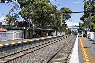
Mount Waverley railway station is a commuter railway station in the suburb of Mount Waverley in the south east of Melbourne, Victoria, Australia, and is part of the Glen Waverley line on Melbourne's suburban rail network. The station opened in 1930 as a part of the extension from East Malvern to Glen Waverley. The station consists of two side which are connected to each other via the adjacent roads, additionally both platforms are connected to each other via a pedestrian subway. Additionally the station is served by bus routes 623 and 733. The station is appromixately 18 kilometres (11 mi) or around a 30-minute train ride away from Flinders Street.

Glen Waverley railway station is a commuter railway station located in the suburb of Glen Waverley in the south-east of Melbourne, Victoria, Australia. The station originally opened in 1930 as part of the line's extension from East Malvern. The station consists of a single island platform that is connected to Kingsway via a ramp on the station's eastern end.
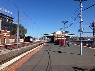
Essendon railway station is located on the Craigieburn line in Victoria, Australia. It serves the northern Melbourne suburb of Essendon, and it opened on 1 November 1860.
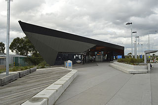
Epping railway station is located on the Mernda line in Victoria, Australia. It serves the northern Melbourne suburb of Epping, and it opened on 23 December 1889.

The Alamein line is a commuter railway line in the city of Melbourne, Victoria, Australia. Operated by Metro Trains Melbourne, it is the city's second shortest metropolitan railway line at 14.9 kilometres (9.3 mi). The line runs from Flinders Street station in central Melbourne to Alamein station in the east, serving 18 stations via Burnley, Camberwell, Riversdale, and Ashburton. The line operates for approximately 19 hours a day with 24 hour service available on Friday and Saturday nights. During peak hours, headways of up to 15 minutes are operated with services every 10–30 minutes during off-peak hours. Trains on the Alamein line run with one or two three-car formations of X'Trapolis 100 trainsets.
The Outer Circle Railway was opened in stages in 1890 and 1891, as a steam-era suburban railway line, in Melbourne, Australia. It traversed much of the modern City of Boroondara, including the suburbs of Kew East, Camberwell, Burwood, Ashburton, and Malvern East. At its longest, it ran from Fairfield station, on what is today the Hurstbridge line, to Oakleigh station, on the current Pakenham and Cranbourne lines.

Proposals for expansion of the Melbourne rail network are commonly presented by political parties, government agencies, industry organisations and public transport advocacy groups. The extensions proposed take a variety of forms: electrification of existing routes to incorporate them into the suburban rail system; reconstruction of former passenger rail lines along pre-existing easements; entirely new routes intended to serve new areas with heavy rail or provide alternative routes in congested areas; or track amplification along existing routes to provide segregation of services. Other proposals are for the construction of new or relocated stations on existing lines, to provide improved access to public transport services.

The Glen Waverley line is a commuter railway line in the city of Melbourne, Victoria, Australia. Operated by Metro Trains Melbourne, it is the city's fifth shortest metropolitan railway line at 21.3 kilometres (13.2 mi). The line runs from Flinders Street station in central Melbourne to Glen Waverley station in the east, serving 20 stations including Burnley, Kooyong, East Malvern, and Jordanville. The line operates for approximately 19 hours a day with 24 hour service available on Friday and Saturday nights. The line operates with headways of up to 10 minutes during peak hours and as long as 30 minutes during off-peak hours. Trains on the Glen Waverley line run with two three-car formations of X'Trapolis 100 trainsets.
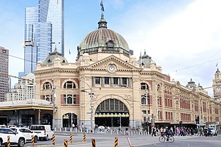
The Melbourne rail network is a metropolitan suburban and freight rail system serving the city of Melbourne, Victoria, Australia. The metropolitan rail network is centred around the Melbourne central business district (CBD) and consists of 222 railway stations across 16 lines, which served a patronage of 99.5 million over the year 2021–2022. It is the core of the larger Victorian railway network, with regional links to both intrastate and interstate rail systems.

Melbourne tram route 75 is operated by Yarra Trams on the Melbourne tram network from Vermont South to Central Pier. The 22.8 kilometre route is operated out of Camberwell depot with A and B class trams. It is the longest route on the network.

Princes Bridge was a Melbourne railway station built in 1859 and was the terminus for all Epping line and Hurstbridge line trains. The station was named after the adjacent Princes Bridge, which crosses the Yarra River. Originally Princes Bridge station was isolated from Flinders Street station, even though it was adjacent to it, sited just on the opposite side of Swanston Street. Some years later the railway tracks were extended under the street to join the two stations, and Princes Bridge slowly became amalgamated into the larger Flinders Street station. This process was completed in May 1997.
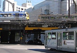
The Flinders Street Viaduct is a railway bridge in Melbourne, Australia. Made up of six tracks built at different times, it links Flinders Street station to Southern Cross station, forming the main connection between the eastern and western parts of the Victorian rail network.

Jolimont Yard was an array of railway lines and carriage sidings on the edge of the central business district of Melbourne, Australia. Located between Flinders Street station, Richmond Junction, the Yarra River and Flinders Street they were often criticised for cutting off the city from the river, being the site of many redevelopment proposals. The Princes Gate Towers were built over part of the yard in the 1960s, which themselves were replaced by Federation Square in the 2000s. The rail sidings themselves were progressively removed from the 1980s to the 1990s with only running lines today, but the area continues to be referred to as the 'Jolimont railyards' by Melburnians.


