
Canada has a vast geography that occupies much of the continent of North America, sharing a land border with the contiguous United States to the south and the U.S. state of Alaska to the northwest. Canada stretches from the Atlantic Ocean in the east to the Pacific Ocean in the west; to the north lies the Arctic Ocean. Greenland is to the northeast with a shared border on Hans Island. To the southeast Canada shares a maritime boundary with France's overseas collectivity of Saint Pierre and Miquelon, the last vestige of New France. By total area, Canada is the second-largest country in the world, after Russia. By land area alone, however, Canada ranks fourth, the difference being due to it having the world's largest proportion of fresh water lakes. Of Canada's thirteen provinces and territories, only two are landlocked while the other eleven all directly border one of three oceans.

Lake Winnipeg is a very large, relatively shallow 24,514-square-kilometre (9,465 sq mi) lake in North America, in the province of Manitoba, Canada. Its southern end is about 55 kilometres (34 mi) north of the city of Winnipeg. Lake Winnipeg is Canada's sixth-largest freshwater lake and the third-largest freshwater lake contained entirely within Canada, but it is relatively shallow excluding a narrow 36 m (118 ft) deep channel between the northern and southern basins. It is the eleventh-largest freshwater lake on Earth. The lake's east side has pristine boreal forests and rivers that were in 2018 inscribed as Pimachiowin Aki, a UNESCO World Heritage Site. The lake is 416 km (258 mi) from north to south, with remote sandy beaches, large limestone cliffs, and many bat caves in some areas. Manitoba Hydro uses the lake as one of the largest reservoirs in the world. There are many islands, most of them undeveloped.
Lake Manitoba is the 14th largest lake in Canada and the 33rd largest lake in the world with a total area of 4,624 square kilometres (1,785 sq mi). It is located within the Canadian province of Manitoba about 75 kilometres (47 mi) northwest of the province's capital, Winnipeg, at 50°59′N98°48′W.

The Nelson River is a river of north-central North America, in the Canadian province of Manitoba. The river drains Lake Winnipeg and runs 644 kilometres (400 mi) before it ends in Hudson Bay. Its full length is 2,575 kilometres (1,600 mi), it has mean discharge of 2,370 cubic metres per second (84,000 cu ft/s), and has a drainage basin of 1,072,300 square kilometres (414,000 sq mi), of which 180,000 square kilometres (69,000 sq mi) is in the United States.

The Assiniboine River is a 1,070-kilometre (660 mi) river that runs through the prairies of Western Canada in Saskatchewan and Manitoba. It is a tributary of the Red River. The Assiniboine is a typical meandering river with a single main channel embanked within a flat, shallow valley in some places and a steep valley in others. Its main tributaries are the Qu'Appelle, Souris, and Whitesand Rivers. For early history and exploration see Assiniboine River fur trade.

Northern Manitoba is a geographic and cultural region of the Canadian province of Manitoba. Originally encompassing a small square around the Red River Colony, the province was extended north to the 60th parallel in 1912. The region's specific boundaries vary, as "northern" communities are considered to share certain social and geographic characteristics, regardless of latitude.

Whiteshell Provincial Park is a provincial park in southeast Manitoba, approximately 120 kilometres (75 mi) east of the city of Winnipeg. The park is considered to be a Class II protected area under the IUCN protected area management categories. It is 275,210 hectares in size.
Gods Lake is a lake in northeastern Manitoba in Canada. The lake covers an area of 1,151 square kilometres (444 sq mi) with a net area of 1,061 square kilometres (410 sq mi), making it the 7th largest lake in the province. It lies north of Island Lake at an elevation of 178 metres (584 ft), approximately 280 kilometres (174 mi) east of Thompson, Manitoba. It has a shore length of 474 kilometres (295 mi). It drains north via the Gods River and the Hayes River to Hudson Bay.

The geography of Saskatchewan is unique among the provinces and territories of Canada in some respects. It is one of only two landlocked regions and it is the only region whose borders are not based on natural features like lakes, rivers, or drainage divides. The borders of Saskatchewan, which make it very nearly a trapezoid, were determined in 1905 when it became a Canadian province. Saskatchewan has a total area of 651,036 square kilometres (251,366 sq mi) of which 591,670 km2 (228,450 sq mi) is land and 59,366 km2 (22,921 sq mi) is water.
The Gods River is a remote wilderness river in the Hudson Bay drainage basin in Northern Manitoba, Canada. Its flows from its source at Gods Lake to its mouth at the Hayes River. The Hayes River flows to Hudson Bay.

The Rural Municipality of Sifton is a rural municipality (RM) in the south-west portion of the Canadian province of Manitoba.
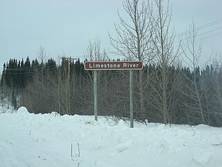
The Limestone River is a river in the Hudson Bay drainage basin in Northern Manitoba, Canada. Its flows from Sakawisew Bay on Limestone Lake to the Nelson River, just downstream from Limestone Generating Station and dam and adjacent to the Fox Lake Cree Nation and to the abandoned community of Sundance.
The Owl River is a river in the Hudson Bay drainage basin in census division 23 in Northern Manitoba, Canada. It flows from Fly Lake to Hudson Bay.
The Black Duck River is a river in the provinces of Manitoba and Ontario, Canada. Flowing northeast from Hosea Lake in Kenora District in Northwestern Ontario, the river criss-crosses the Manitoba-Ontario border before reaching to its mouth at Hudson Bay in the Northern Region of Manitoba just west of Manitoba's easternmost point where the inter-provincial border meets the bay.

Southern Indian Lake is a large lake in northern Manitoba, Canada. It has an area of 2,247 square kilometres (868 sq mi) with a surface elevation of 258 metres (846 ft).
Carroll Lake is an irregularly-shaped lake in the province of Manitoba, and in the Unorganized Part of Kenora District in Northwestern province of Ontario, Canada. It is in the Hudson Bay drainage basin, and, with the exception of portions of two small bays in the west, lies mostly in Ontario. The Ontario portion of the lake is within Woodland Caribou Provincial Park, and the small Manitoba portions within Atikaki Provincial Wilderness Park.
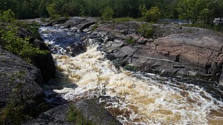
Whitemouth Falls Provincial Park is a provincial park located where the Whitemouth River joins the Winnipeg River in Manitoba, Canada. It was designated as a Provincial Park in 1974.


