Atal II

Last updated
Atal II
P. 6557
India Uttarakhand relief map.svg
Red triangle with thick white border.svg
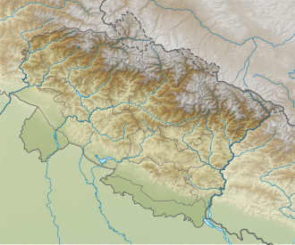
Atal II
Location in Uttarakhand
Highest point
Elevation 6,557 m (21,512 ft)
Coordinates 30°59′51″N79°09′04″E / 30.99750°N 79.15111°E / 30.99750; 79.15111 Coordinates: 30°59′51″N79°09′04″E / 30.99750°N 79.15111°E / 30.99750; 79.15111
Geography
Location Uttarakhand, India
Parent range Garhwal Himalaya
Climbing
First ascent In October 2018, Atal I was climbed by Nehru Institute of Mountaineering led by Colonel Amit Bisht, principal N.I.M.

Atal II is a mountain of the Garhwal Himalaya in Uttarakhand India. Earlier it was known as P.6557. It was renamed after a team from the N.I.M Nehru Institute of Mountaineering climbed four unnamed peaks and named it after former Prime Minister Atal Bihari Vajpayee, according to Colonel Amit Bisht, principal of the N.I.M. [1] The peak lies above the Shyamvarn Glacier. The elevation of Atal II is 6,557 metres (21,512 ft). It is joint 74th highest located entirely within the Uttrakhand. Nanda Devi is the highest mountain in this category. It lies 6 km ENE of Sudarshan Parbat 6,507 metres (21,348 ft). Swetvarn 6,340 metres (20,801 ft) lies 5.1 km WSW and it is 5.5 km east of Chaturbhuj 6,654 metres (21,831 ft). It lies 2.9 km ESE of Yogeshwar 6,678 metres (21,909 ft). [2]

Contents

Climbing history

Atal II was climbed by Nehru Institute of Mountaineering led by Colonel Amit Bisht, principal N.I.M.in October 2018. The expedition was flagged off from Dehradun on October 4 by Chief Minister Trivendra Singh Rawat. The expedition was jointly conducted by N.I.M. and the tourism department of Uttarakhand. [3] [4]

Neighboring and subsidiary peaks

Neighboring or subsidiary peaks of Atal II:

Glaciers and rivers

Shyamvarn bamak on the western side. Nilamber Glacier on the eastern side both these Glaciers are tributaries of Raktvarn Bamak which drain itself at Gangotri Glacier. From the snout of Gangotri Glacier which was called Gomukh emerges Bhagirathi river. one of the main tributaries of river Ganga that later joins Alaknanda River the other main tributaries of river Ganga at Devprayag and became Ganga there after. [5]

See also

Related Research Articles

Matri is a mountain of the Garhwal Himalaya in Uttarakhand, India. Matri standing majestically at 6,721 metres (22,051 ft). It is joint 46th highest located entirely within the Uttrakhand. Nanda Devi, is the highest mountain in this category. Matri lies between the Chaturbhuj 6,654 metres (21,831 ft) and Chirbas Parbat 6,529 metres (21,421 ft). Its nearest higher neighbor Sri Kailash lies 10.3 km east. It is located 4.6 km NW of Sudarshan Parbat 6,507 metres (21,348 ft) and 5.7 km NW lies Kalidhang 6,373 metres (20,909 ft).

Swachhand is a mountain of the Garhwal Himalayas in Uttarakhand, India. Swachhand is 6,721 metres (22,051 ft) high. Its peak is the 46th highest located entirely within the Uttrakhand. Nanda Devi is the highest mountain in this category. Swachhand lies between the Satopanth 7,075 metres (23,212 ft) NNW and Janhukut 6,805 metres (22,326 ft) SSE. It's neighbour Janhukut peaks at 3.8 km SSE. It is located 8.9 km NW of Chaukhamba I 7,138 metres (23,419 ft) and 8.9 km NW lies Bhagirathi I 6,856 metres (22,493 ft).

Chirbas Parbat is a mountain of the Garhwal Himalaya in Uttarakhand, India. The elevation of Chirbas Parbat is 6,529 metres (21,421 ft) and its prominence is 643 metres (2,110 ft). It is joint 81st highest located entirely within the Uttrakhand. Nanda Devi, is the highest mountain in this category. Chirbas Parbat lies between the Kalidhang 6,373 metres (20,909 ft) and Matri 6,721 metres (22,051 ft). Its nearest higher neighbor Matri lies 3 km SE. It is located 5.9 km NW of Chaturbhuj 6,654 metres (21,831 ft) and 13.8 km east lies Trimukhi Parbat 6,450 metres (21,161 ft).

Sudarshan Parbat Mountain in Uttarakhand, India

Sudarshan Parbat is a mountain of the Garhwal Himalaya in Uttarakhand India.The elevation of Sudarshan Parbat is 6,529 metres (21,421 ft) and its prominence is 456 metres (1,496 ft). It is joint 87th highest located entirely within the Uttrakhand. Nanda Devi, is the highest mountain in this category. Sudarshan Parbat lies 2.1 km south of Chaturbhuj 6,654 metres (21,831 ft) and 3.3 km west of Shyamvarn 6,135 metres (20,128 ft). Its nearest higher neighbor Chaturbhuj. It is located 3.7 km SW of Yogeshwar 6,678 metres (21,909 ft) and 9.9 km SW lies Manda I 6,511 metres (21,362 ft).

Yogeshwar is a mountain of the Garhwal Himalaya in Uttarakhand, India. The elevation of Yogeshwar is 6,678 metres (21,909 ft) and its prominence is 295 metres (968 ft). It is joint 52nd highest located entirely within the Uttrakhand. Nanda Devi, is the highest mountain in this category. Yogeshwar lies on the ridge between Chaturbhuj 6,654 metres (21,831 ft) and Sri Kailash 6,932 metres (22,743 ft). Its nearest higher neighbor unnamed peak 6,715 metres (22,031 ft) lies 2.7 km N. It is located 2.7 km east of Chaturbhuj 6,654 metres (21,831 ft) and 5 km NW lies Matri 6,450 metres (21,161 ft).

Chaturbhuj is a mountain of the Garhwal Himalaya in Uttarakhand, India. The elevation of Chaturbhuj is 6,654 metres (21,831 ft) and its prominence is 357 metres (1,171 ft). It is 52nd highest located entirely within the Uttrakhand. Nanda Devi, is the highest mountain in this category. Chaturbhuj lies between the Matri 6,721 metres (22,051 ft) and Shwetvarn 6,340 metres (20,801 ft). Its nearest higher neighbor Yogeshwar lies 2.7 km east. It is located 5.9 km NW of chirbas Parbat 6,529 metres (21,421 ft) and 8.5 km east lies Sri Kailash 6,932 metres (22,743 ft).

Pilapani Parbat is a mountain of the Garhwal Himalaya in Uttarakhand India. The elevation of Pilapani Parbat is 6,796 metres (22,297 ft) and its prominence is 599 metres (1,965 ft). It is 33rd highest located entirely within the Uttrakhand. Nanda Devi is the highest mountain in this category, and 488th highest in the world. Pilapani Parbat lies between the Sri Kailash6,932 metres (22,743 ft) and Mana Parbat III 6,730 metres (22,080 ft). Its nearest higher neighbor Sri Kailash lies 6.5 km NNW. It is located 9.5 km SE of Yogeshwar 6,678 metres (21,909 ft) and 11.7 km SW lies Bhagirathi Parbat II 6,512 metres (21,365 ft).

Koteshwar I is a mountain of the Garhwal Himalaya in Uttarakhand, India. The elevation of Koteshwar I is 6,080 metres (19,948 ft). It is the 161st highest peak in Uttrakhand. Nanda Devi, is the highest mountain in this category. It lies close to Sudarshan Parbat 6,507 metres (21,348 ft) in the south. It has two approach route one from Thely Bamak and another from Swetvarn Bamak. Its nearest higher neighbor Sudarshan Parbat 6,507 metres (21,348 ft) lies 1.3 km North. It is located 5 km SW of Yogeshwar 6,678 metres (21,909 ft) and 3.2 km east lies Shyamvarn 6,135 metres (20,128 ft).

Kharchakund Mountain in Uttarakhand, India

Kharchakund is a mountain of the Garhwal Himalaya in Uttarakhand, India. The elevation of Kharchakund is 6,612 metres (21,693 ft) and its prominence is 835 metres (2,740 ft). It is 64th highest located entirely within the Uttrakhand. Nanda Devi, is the highest mountain in this category. It is surrounded by Gangotri Glacier and Ghanoim Bamak. Its nearest higher neighbor Kedarnath Dome 6,831 metres (22,411 ft) lies 6.4 km WNW. It is located 1.2 km NNE of Sumeru Parbat 6,351 metres (20,837 ft) and 10.7 km east lies Janhukut 6,829 metres (22,405 ft).

Kirti Stambh is a mountain of the Garhwal Himalaya in Uttarakhand India.The elevation of Kirti Stambh is 6,270 metres (20,571 ft) and its prominence is 100 metres (328 ft). It is 128th highest located entirely within the Uttrakhand. Nanda Devi, is the highest mountain in this category. It lies between Thalaysagar and Bhartekunta. Its nearest higher neighbor Bhartekunta 6,578 metres (21,581 ft) lies 2.3 km SE. It is located 5.1 km SSE of Thalaysagar 6,904 metres (22,651 ft) and 12.8 km NEE lies Bhagirathi I 6,856 metres (22,493 ft).

Bhartekunta Mountain in Uttarakhand, India

Bhartekunta is a mountain of the Garhwal Himalaya in Uttarakhand India.The elevation of Bhartekunta is 6,578 metres (21,581 ft) and its prominence is 280 metres (919 ft). It is 69th highest located entirely within the Uttrakhand. Nanda Devi, is the highest mountain in this category. It lies between Kirti Stambh and Kedarnath (mountain). Its nearest higher neighbor Kedarnath (mountain) 6,940 metres (22,769 ft) lies 3 km ESE. It is located 2.3 km SE of Kirti Stambh 6,279 metres (20,600 ft) and 6.9 km north lies Meru Peak 6,660 metres (21,850 ft).

Satopanth South West also called P. 6770 is a mountain of the Garhwal Himalaya in Uttarakhand, India. The elevation of Satopanth south west is 6,770 metres (22,211 ft) and its prominence is 195 metres (640 ft). It is 40th highest located entirely within the Uttrakhand. Nanda Devi, is the highest mountain in this category. It lies in the same connecting ridge that joins Satopanth and Bhagirathi Parbat I. It lies 1.8 km SW of Satopanth. Its nearest higher neighbor Satopanth 7,075 metres (23,212 ft). It is located 3.4 km SE of Vasuki South 6,702 metres (21,988 ft) and 5.2 km NNW lies Bhagirathi I 6,856 metres (22,493 ft).

Jogin I Mountain in Uttarakhand, India

Jogin I is a mountain of the Garhwal Himalaya in Uttarakhand India.The elevation of Jogin I is 6,465 metres (21,211 ft) and its prominence is 843 metres (2,766 ft). It is 94th highest located entirely within the Uttrakhand. Nanda Devi, is the highest mountain in this category. It lies 5.4 km east of Gangotri III and 7.4 km west of Bhrigupanth 6,772 metres (22,218 ft). It lies 2.2 km South of Jogin II. Its nearest higher neighbor is Gangotri III 6,577 metres (21,578 ft). It is located 6.9 km NW of Thalaysagar 6,904 metres (22,651 ft) and 8.8 km NW lies Gangotri I 6,682 metres (21,923 ft).

Manda I Mountain in Uttarakhand, India

Manda I is a mountain of the Garhwal Himalaya in Uttarakhand India also called Manda. The elevation of Manda I is 6,510 metres (21,358 ft) and its prominence is 226 metres (741 ft). It is joint 86th highest located entirely within the Uttrakhand. Nanda Devi, is the highest mountain in this category. It lies 1.6km north of Manda II 6,568 metres (21,549 ft) and 3.9km north of Manda III 6,529 metres (21,421 ft). It lies 7.8km NE of Jogin II 6,342 metres (20,807 ft). It is located 6.6km north of Bhrigupanth 6,772 metres (22,218 ft) and 9.6km SW lies Jogin I 6,465 metres (21,211 ft).

Shwetvarna is a mountain of the Garhwal Himalaya in Uttarakhand India.The elevation of Shwetvarna is 6,340 metres (20,801 ft) and its prominence is 240 metres (787 ft). It is 111th joint highest located entirely within the Uttrakhand. Nanda Devi, is the highest mountain in this category. It lies 1.2 km SSE of Chaturbhuj 6,654 metres (21,831 ft) its nearest higher neighbor and it is 1.2 km SSW of Sudarshan Parbat 6,507 metres (21,348 ft). It lies 3 km NW of Shyamvarn 6,135 metres (20,128 ft).

Srikantha is a mountain of the Garhwal Himalaya in Uttarakhand India. The elevation of Srikantha is 6,133 metres (20,121 ft) and its prominence is 471 metres (1,545 ft). It is 151st highest located entirely within the Uttrakhand. Nanda Devi, is the highest mountain in this category. It lies 5.8 km NW of Gangotri I 6,672 metres (21,890 ft). Jaonli 6,632 metres (21,759 ft) lies 12.3 km SSE and it is 18.6 km west of Manda I 6,510 metres (21,358 ft). It lies 14.4 km NW of Jogin I 6,465 metres (21,211 ft).

Saife is a mountain of the Garhwal Himalaya in Uttarakhand India. The elevation of Saife is 6,161 metres (20,213 ft). It is 147th highest located entirely within the Uttrakhand. Nanda Devi, is the highest mountain in this category. It lies 1.5 km SSE of Sudarshan Parbat 6,507 metres (21,348 ft) its nearest higher neighbor. Shyamvarn 6,135 metres (20,128 ft) lies 2.5 km ENE and it is 2.4 km south of Shwetvarna 6,340 metres (20,801 ft). It lies 4.4 km SSW of Yogeshwar 6,678 metres (21,909 ft).

Shyamvarn is a mountain of the Garhwal Himalaya in Uttarakhand India. The peak lies above the Shyamvarn Glacier. The elevation of Shyamvarn is 6,135 metres (20,128 ft) and its prominence is 250 metres (820 ft). It is 150th highest located entirely within the Uttrakhand. Nanda Devi, is the highest mountain in this category. It lies 3.3 km east of Sudarshan Parbat 6,507 metres (21,348 ft). Saife 6,161 metres (20,213 ft) lies 2.5 km WSW and it is 3 km ESE of Shwetvarna 6,340 metres (20,801 ft). It lies 2.8 km South of Yogeshwar 6,678 metres (21,909 ft).

Atal I is a mountain of the Garhwal Himalaya in Uttarakhand India. Earlier it was known as P.6566. It was rename after a team from N.I.M. Nehru Institute of Mountaineering climb four unnamed peaks and named it after former Prime Minister Atal Bihari Vajpayee According to Colonel Amit Bisht, principal N.I.M. The peak lies above the Shyamvarn Glacier. The elevation of Atal I is 6,566 metres (21,542 ft). It is joint 72nd highest located entirely within the Uttrakhand. Nanda Devi, is the highest mountain in this category. It lies 5.7 km ENE of Sudarshan Parbat 6,507 metres (21,348 ft). Swetvarn 6,340 metres (20,801 ft) lies 5 km west and it is 5.6 km ESE of Chaturbhuj 6,654 metres (21,831 ft). It lies 3.1 km SE of Yogeshwar 6,678 metres (21,909 ft).

Kalidhang is a mountain of the Garhwal Himalaya in Uttarakhand India. It is situated in the Gangotri National Park. The elevation of Kalidhang is 6,373 metres (20,909 ft) and its prominence is 563 metres (1,847 ft). It is joint 105th highest located entirely within the Uttrakhand. Nanda Devi, is the highest mountain in this category. It lies 3 km WNW of Chirbas Parbat 6,529 metres (21,421 ft) its nearest higher neighbor. Matri 6,721 metres (22,051 ft) lies 5.7 km SE and it is 11.8 km NNE of Manda I 6,510 metres (21,358 ft). It lies 10.1 km NNW of Sudarshan Parbat 6,507 metres (21,348 ft).

References

  1. "Four Himalayan peaks named after Atal Bihari Vajpayee". The Times of India. Retrieved 4 July 2020.
  2. "3D mountain model of the world by PeakVisor". PeakVisor. Retrieved 4 July 2020.
  3. "Four Himalayan Peaks Named After Atal Bihari Vajpayee". NDTV. Retrieved 4 July 2020.
  4. "Four Himalayan Peaks Near Gangotri Named After Vajpayee". Outlook India. Retrieved 4 July 2020.
  5. "Devprayag". The Times of India Travel. Retrieved 22 May 2020.