Atescatempa | |
|---|---|
Municipality | |
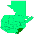
 Atescatempa Location in Guatemala | |
| Coordinates: 14°10′30″N89°44′30″W / 14.17500°N 89.74167°W | |
| Country | |
| Department | |
| Area | |
• Municipality | 31.0 sq mi (80.2 km2) |
| Population | |
• Municipality | 18,402 |
| • Density | 594/sq mi (229/km2) |
| • Urban | 9,606 |
| Climate | Aw |
Atescatempa is a town and municipality in the Jutiapa department of Guatemala. Its population as of 2023 is 20,300. [2]