Puerto Barrios is a city in Guatemala, located within the Gulf of Honduras. The bay in which the harbour is located is called Bahia de Amatique. Puerto Barrios is the departmental seat of Izabal department and is the administrative seat of Puerto Barrios municipality.

Chiquimula is one of the 22 departments of Guatemala, in Central America. The departmental capital is also called Chiquimula. The department was established by decree in 1871, and forms a part of the northeastern region of Guatemala. Physically, it is mountainous, with a climate that varies between tropical and temperate, depending on the location.
El Progreso is a department in Guatemala. The departmental capital is Guastatoya. The Spanish established themselves in the region by 1551, after the Spanish conquest of Guatemala. El Progreso was declared a department in 1908, but was dissolved in 1920 before being reestablished in 1934. Guastatoya was badly affected by the 1976 Guatemala earthquake.

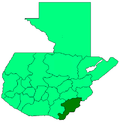
Cuilapa, also known as Santa Rosa Cuilapa, is a town, with a population of 41,359, in Guatemala. It serves as the capital of the department of Santa Rosa and as the administrative seat for the surrounding municipality of Cuilapa.
Concepción Huista is a town and municipality in the Guatemalan department of Huehuetenango.
Nentón is a town and municipality in the Guatemalan department of Huehuetenango. Its territory extends 717 km2 with a population of 45,679. It became a municipality on December 5, 1876 and was formerly known as San Benito Nentón. The population speaks Spanish and Chuj.
El Tejar is a town, with a population of 15,639, and a municipality in the Chimaltenango department of Guatemala.
San Miguel Chicaj is a town and municipality in the Baja Verapaz department of Guatemala. San Miguel Chicaj has an area of 280 Km², which makes one of the largest municipality of Baja Verapaz Department. It has a population of 33,131, mostly of achí background.
Santa Cruz El Chol is a municipality in the Baja Verapaz department of Guatemala. It is situated at 1008 m above sea level and contains about 8817 people. It covers a terrain of 140 km² and its annual festival is held from December 6-December 8.
Purulhá is a town and municipality in the Baja Verapaz department of Guatemala. It is situated at 1570 m above sea level. The municipality has a population of 56,822 and covers an area of 536 km². The annual festival is June 10-June 13.

Mixco is a city and municipality in the Guatemala department of Guatemala. It is next to the main Guatemala City municipality and has become part of the Guatemala City Metropolitan Area. Most of Mixco is separated from the city by canyons, for which a multitude of bridges have been created. Ciudad San Cristóbal, one of Guatemala's largest cities, is located in this municipality. It is the second largest city in Guatemala Department, after Guatemala City, with a population of 465,773.

Santa Catarina Pinula is a town, with a population of 70,982 and a municipality in the Guatemala Department of Guatemala. Its name, according to Guatemalan colonial historian Francisco Antonio de Fuentes y Guzmán in his book Recordación Florida comes from:
Morales is a municipality in Izabal Department of Guatemala. The municipality was created in 1920 and is formed by the town of Morales, 9 villages and 56 rural communities. The Cuevas del Silvino National Park is located a few kilometers northeast of Morales.

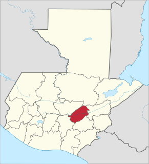
Mataquescuintla is a town and municipality in the Jalapa department of south-east Guatemala. It covers 262 square kilometres (101 sq mi).
El Quetzal is a town and municipality in the San Marcos department of Guatemala. It was recognised as municipality on 19 June 1900. The major source of income is the agriculture.
Pajapita is a town and municipality in the San Marcos department of Guatemala.It was created on 31 May 1920, after the station of Vado Ancho on the Panamerican Railroad of Guatemala was built. Due to its privileged location on the way from Guatemala to Mexico, Pajapita enjoyed considerable development while the Guatemalan railways were owned by International Railways of Central America (IRCA}, an American company that belonged to the United Fruit Company. However, with the decline of the rail that followed the constructions of major highways in the country the importance of the town of Vado Ancho diminished, to the point that in the early 21st century it was completely abandoned.
Barberena is a town, with a population of 47,093, and a municipality in Santa Rosa department of Guatemala. Filled with local vendors and stores selling American goods, Barberena is a small town typical of the Guatemalan countryside.
Concepción is a municipality in the Sololá department of Guatemala. The outstanding characteristic of the municipality is that 100% of its inhabitants are native people.
La Blanca is a municipality in the San Marcos department of Guatemala on the Pacific Ocean shore. It was created on 23 January 2014, when it was split from Ocos, along with Chiquirines and Pueblo Nuevo villages and became San Marcos Department thirtieth municipality. When created in 2014, La Blanca had about 25,000 inhabitants.
Petatán is a municipality in the Guatemalan department of Huehuetenango.