Related Research Articles

In meteorology, a cyclone is a large air mass that rotates around a strong center of low atmospheric pressure, counterclockwise in the Northern Hemisphere and clockwise in the Southern Hemisphere as viewed from above. Cyclones are characterized by inward-spiraling winds that rotate about a zone of low pressure. The largest low-pressure systems are polar vortices and extratropical cyclones of the largest scale. Warm-core cyclones such as tropical cyclones and subtropical cyclones also lie within the synoptic scale. Mesocyclones, tornadoes, and dust devils lie within the smaller mesoscale.

An anticyclone is a weather phenomenon defined as a large-scale circulation of winds around a central region of high atmospheric pressure, clockwise in the and counterclockwise in the Southern Hemisphere as viewed from above. Effects of surface-based anticyclones include clearing skies as well as cooler, drier air. Fog can also form overnight within a region of higher pressure.

In meteorology, precipitation is any product of the condensation of atmospheric water vapor that falls from clouds due to gravitational pull. The main forms of precipitation include drizzle, rain, sleet, snow, ice pellets, graupel and hail. Precipitation occurs when a portion of the atmosphere becomes saturated with water vapor, so that the water condenses and "precipitates" or falls. Thus, fog and mist are not precipitation but colloids, because the water vapor does not condense sufficiently to precipitate. Two processes, possibly acting together, can lead to air becoming saturated: cooling the air or adding water vapor to the air. Precipitation forms as smaller droplets coalesce via collision with other rain drops or ice crystals within a cloud. Short, intense periods of rain in scattered locations are called showers.

El Niño–Southern Oscillation (ENSO) is a global climate phenomenon that emerges from variations in winds and sea surface temperatures over the tropical Pacific Ocean. Those variations have an irregular pattern but do have some semblance of cycles. The occurrence of ENSO is not predictable. It affects the climate of much of the tropics and subtropics, and has links (teleconnections) to higher-latitude regions of the world. The warming phase of the sea surface temperature is known as El Niño and the cooling phase as La Niña. The Southern Oscillation is the accompanying atmospheric component, which is coupled with the sea temperature change. El Niño is associated with higher than normal air sea level pressure over Indonesia, Australia and across the Indian Ocean to the Atlantic. La Niña has roughly the reverse pattern: high pressure over the central and eastern Pacific and lower pressure through much of the rest of the tropics and subtropics. The two phenomena last a year or so each and typically occur every two to seven years with varying intensity, with neutral periods of lower intensity interspersed. El Niño events can be more intense but La Niña events may repeat and last longer.

Tropical cyclones and subtropical cyclones are named by various warning centers to simplify communication between forecasters and the general public regarding forecasts, watches and warnings. The names are intended to reduce confusion in the event of concurrent storms in the same basin. Once storms develop sustained wind speeds of more than 33 knots, names are generally assigned to them from predetermined lists, depending on the basin in which they originate. Some tropical depressions are named in the Western Pacific, while tropical cyclones must contain a significant amount of gale-force winds before they are named in the Southern Hemisphere.
Tropical cyclone warnings and watches are alerts issued by national weather forecasting bodies to coastal areas threatened by the imminent approach of a tropical cyclone of tropical storm or hurricane intensity. They are notices to the local population and civil authorities to make appropriate preparation for the cyclone, including evacuation of vulnerable areas where necessary. It is important that interests throughout the area of an alert make preparations to protect life and property, and do not disregard it on the strength of the detailed forecast track.
This is a list of meteorology topics. The terms relate to meteorology, the interdisciplinary scientific study of the atmosphere that focuses on weather processes and forecasting.

A mesoscale convective system (MCS) is a complex of thunderstorms that becomes organized on a scale larger than the individual thunderstorms but smaller than extratropical cyclones, and normally persists for several hours or more. A mesoscale convective system's overall cloud and precipitation pattern may be round or linear in shape, and include weather systems such as tropical cyclones, squall lines, lake-effect snow events, polar lows, and mesoscale convective complexes (MCCs), and generally forms near weather fronts. The type that forms during the warm season over land has been noted across North and South America, Europe, and Asia, with a maximum in activity noted during the late afternoon and evening hours.

Tropical cyclogenesis is the development and strengthening of a tropical cyclone in the atmosphere. The mechanisms through which tropical cyclogenesis occurs are distinctly different from those through which temperate cyclogenesis occurs. Tropical cyclogenesis involves the development of a warm-core cyclone, due to significant convection in a favorable atmospheric environment.

Extratropical cyclones, sometimes called mid-latitude cyclones or wave cyclones, are low-pressure areas which, along with the anticyclones of high-pressure areas, drive the weather over much of the Earth. Extratropical cyclones are capable of producing anything from cloudiness and mild showers to severe gales, thunderstorms, blizzards, and tornadoes. These types of cyclones are defined as large scale (synoptic) low pressure weather systems that occur in the middle latitudes of the Earth. In contrast with tropical cyclones, extratropical cyclones produce rapid changes in temperature and dew point along broad lines, called weather fronts, about the center of the cyclone.

A tropical cyclone is a rapidly rotating storm system characterized by a low-pressure center, a closed low-level atmospheric circulation, strong winds, and a spiral arrangement of thunderstorms that produce heavy rain and squalls. Depending on its location and strength, a tropical cyclone is referred to by different names, including hurricane, typhoon, tropical storm, cyclonic storm, tropical depression, or simply cyclone. A hurricane is a strong tropical cyclone that occurs in the Atlantic Ocean or northeastern Pacific Ocean, and a typhoon occurs in the northwestern Pacific Ocean. In the Indian Ocean and South Pacific, comparable storms are referred to as "tropical cyclones". In modern times, on average around 80 to 90 named tropical cyclones form each year around the world, over half of which develop hurricane-force winds of 65 kn or more. Tropical cyclones carry heat and energy away from the tropics and transport it towards temperate latitudes, which plays an important role in regulating global climate.
Traditionally, areas of tropical cyclone formation are divided into seven basins. These include the north Atlantic Ocean, the eastern and western parts of the northern Pacific Ocean, the southwestern Pacific, the southwestern and southeastern Indian Oceans, and the northern Indian Ocean. The western Pacific is the most active and the north Indian the least active. An average of 86 tropical cyclones of tropical storm intensity form annually worldwide, with 47 reaching hurricane/typhoon strength, and 20 becoming intense tropical cyclones, super typhoons, or major hurricanes.
The following outline is provided as an overview of and topical guide to tropical cyclones:
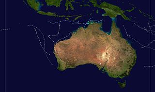
The 1974–75 Australian region cyclone season was an above average tropical cyclone season.

Climate change can affect tropical cyclones in a variety of ways: an intensification of rainfall and wind speed, a decrease in overall frequency, an increase in the frequency of very intense storms and a poleward extension of where the cyclones reach maximum intensity are among the possible consequences of human-induced climate change. Tropical cyclones use warm, moist air as their source of energy or "fuel". As climate change is warming ocean temperatures, there is potentially more of this fuel available.

An atmospheric river (AR) is a narrow corridor or filament of concentrated moisture in the atmosphere. Other names for this phenomenon are tropical plume, tropical connection, moisture plume, water vapor surge, and cloud band.

Peter John Webster is a meteorologist and climate dynamicist relating to the dynamics of large-scale coupled ocean-atmosphere systems of the tropics, notably the Asian monsoon. Webster holds degrees in applied physics, mathematics and meteorology. Webster studies the basic dynamics of the coupled ocean-atmosphere system in the tropics and has applied this basic knowledge to developing warning systems for extreme weather events in Asia. He has served on a number of prestigious national and international committees including the World Climate Research Program's Joint Scientific Committee (1983-1987), chaired the international Tropical Ocean Global Atmospheric (TOGA) organizing committee (1988–94) and was co-organizer of the multinational TOGA Couple Ocean-Atmosphere (1993). He is Emeritus Professor in Earth and Atmospheric Sciences at Georgia Institute of Technology and co-founder and Chief Scientist of Climate Forecast Applications Network LLC, a weather and climate services company.

This glossary of meteorology is a list of terms and concepts relevant to meteorology and atmospheric science, their sub-disciplines, and related fields.

During 2003, tropical cyclones formed within seven different tropical cyclone basins, located within various parts of the Atlantic, Pacific and Indian Oceans. During the year, a total of 129 systems formed with 85 of these developing further and were named by the responsible warning centre. The strongest tropical cyclone of the year was Cyclone Inigo, which was estimated to have a minimum barometric pressure of 900 hPa (26.58 inHg) and was tied with Cyclone Gwenda for being the most intense recorded cyclone in the Australian region in terms of pressure, with the possible exception of Cyclone Mahina. So far, 26 Category 3 tropical cyclones formed, including six Category 5 tropical cyclones formed in 2003, tying 2021. The accumulated cyclone energy (ACE) index for the 2003, as calculated by Colorado State University was 833 units.
The year 1997 was regarded as one of the most intense tropical cyclone years on record, featuring a record 12 category 5-equivalent tropical cyclones, according to the Saffir–Simpson hurricane wind scale. The year also featured the second-highest amount of accumulated cyclone energy (ACE) on record, just behind 1992 and 2018. Throughout the year, 108 tropical cyclones have developed in bodies of water, commonly known as tropical cyclone basins. However, only 89 tropical cyclones were of those attaining 39 mph or greater, falling just below the long term average of 102 named systems. The most active basin was the Western Pacific, attaining an ACE amount of 571, the highest ever recorded in any season in any basin on record. The deadliest tropical cyclone was Severe Tropical Storm Linda (Openg). The costliest tropical cyclone was Super Typhoon Winnie (Ibiang), which set a record for having the largest eye on record. The most intense tropical cyclone was Hurricane Linda, peaking at 902 hPa/mbar. Typhoon Paka (Rubing), the longest-lived system, produced the fourth-highest ACE for a single tropical cyclone, just behind Typhoon Nancy (1961), Hurricane/Typhoon Ioke (2006), and Cyclone Freddy (2023). The accumulated cyclone energy (ACE) index for the 1997, as calculated by Colorado State University was 1,099.2 units.
References
- ↑ "New Meteorological Phenomenon Discovered: Atmospheric Lakes". Sci-News. 30 December 2021. Retrieved 31 December 2021.
- 1 2 "Researchers identify new meteorological phenomenon dubbed 'atmospheric lakes'". phys.org. Retrieved 22 January 2022.
- 1 2 3 Mapes, Brian E.; Tsai, Wei-Ming (16 December 2021). "Long-lived vapor lakes over the Indian Ocean: closest outdoor phenomenon to the self-aggregation paradigm?". AGU Fall Meeting 2021. American Geophysical Union.
- 1 2 Union, American Geophysical. "Researchers identify new meteorological phenomenon dubbed 'atmospheric lakes'". phys.org. Retrieved 8 November 2023.
- 1 2 Nield, David (25 December 2021). "Scientists Identify a Previously Unknown Type of Storm, Called an 'Atmospheric Lake'". ScienceAlert. Retrieved 8 November 2023.
- ↑ "New Meteorological Phenomenon Discovered: Atmospheric Lakes". Sci.News. 30 December 2021. Retrieved 8 November 2023.