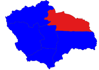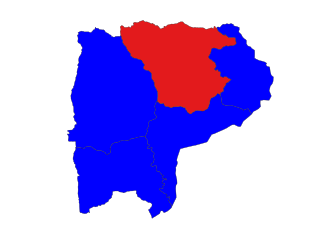
Magway Region is an administrative division in central Myanmar. It is the second largest of Myanmar's seven divisions, with an area of 44,820 km2. Pa Del Dam (ပဒဲဆည်) is one of the dams in Aunglan Township, Magway Division. The capital and second largest city of the Magway Division is Magway. The largest city is Pakokku. The major cities of Magway Division are Magway, Pakokku, Chauk, Aunglan, Yenangyaung, Taungdwingyi, Minbu, Thayet and Gangaw.

Aunglan is the biggest city in Thayet District of the Magway Region of Myanmar. It is a port on the left (eastern) bank of the Irrawaddy, across and just north of Thayetmyo, between the cities of Pyay (Prome), Taungdwingyi (Prome) and Magway. It is the administrative seat for Aunglan Township. According to the 2014 census, the population was estimated as over 235,000. The rural population is over 182,000 and urban population is 52,865. 47.5% of total population is male and 52.5% is female. Aunglan was a new city formed moving from Myede. After the second Anglo-Burmese war, the south of Myede Township was annexed by the British and the north was ruled by the Myanmar King.

Hlegu Township is a township of Yangon Burma, Burma (Myanmar). It is northeast of the city Yangon and is largely rural.

Saw Township is a township of Pakokku District in the Magway Region of Burma (Myanmar). The principal town and administrative seat is Saw.

Chauk Township is a township of Magway District in the Magway Division of Burma (Myanmar). The principal town and administrative seat is Chauk.

Sinbaungwe Township or Tantabin Township is a township of Thayet District in the Magway Region of Burma (Myanmar). It is located to the west of the Pegu Range in the foothills and on the plain of the Irrawaddy. Most of the township is east of the Irrawaddy, but about 20% of the township lies on the right (west) bank. The major town and administrative center is Sinbaungwe (Tantabin).

Mindon Township is a township of Thayet District in the Magway Region of Burma (Myanmar). Its administrative seat is Mindon.

Thayet Township is a township of Thayet District in the Magway Region of Burma (Myanmar). It lies on the west side of the Irrawaddy. The major town and administrative center is Thayet. Notable peaks are Mount Myinba (1688 ft.) and Mount Myinmagyi (1032 ft.).

Seikphyu Township is a township of Pakokku District in Magway Division of Burma (Myanmar). The principal town and administrative seat is Seikphyu. The township has its southeastern border along the Irrawaddy where its principal town, Seikphyu, is a port. The township lies between 20° 51' and 21° 15' north latitude and 94° 09' and 94° 48' east longitude. The Yaw River forms the township's eastern boundary. It is one of the areas destroyed by Cyclone Giri on 23 October 2010.

Myaing Township is a township of Pakokku District in the Magway Region of Burma (Myanmar). Its administrative seat is Myaing.

Pakokku Township is a township of Pakokku District in Magway Division of Burma (Myanmar). The principal town and administrative seat is Pakokku. The township has its eastern and southeastern border along the Irrawaddy where its principal town, Pakokku, is a port. The Yaw River forms the township's southwest border. There is a commercial airport at Lanywa (Lan).
Bago Township or Pegu Township is a township in Bago District in the Bago Region of Burma. The principal town is Bago.

Kawa Township. is a township in Bago District in the Bago Region of Myanmar. The principal town is Kawa. It is located in the east banner of Bago River and south of Bago. Kawa has 93 villages. Kawa is between Sittaung River and Bago river. The places near the river produce salts. The popular product of Kawa is Kawa Bag.
Thanatpin Township is a township in Taungoo District in the Bago Region of Burma. The principal town is Thanatpin.
Waw Township is a township in Bago District in the Bago Region of Burma. The principal town is Waw.
Nyaunglebin Township is a township situated in Bago Division, Bago Region of Myanmar.
Shwegyin Township is a township in Bago District in the Bago Region of Myanmar. The principal town is Shwegyin (town).
Zigon Township is a township in the Tharrawaddy District of the Bago Region in Burma. The principal town is Zigon.
Kyauktaga Township is a township in Bago District in the Bago Region of Burma (Myanmar). The principal town is Kyauktaga, and Penwegon is the other major town. Both are located on the Bago–Taungoo highway and rail line.

Yesagyo Township is a township of Pakokku District in the Magway Region of central Burma (Myanmar). The principal town and administrative seat is Yesagyo.
This page is based on this
Wikipedia article Text is available under the
CC BY-SA 4.0 license; additional terms may apply.
Images, videos and audio are available under their respective licenses.


