Yesagyo Township

Last updated
Yesagyo Township
Yesagyo tsp in Pakokku district.svg
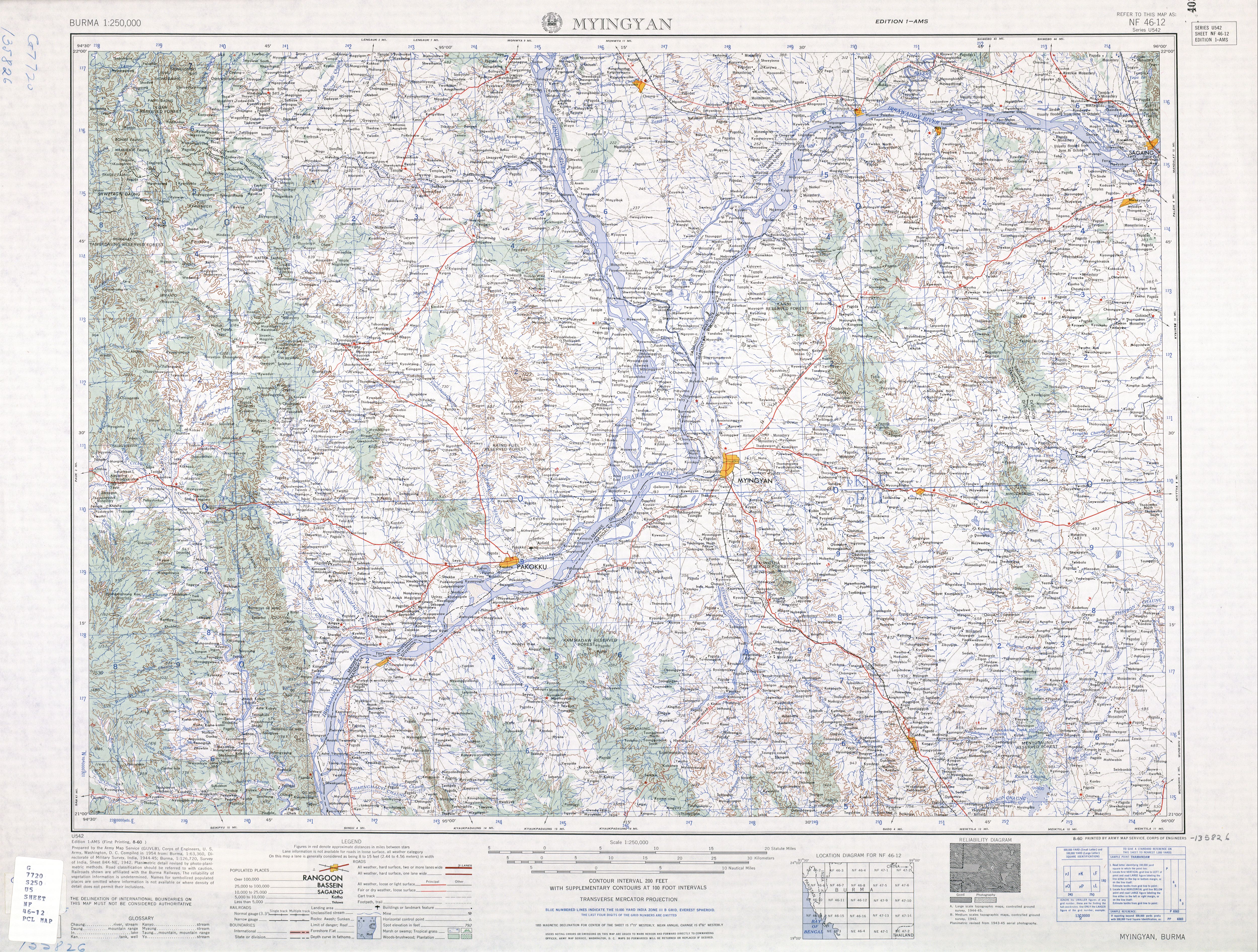
Location in Pakokku district
Myanmar location map.svg
Red pog.svg
Yesagyo Township
Location in Burma
Coordinates: 21°35′N95°11′E / 21.583°N 95.183°E / 21.583; 95.183 Coordinates: 21°35′N95°11′E / 21.583°N 95.183°E / 21.583; 95.183
CountryFlag of Myanmar.svg  Burma
Division Magway Division
District Pakokku District
Time zone UTC+6:30 (MST)
Area code(s) 062
[1]

Yesagyo Township (Yaesagyo Township) is a township of Pakokku District in the Magway Region of central Burma (Myanmar). The principal town and administrative seat is Yesagyo.

Contents

The township is served by the Chaung-U to Pakokku railway.

Borders

Yesagyo is the easternmost township of Magway Region. The Chindwin River and then the Irradwaddy form the eastern boundary of the township except for a small area on the eastern side of the Chindwin directly across from the town of Yesagyo, [2] which area was formerly an island in the Chindwin. [3] Yesagyo Township is bounded by the following townships: [4]

Sights

The wooden Pakhangyi Monastery on brick foundations was constructed by King Mindon in 1886 and restored in 1992. [5] In 1992 the Pakhangyi Archaeological Museum was opened there. In 1996 Burma applied for World Heritage Site status for the site. [6]

Notes

  1. "National Telephone Area Codes". Myanmar's Net.
  2. "Magway Division, Myanmar" map ID: MIMU270v01, creation date:15 Jul 2010, Myanmar Information Management Unit (MIMU)
  3. "Burma 1:250,000 topographic map, Series U542, NF 46-12, Myingyin" U.S. Army Map Service, August 1960
  4. "Myanmar States/Divisions & Townships Overview Map" Myanmar Information Management Unit (MIMU)
  5. "Pakhangyi monastery" Asterism Travels & Tours - Myanmar
  6. "Wooden Monasteries of Konbaung Period: Ohn Don, Sala, Pakhangyi, Pakhannge, Legaing, Sagu, Shwe-Kyaung (Mandalay) (04/10/1996)" Tentative Lists UNESCO World Heritage Centre


Related Research Articles

Magway Region Region of Myanmar

Magway Region is an administrative division in central Myanmar. It is the second largest of Myanmar's seven divisions, with an area of 44,820 km2. Pa Del Dam (ပဒဲဆည်) is one of the dams in Aunglan Township, Magway Division. The capital and second largest city of the Magway Division is Magway. The largest city is Pakokku. The major cities of Magway Division are Magway, Pakokku, Chauk, Aunglan, Yenangyaung, Taungdwingyi, Minbu, Thayet and Gangaw.

Sagaing Region Region of Myanmar

Sagaing Region is an administrative region of Myanmar, located in the north-western part of the country between latitude 21° 30' north and longitude 94° 97' east. It is bordered by India’s Nagaland, Manipur, and Arunachal Pradesh States to the north, Kachin State, Shan State, and Mandalay Region to the east, Mandalay Region and Magway Region to the south, with the Ayeyarwady River forming a greater part of its eastern and also southern boundary, and Chin State and India to the west. The region has an area of 93,527 km2. In 1996, it had a population of over 5,300,000 while its population in 2012 was 6,600,000. The urban population in 2012 was 1,230,000 and the rural population was 5,360,000. The capital city of Sagaing Region is Monywa.

Pakokku City in Magway Region, Myanmar

Pakokku is the largest city in the Magway Region of Myanmar, also known as Burma. It is situated about 30 km north-east of Bagan on the Irrawaddy River. It is the administration seat of Pakokku Township, Pakokku District and Gangaw District. Pakokku Bridge is part of the India–Myanmar–Thailand Trilateral Highway and is the longest bridge in Myanmar.It is home of the Pakokku airport.

Chaung-U Town in Sagaing Region, Myanmar

Chaung-U is a town in central Myanmar. It is located in Monywa District, Sagaing Division. It is the principal town of Chaung-U township. In the Bagan dynasty, when King Popa Saw Rahan governed the country, it was named "San Tauk Village". It was a large village where different natives of the Union of Myanmar, like Kayin, Shan and Lawah (Wah) natives, lived happily together. Then, King Kyansit founded the city, gathering ten villages together, for example, Ywa Thit and Ywa Ma, naming it Chaung Oo. It is situated 231.46 feet (70.55 m) above sea level at north latitude 22° 45' and east longitude 95° 8' to 95° 25'. The Monywa–Mandalay highway road passes it, so the communication to it is good, quick and easy. The Monywa–Mandalay railway meets that of Chaung-U–Pakokku in the town's station, so it is possible to get there by train. Its official township boundary touches the boundaries of other townships: Myinmu is in the east, Myaung is in the south and south-east, Salingyi is in the west, and Monywa is in the north. The Chindwin River is in the west of the township and the town is six miles away from the river. In Chaung-U there are historical ancient pagodas. Besides, its township has other historical villages, streams, and hills.

Pyin Oo Lwin District District in Mandalay, Myanmar

Pyin Oo Lwin District is a district of the Mandalay Region in central Burma. It lies northeast of Mandalay, with the Myitnge River as its southern boundary. To the east it is bordered by Shan State and in part by the Chaung Magyi. It goes north as far as the town of Dakaung where it adjoins Htigyaing Township, Katha District in Sagaing Region. Its western boundary, is for the most part the Irrawaddy, but a very small portion of Thabeikkyin Township is west of the Irrawaddy, near the town of Baw in Sagaing Region. To the southwest it borders Mandalay District.

Yamethin Township Township in Mandalay Region, Burma

Yamethin Township is a township of Yamethin District in the Mandalay Region of Burma (Myanmar). The administrative seat and principal city is Yamethin, which is also the major rail stop in the township.

Mindat Township Township in Chin State, Myanmar

Mindat Township is a township located in Mindat District in the Chin State of Myanmar. The township is located between latitude 21.19 and 21.47, longitude 93.23 and 94.29. The third highest peak in Myanmar, Nat Ma Taung at 3,053 metres (10,016 ft), is visible from here, though it is within Kanpetlet township boundary. Mindat was a part of Pakokku Hill Tracts District.

Taungtha, Mandalay Town in Mandalay Region, Myanmar

Taungtha or Thaungtha is a town in the Mandalay Division of central Myanmar. It located south-west of the volcanic cone Mount Taungtha (1788 ft) and above the right (east) bank of the Sindewa (Sintewa) River.There are six quarters in Taungtha township. Taungtha is the administrative seat for Taungtha Township, and is on both the Taunggyi–Myingyan railway and the Meiktila–Myingyan highway. It is also on the Western Trunk Road from Kyaukpadaung to Natogyi.

Myaung is a town in the Sagaing Region in central Myanmar. It is a crowded and peaceful town where is located on the west bank of the Ayeyarwady River. It is a region between the Rivers of Ayeyarwady and Chindwin. There are many ancient and historical pagodas, monasteries, and places in Myaung Township. Myaung Township is officially demarcated with the neighbour boundaries of Chaung-U in the north-west, of Myinmu in the east and north east. In the township of Myaung, Kyauk Nagar Mountain is very famous, where very ancient rocky statues like the rocky dragon-shaped statues are found, and the Buddhist Region rich of many pagodas is situated. Myaung Township is one of the townships which were historically concerned with King Kyansit like Chaung-U Township. There are also many pagodas or Buddhist temples and monasteries of or built by King Kyansittha at the age of Bagan. It is a crowded town since it is located on the west bank of the river. To get there, there is Myaung-Payeinma Road, turning in from the Monywa-Mandalay one.

Saw Township Township in Magway Region, Burma

Saw Township is a township of Pakokku District in the Magway Region of Burma (Myanmar). The principal town and administrative seat is Saw.

Chauk Township Township in Magway Division, Burma

Chauk Township is a township of Magway District in the Magway Division of Burma (Myanmar). The principal town and administrative seat is Chauk.

Monywa District District in Sagaing Region, Burma

Monywa District is an administrative district in southern Sagaing Division, Burma (Myanmar). Its administrative center is the city of Monywa.

Pauk Township Township in Magway Division, Burma

Pauk Township is a township of Pakokku District in Magway Division of Burma (Myanmar). The principal town and administrative seat is Pauk.

Hkamti Township Township in Sagaing Region, Burma

Hkamti Township or Khamti Township is a township in Hkamti District in the Sagaing Region of Burma (Myanmar). The principal town is Hkamti. As of 2014 the township had a population of 47,658 people and covered an area of 8,174 square kilometres (3,156 sq mi). The township is dominated by the Chindwin River and its tributaries and thickly forested areas. Nearly half the active working population are employed in agriculture, forestry or fishing. The township is a producer of rice, and has reserves of gold and jade being mined.

Kale Township Township in Sagaing Region, Burma

Kale Township is a township in Kale District in the Sagaing Division of Burma (Myanmar). The principal town is Kalay.

Seikphyu Township Township in Magway Division, Burma

Seikphyu Township is a township of Pakokku District in Magway Division of Burma (Myanmar). The principal town and administrative seat is Seikphyu. The township has its southeastern border along the Irrawaddy where its principal town, Seikphyu, is a port. The township lies between 20° 51' and 21° 15' north latitude and 94° 09' and 94° 48' east longitude. The Yaw River forms the township's eastern boundary. It is one of the areas destroyed by Cyclone Giri on 23 October 2010.

Myaing Township Township in Magway, Burma

Myaing Township is a township of Pakokku District in the Magway Region of Burma (Myanmar). Its administrative seat is Myaing.

Pakokku Township Township in Magway Division, Burma

Pakokku Township is a township of Pakokku District in Magway Division of Burma (Myanmar). The principal town and administrative seat is Pakokku. The township has its eastern and southeastern border along the Irrawaddy where its principal town, Pakokku, is a port. The Yaw River forms the township's southwest border. There is a commercial airport at Lanywa (Lan).

Seikphyu Town in Magway Region, Myanmar

Seikphyu is the principal town and administrative seat for Seikphyu Township in Pakokku District in the Magway Division of Myanmar, on the right (western) bank of the Irrawaddy immediately below its confluence with the Yaw River. It is located across the Irrawaddy river from Chauk and is connected by Anawrahta Bridge. It is situated 34 kilometers south-south-west of ancient Bagan City and 44 kilometers from Nyaung U Airport.

Yesagyo Town in Magway Region, Myanmar

Yesagyo is a town in the Magway Division in Myanmar. It is situated on the Chindwin River, near the site where it flows into Irrawaddy River. It is the principal town and administrative seat of Yesagyo Township.Yesagyo is a second biggest city of Pakokku District.