A woodland or wood is a low-density forest forming open habitats with plenty of sunlight and limited shade. Woodlands may support an understory of shrubs and herbaceous plants including grasses. Woodland may form a transition to shrubland under drier conditions or during early stages of primary or secondary succession. Higher density areas of trees with a largely closed canopy that provides extensive and nearly continuous shade are referred to as forests.

The Teutoburg Forest is a range of low, forested hills in the German states of Lower Saxony and North Rhine-Westphalia. In 9 CE, this region was the site of a major Roman defeat, the Battle of the Teutoburg Forest. Until the 19th century the official name of the hill ridge was Osning.

Olympic National Forest is a U.S. National Forest located in Washington, USA. With an area of 628,115 acres (2,541.89 km2), it nearly surrounds Olympic National Park and the Olympic Mountain range. Olympic National Forest contains parts of Clallam, Grays Harbor, Jefferson, and Mason counties. The landscape of the national forest varies, from the temperate Olympic rain forest to the salt water fjord of Hood Canal to the peaks of Mt. Washington.

Forest Park is a public municipal park in the Tualatin Mountains west of downtown Portland, Oregon, United States. Stretching for more than 8 miles (13 km) on hillsides overlooking the Willamette River, it is one of the country's largest urban forest reserves. The park, a major component of a regional system of parks and trails, covers more than 5,100 acres (2,064 ha) of mostly second-growth forest with a few patches of old growth. About 70 miles (110 km) of recreational trails, including the Wildwood Trail segment of the city's 40-Mile Loop system, crisscross the park.

The Flathead National Forest is a national forest in the western part of the U.S. state of Montana. The forest lies primarily in Flathead County, south of Glacier National Park. The forest covers 2,404,935 acres of which about 1 million acres (4,000 km2) is designated wilderness. It is named after the Flathead Native Americans who live in the area.
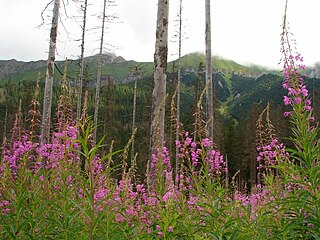
An evergreen forest is a forest made up of evergreen trees. They occur across a wide range of climatic zones, and include trees such as conifers, live oak, and holly in cold climates, eucalypts, acacias and banksias in more temperate zones, and rainforest trees in tropical zones.

The Colville National Forest is a U.S. National Forest located in northeastern Washington state. It is bordered on the west by the Okanogan National Forest and the Kaniksu National Forest to the east. The forest itself also contains Little Pend Oreille National Wildlife Refuge and the Lake Roosevelt National Recreation Area.

The Pacific Northwest Trail (PNT) is a 1200-mile hiking trail running from the Continental Divide in Montana to the Pacific Ocean on Washington’s Olympic Coast. Along the way, the PNT crosses three national parks, seven national forests, two other national scenic trails, and against the grain of several mountain ranges, including the Continental Divide, Whitefish Divide, Purcells, Selkirks, Kettles, Cascades, and Olympics. The Pacific Northwest Trail was designated as the Pacific Northwest National Scenic Trail by Congress in 2009.
Glacier View Wilderness is a 3,073-acre (1,244 ha) wilderness adjacent to the west side of Mount Rainier National Park in Washington State. It was designated as wilderness in 1984. Glacier View Wilderness has views of the glaciated slopes of Mount Rainier which lies to the east. This includes viewing points from Mt. Belijica and Glacier View Point. Glacier View Point is the former site of a fire lookout built in 1934. The wilderness is administered by the Gifford Pinchot National Forest through the Cowlitz Valley Ranger district with headquarters located in Randle, Washington.
Mill Creek Wilderness is a wilderness area located in the Ochoco National Forest of central Oregon. It was established in 1984 and comprises 17,400 acres (7,040 ha). Of the three wilderness areas in the Ochoco National Forest - Mill Creek, Bridge Creek, and Black Canyon - Mill Creek is the largest and most heavily used.

Northwest River Natural Area Preserve is a 2,774-acre (11.23 km2) Natural Area Preserve located in the city of Chesapeake, Virginia. Located along the Northwest River, the preserve protects upland forests as well as swamps and marshes along the river.

The flora of China is diverse. More than 30,000 plant species are native to China, representing nearly one-eighth of the world's total plant species, including thousands found nowhere else on Earth.

The Northwest Angle State Forest is a state forest located in Lake of the Woods County, Minnesota. The name of the forest is derived from its location near the Northwest Angle, the northernmost point of the contiguous United States. The forest borders the Canadian provinces of Manitoba and Ontario, and the Red Lake Indian Reservation. The forest is managed by the Minnesota Department of Natural Resources.
Smoky Dome, at 10,095 feet (3,077 m) above sea level is the highest peak in the Soldier Mountains of Idaho. Smoky Dome is located northwest of Fairfield in Camas County and Sawtooth National Forest.

Iron Mountain, at 9,694 feet (2,955 m) high is one of the peaks of the Soldier Mountains of Idaho. Iron Mountain is located at the west end of the range northwest of Fairfield in Camas County and Sawtooth National Forest.

Boardman Peak, at 9,457 feet (2,882 m) high is one of the peaks of the Soldier Mountains of Idaho. Boardman Peak is located at the center of the range southeast of Iron Mountain, northwest of Smoky Dome, and northwest of Fairfield in Camas County and Sawtooth National Forest. No trails go to the summit, but several pass near the peak, and the ascent is only class 2.

Calkins Peak, is a peak also known as Calkens, O'Calkens Peak, Caulkens Peak, and O'Caulkens Peak. At an elevation of 11,487 feet (3,501 m) above sea level it is the second highest peak in the White Cloud Mountains of Idaho. The peak is located in Sawtooth National Recreation Area in Custer County about 5.75 mi (9.25 km) north-northwest of Castle Peak, its line parent. It is the 46th highest peak in Idaho, and it is located about 0.5 mi (0.80 km) north-northeast of White Cloud Peak 9 and 1 mi (1.6 km) north-northwest of D. O. Lee Peak. Calkins Peak is directly north of Slide Lake, northwest of Sheep Lake, and southwest of Tin Cup Lake. Calkins Peak is named for Stephen Calkins (1842–1922), a prospector who established lode claims in the area.
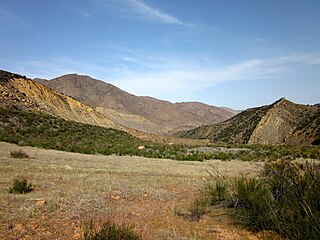
The Sespe Wilderness is a 219,700-acre (88,900 ha) wilderness area in the eastern Topatopa Mountains and southern Sierra Pelona Mountains, within the Los Padres National Forest (LPNF), in Ventura County, Southern California. The wilderness area is primarily located within the Ojai and Mt. Pinos ranger districts of the LPNF.