Related Research Articles

Waikato is a region of the upper North Island of New Zealand. It covers the Waikato District, Waipa District, Matamata-Piako District, South Waikato District and Hamilton City, as well as Hauraki, Coromandel Peninsula, the northern King Country, much of the Taupō District, and parts of the Rotorua Lakes District. It is governed by the Waikato Regional Council.

Waiuku is a rural town in the Auckland Region of New Zealand. It is located at the southern end of the Waiuku River, which is an estuarial arm of the Manukau Harbour, and lies on the isthmus of the Āwhitu Peninsula, which extends to the northeast. It is 40 kilometres southwest of Auckland city centre, and 12 kilometres north of the mouth of the Waikato River.
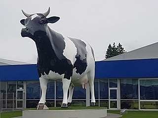
Morrinsville is a provincial town in the Waikato region of New Zealand's North Island, with an estimated population of 8,960 as of June 2023. The town is located at the northern base of the Pakaroa Range, and on the south-western fringe of the Hauraki Plains. Morrinsville is around 33 kilometres east of Hamilton and 22 kilometres west of Te Aroha. The town is bordered by the Piako River to the east and the Waitakaruru Stream to the south.
Paeroa is a town in the Hauraki District of the Waikato Region in the North Island of New Zealand. Located at the base of the Coromandel Peninsula, it is close to the junction of the Waihou River and Ohinemuri River, and is approximately 20 kilometres south of the Firth of Thames.
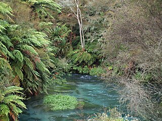
The Waihou River is located in the northern North Island of New Zealand. Its former name, Thames River, was bestowed by Captain James Cook in November 1769, when he explored 14 mi (23 km) of the river from the mouth. An older Māori name was "Wai Kahou Rounga". A 1947 Geographic Board enquiry ruled that the official name would be Waihou.
The Thames Valley is a non-administrative region in the North Island of New Zealand. Broadly, it is the valley component of the Waihou River catchment. The lower part of the valley is more commonly known as the Hauraki Plains. Geographically the valley extends as far as the Hinuera Gap, although this is not often referred to as such. In geographical history of New Zealand, the Thames Valley was the path of the ancestral Waikato River when it discharged into the Firth of Thames over 20,000 years ago.

The Piako River is a lowland river system that drains into the Firth of Thames on the North Island of New Zealand. Together with the Waihou River, it is one of the two main rivers systems which drains the Hauraki Plains. It is the dominant river system in the Matamata-Piako District, and on its journey it passes through the towns of Morrinsville and Ngatea.

The Hauraki Plains are a geographical feature and non-administrative area located in the northern North Island of New Zealand, at the lower (northern) end of the Thames Valley. They are located 75 kilometres south-east of Auckland, at the foot of the Coromandel Peninsula and occupy the southern portion of a rift valley bounded on the north-west by the Hunua Ranges, to the east by the Coromandel and Kaimai ranges and to the west by a series of undulating hills which separate the plains from the much larger plains of the Waikato River. Broadly, the northern and southern parts of the Hauraki Plains are administered by the Hauraki District and the Matamata-Piako District respectively.

Mount Taupiri is a hill at the southern end of the Taupiri Range in the Waikato. The highest peak in the range, it rises to 288 metres above sea level and overlooks Taupiri township immediately to its south. It is separated from the Hakarimata Range to the south by the Taupiri Gorge, through which the Waikato River flows from the Waikato Basin to the Lower Waikato. The Mangawara Stream joins the Waikato River at the base of the hill.

Hauraki-Waikato is a New Zealand parliamentary Māori electorate first established for the 2008 election. It largely replaced the Tainui electorate. Nanaia Mahuta of the Labour Party, formerly the MP for Tainui, became MP for Hauraki-Waikato in the 2008 general election and was re-elected in 2011, 2014, 2017 and 2020.

Ngāti Pāoa is a Māori iwi (tribe) that has extensive links to the Hauraki and Waikato tribes of New Zealand. Its traditional lands stretch from the western side of the Hauraki Plains to Auckland. They also settled on Hauraki Gulf islands such as Waiheke.
Glen Murray is a rural community in the Waikato District and Waikato region of New Zealand's North Island, on Highway 22, about 6 km (3.7 mi) up the Tikotiko Stream from Lake Whangape. In 2013 the population of meshblock 0846601, which includes Glen Murray, was 42. It has a garage and a War Memorial Hall, which opened in 1952. It is named after William Murray, who moved from Piako in 1885.
Waotu or Te Waotu is a rural community in the South Waikato District and Waikato region of New Zealand's North Island.
Te Miro is an area in the Waipa District of the Waikato Region of the North Island of New Zealand. Te Miro is situated 31 kilometres east southeast of Hamilton, and 24 kilometres northeast of Cambridge. Te Miro has a population of approximately 500.
Kiwitahi is a rural community in the Matamata-Piako District and Waikato region of New Zealand's North Island, located directly south of Morrinsville.

Motumaoho is a small village in the Waikato region of New Zealand's North Island, just to the west of the Pakaroa Range. It is on SH26, 25 km (16 mi) east of Hamilton and 7 km (4.3 mi) west of Morrinsville. The village is bordered by the Waitakaruru Stream to the east. Motumaoho can be translated as an intruding clump of trees.
Maratoto is a valley and rural community in the Hauraki District and Waikato region of New Zealand's North Island, north of Paeroa.
Mackaytown is a settlement in the Hauraki District and Waikato region of New Zealand's North Island, located at the north-western end of the Karangahake Gorge just south of Paeroa.
Kopuarahi is a rural settlement and farming community in the Hauraki District and Waikato region of New Zealand's North Island.
Pāoa ('smoke') was a Māori rangatira (chieftain) of the Tainui tribal confederation from the Waikato region, New Zealand. He is the ancestor of the Ngāti Pāoa iwi. He probably lived in the first half of the seventeenth century.
References
- 1 2 3 4 5 6 7 Buchanan, Bruce (16 June 1972). "Te Awaiti". Ohinemuri Regional History Journal. 16.
- ↑ Hicks, Brendan (2018). Boat electrofishing survey of the Awaiti and Bancrofts canals (Tee Head Canal), Piako River system (PDF). Hamilton: Environmental Research Institute.
- ↑ Prickett, Nigel (1990). "Archaeological Excavations at Raupa: the 1987 Season". Records of the Auckland Institute and Museum . 27: 73–153. ISSN 0067-0464. JSTOR 42906403. Wikidata Q58677392.
- ↑ "A scrub fire in rural Awaiti near Paeroa has now been put out". NZCity. Newstalk ZB. 27 December 2020.
- ↑ Leaman, Aaron (31 December 2020). "Firefighters extinguish grass fire threatening homes at Port Waikato". stuff.co.nz. Waikato Times.