Greater Wellington, also known as the Wellington Region, is a non-unitary region of New Zealand that occupies the southernmost part of the North Island. The region covers an area of 8,049 square kilometres (3,108 sq mi), and has a population of 550,500.

Taranaki is a region in the west of New Zealand's North Island. It is named after its main geographical feature, the stratovolcano Mount Taranaki, also known as Mount Egmont.

The West Coast is a region of New Zealand on the west coast of the South Island. It is administered by the West Coast Regional Council, and is known co-officially as Te Tai Poutini. It comprises the territorial authorities of Buller District, Grey District and Westland District. The principal towns are Westport, Greymouth and Hokitika. The region, one of the more remote areas of the country, is also the most sparsely populated. With a population of just 32,900 people, the West Coast is the least populous region in New Zealand. The population in the region grew by 0.4% over the year to July 2023.

The Waikato is a region of the upper North Island of New Zealand. It covers the Waikato District, Waipa District, Matamata-Piako District, South Waikato District and Hamilton City, as well as Hauraki, Coromandel Peninsula, the northern King Country, much of the Taupō District, and parts of the Rotorua Lakes District. It is governed by the Waikato Regional Council.
The Bay of Plenty Region is a local government region in the North Island of New Zealand. Also called just the Bay of Plenty (BOP), it is situated around the marine bight of that same name. The bay was named by James Cook after he noticed the abundant food supplies at several Māori villages there, in stark contrast to the earlier observations he had made in Poverty Bay.

The Northland Region is the northernmost of New Zealand's 16 local government regions. New Zealanders sometimes refer to it as the Winterless North because of its mild climate all throughout the year. The main population centre is the city of Whangārei, and the largest town is Kerikeri. At the 2018 New Zealand census, Northland recorded a population growth spurt of 18.1% since the previous 2013 census, placing it as the fastest growing region in New Zealand, ahead of other strong growth regions such as the Bay of Plenty Region and Waikato.

Kaipara District is a territorial authority district in the Northland Region of New Zealand.

Matamata-Piako District is a local government area in the Waikato region of New Zealand. It lies to the east of the city of Hamilton.

Auckland is one of the 16 regions of New Zealand, which takes its name from the eponymous urban area. The region encompasses the Auckland metropolitan area, smaller towns, rural areas, and the islands of the Hauraki Gulf. Containing 33 percent of the nation's residents, it has by far the largest population and economy of any region of New Zealand, but the second-smallest land area.
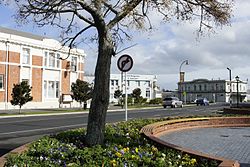
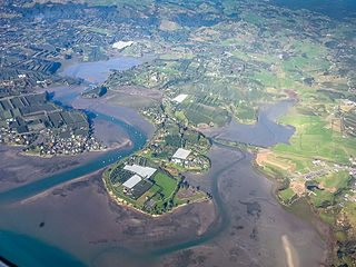
Paeroa is a town in the Hauraki District of the Waikato Region in the North Island of New Zealand. Located at the base of the Coromandel Peninsula, it is close to the junction of the Waihou River and Ohinemuri River, and is approximately 20 kilometres south of the Firth of Thames.

The Thames-Coromandel District is a territorial authority district in the North Island of New Zealand, covering all the Coromandel Peninsula and extending south to Hikutaia.

Waikato District is a territorial authority of New Zealand, in the northern part of Waikato region, North Island. Waikato District is administered by the Waikato District Council, with headquarters in Ngāruawāhia.

Waipa District is a municipality in the Waikato region of New Zealand that is administered by the Waipa District Council. Its most populous town is Cambridge. The seat of the council is at the second most populous town, Te Awamutu. The district is south and south-east of the city of Hamilton. It has five wards: Te Awamutu, Cambridge, Pirongia, Maungatautari and Kakepuku.

South Waikato District is a local government district in the Waikato Region of the North Island of New Zealand. It is located between the cities of Hamilton to the north, Rotorua to the east, Taupō to the south and Ruapehu District to the west.

Western Bay of Plenty District is a territorial district within the Bay of Plenty Region of New Zealand. The district envelops Tauranga city by land, and includes Matakana Island, at the entrance to Tauranga Harbour.

The Far North District is the northernmost territorial authority district of New Zealand, consisting of the northern part of the Northland Peninsula in the North Island. It stretches from North Cape / Otou and Cape Reinga / Te Rerenga Wairua in the north, down to the Bay of Islands, the Hokianga and the town of Kaikohe.

Whangarei District is a territorial authority district in the Northland Region of New Zealand that is governed by the Whangarei District Council. The district is made up in area largely by rural land, and includes a fifth of the Northland Region. It extends southwards to the southern end of Bream Bay, northwards to Whangaruru and almost to the Bay of Islands, and westwards up the Mangakahia River valley past Pakotai and almost to Waipoua Forest. It includes the Hen and Chicken Islands and the Poor Knights Islands.

Ōtorohanga District is a territorial authority in the King Country area and Waikato region of the North Island of New Zealand. It is a mostly rural area, with Ōtorohanga town being by far the biggest urban area, with a population nearing 3,000. The District was called Otorohanga County from 1971 to 1979.
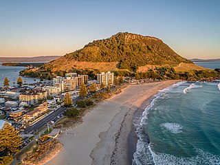
Tauranga is a coastal city in the Bay of Plenty Region and the fifth-most populous city of New Zealand, with an urban population of 161,800, or roughly 3% of the national population. It was settled by Māori late in the 13th century, colonised by Europeans in the early 19th century, and was constituted as a city in 1963.

Southland is New Zealand's southernmost region. It consists of the southwestern portion of the South Island and includes Stewart Island. Southland is bordered by the culturally similar Otago Region to the north and east, and the West Coast Region in the extreme northwest. The region covers over 3.1 million hectares and spans 3,613 km of coastline. As of June 2023, Southland has a population of 103,900, making it the eleventh-most-populous New Zealand region, and the second-most sparsely populated. Approximately half of the region's population lives in Invercargill, Southland's only city.