Western Bay of Plenty District

Last updated
Western Bay of Plenty District
NZL-TePuke-Kiwiplantage.jpg
Kiwifruit orchard at Te Puke
Western Bay of Plenty DC.PNG
Coordinates: 37°47′24″S176°00′14″E / 37.79°S 176.004°E / -37.79; 176.004
Country New Zealand
Region Bay of Plenty
Wards Waihi Beach-Katikati
Kaimai
Te Puke-Maketu
Seat Greerton, Tauranga
Government
  MayorJames Denyer
  Deputy MayorJohn Scrimgeour
   Territorial authority Western Bay of Plenty District Council
Area
[1]
  Land1,944.42 km2 (750.74 sq mi)
Population
 (June 2023) [2]
  Total60,800
Time zone UTC+12 (NZST)
  Summer (DST) UTC+13 (NZDT)
Postcode(s)
Website www.westernbay.govt.nz OOjs UI icon edit-ltr-progressive.svg

Western Bay of Plenty District is a territorial district within the Bay of Plenty Region of New Zealand. The district envelops Tauranga city by land, and includes Matakana Island, at the entrance to Tauranga Harbour.

Contents

Local government

The seat of the Western Bay of Plenty District Council is at Greerton in Tauranga City (which is a separate area that is not part of the district). The district came into being in the local government reorganisation of 1989; with minor modifications to the boundaries, it merged the old Tauranga County and Te Puke Borough. The most significant changes were in the northwest, with Waihi Beach being transferred to the district from the old Ohinemuri County, and near Tauranga City, where some of the hinterland, formerly in the county, was transferred to the city.

Wards

For the purposes of electing district councillors, the wards within the district consist of the following:

Populated places

Western Bay of Plenty District consists of the following towns, localities, settlements and communities:

Notes
  1. 1 2 3 Formerly a populated place within Kaimai Ward until 2019.
  2. Partially shared with Whakatāne District.

Population

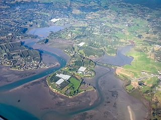
Western Bay of Plenty District covers 1,944.42 km2 (750.74 sq mi) [1] and had an estimated population of 60,800 as of June 2023, [2] with a population density of 31 people per km2. 2,780 live in Waihi Beach, 5,800 in Katikati, and 10,250 in Te Puke.

Ethnicities, 2023 Census
EthnicityPopulation
New Zealand European
45,003
Māori
12,111
Pasifika
1,899
Asian
4,113
MELAA
426
Other
741
Historical population
YearPop.±% p.a.
200641,826    
201343,323+0.50%
201850,904+3.28%
202356,184+1.99%
Source: [3] [4]

Western Bay of Plenty District had a population of 56,184 in the 2023 New Zealand census, an increase of 5,280 people (10.4%) since the 2018 census, and an increase of 12,861 people (29.7%) since the 2013 census. There were 24,096 dwellings. There were 10,062 people (17.9%) aged under 15 years, 8,481 (15.1%) aged 15 to 29, 24,789 (44.1%) aged 30 to 64, and 12,849 (22.9%) aged 65 or older. [4]

Ethnicities were 80.1% European/Pākehā, 21.6% Māori, 3.4% Pasifika, 7.3% Asian, 0.8% Middle Eastern, Latin American and African New Zealanders, and 1.3% other. People may identify with more than one ethnicity. [4]

Western Bay of Plenty District had a population of 51,321 at the 2018 New Zealand census. There were 18,462 households, comprising 25,647 males and 25,677 females, giving a sex ratio of 1.0 males per female. The median age was 45.2 years (compared with 37.4 years nationally).

The percentage of people born overseas was 19.2, compared with 27.1% nationally.

Although some people chose not to answer the census's question about religious affiliation, 51.1% had no religion, 33.3% were Christian, 2.0% had Māori religious beliefs, 1.0% were Hindu, 0.1% were Muslim, 0.5% were Buddhist and 4.3% had other religions.

Of those at least 15 years old, 6,735 (16.1%) people had a bachelor's or higher degree, and 7,935 (19.0%) people had no formal qualifications. The median income was $30,300, compared with $31,800 nationally. 6,438 people (15.4%) earned over $70,000 compared to 17.2% nationally. The employment status of those at least 15 was that 19,869 (47.6%) people were employed full-time, 7,083 (17.0%) were part-time, and 1,215 (2.9%) were unemployed. [3]

Individual wards (2018 boundaries)
NameArea (km2)PopulationDensity (per km2)HouseholdsMedian ageMedian income
Katikati-Waihi Beach Ward364.6813,92338.185,58653.0 years$26,000
Maketu-Te Puke Ward816.6918,42322.566,16237.7 years$30,400
Kaimai Ward769.6618,96924.656,71446.1 years$35,300
New Zealand37.4 years$31,800

Related Research Articles

<span class="mw-page-title-main">Bay of Plenty Region</span> Region in North Island, New Zealand

The Bay of Plenty Region, often abbreviated to BOP, is a region in the North Island of New Zealand situated around the body of water of the same name. The bay was named by James Cook after he noticed the abundant food supplies at several Māori villages there, in stark contrast to the earlier observations he had made in Poverty Bay.

<span class="mw-page-title-main">Kaimai Range</span> Mountain range in North Island of New Zealand

The Kaimai Range is a mountain range in the North Island of New Zealand. It is part of a series of ranges, with the Coromandel Range to the north and the Mamaku Ranges to the south. The Kaimai Range separates the Waikato in the west from the Bay of Plenty in the east.

<span class="mw-page-title-main">Waihi</span> Town in Waikato region, New Zealand

Waihi is a town in Hauraki District in the North Island of New Zealand, especially notable for its history as a gold mine town.

<span class="mw-page-title-main">Hauraki District</span> Territorial authority district in Waikato Region, New Zealand

Hauraki District is a territorial authority governed by the Hauraki District Council within the Hauraki region of New Zealand. The seat of the council is at Paeroa.

<span class="mw-page-title-main">Katikati</span> Town in the Bay of Plenty, New Zealand

Katikati is a town in New Zealand located on the Uretara Stream near a tidal inlet towards the northern end of Tauranga Harbour, 28 kilometres south of Waihi and 40 kilometres northwest of Tauranga. State Highway 2 passes through the town; a bypass scheduled to have begun construction in 2008 is on hold.

<span class="mw-page-title-main">Te Puke</span> Town in the Bay of Plenty, New Zealand

Te Puke is a town located 18 kilometres southeast of Tauranga in the Western Bay of Plenty of New Zealand. It is particularly well known for the cultivation of Kiwifruit.

<span class="mw-page-title-main">Waihi Beach</span> Town in the Bay of Plenty, New Zealand

Waihi Beach is a coastal town at the western end of the Bay of Plenty in New Zealand's North Island. It lies 10 kilometres to the east of the town of Waihi, at the foot of the Coromandel Peninsula. The main beach is 10 kilometres long. The town had a permanent population of 2,780 as of June 2023.

<span class="mw-page-title-main">Ngāi Te Rangi</span> Māori iwi in New Zealand

Ngāi Te Rangi or Ngāiterangi is a Māori iwi, based in Tauranga, New Zealand. Its rohe extends to Mayor Island / Tuhua and Bowentown in the north, to the Kaimai Range in the west, south of Te Puke and to Maketu in the east.

<span class="mw-page-title-main">Maketu</span> Town in the Bay of Plenty, New Zealand

Maketu is a small town on the Western Bay of Plenty coast in New Zealand.

<span class="mw-page-title-main">East Coast Main Trunk</span> Railway in New Zealand running between Hamilton and Kawerau

The East Coast Main Trunk (ECMT) is a railway line in the North Island of New Zealand, originally running between Hamilton and Taneatua via Tauranga, connecting the Waikato with the Bay of Plenty. The ECMT now runs between Hamilton and Kawerau, with a branch line to Taneatua from the junction at Hawkens. The line is built to narrow gauge of 1,067 mm, the uniform gauge in New Zealand. It was known as the East Coast Main Trunk Railway until 2011, when the word "Railway" was dropped.

<span class="mw-page-title-main">Ōmokoroa</span> Settlement in the Bay of Plenty, New Zealand

Ōmokoroa is a small urban area in the Western Bay of Plenty District of New Zealand. The suburb is considered part of Greater Tauranga, and is within the Coromandel electorate. Ōmokoroa began as a small rural holiday village, but is expanding to be a commuter town, with a 25-minute drive to Tauranga City.

<span class="mw-page-title-main">Ngāti Pūkenga</span> Māori iwi in New Zealand

Ngāti Pūkenga is a Māori iwi centred in Tauranga in the Bay of Plenty region of New Zealand. Its rohe extends to Mayor Island / Tuhua and Waihi in the north, to the Kaimai Range in the west, south of Te Puke and to Maketu in the east, and it has tribal holdings in Whangarei, Hauraki and Maketu.

Kaimai is a former New Zealand parliamentary electorate, from 1978 to 1996. In 1996 the MP Robert Anderson was selected for the new seat of Coromandel, but retired due to illness, and was replaced by Murray McLean, who won the new seat.

<span class="mw-page-title-main">Gisborne District</span> District and unitary region of New Zealand

Gisborne District or the Gisborne Region is a local government area of northeastern New Zealand. It is governed by Gisborne District Council, a unitary authority. It is named after its largest settlement, the city of Gisborne. The region is also commonly referred to as the East Coast.

The Bay of Plenty Times is the regional daily paper for the Bay of Plenty area, including Tauranga, in the North Island of New Zealand.

<span class="mw-page-title-main">Paengaroa</span> Town in the Bay of Plenty, New Zealand

Paengaroa is a village in the Bay of Plenty, New Zealand which lies 11 km from Te Puke, 35 km from Tauranga and 46.2 km from Rotorua.

<span class="mw-page-title-main">Tanners Point</span> Rural settlement in the Bay of Plenty, New Zealand

Tanners Point is a rural settlement in the Western Bay of Plenty District and Bay of Plenty Region of New Zealand's North Island. It is on a headland on the eastern side of Tauranga Harbour, opposite Katikati Entrance.

<span class="mw-page-title-main">Fairview, Bay of Plenty</span> Rural settlement in the Bay of Plenty, New Zealand

Fairview or Fairview Estate is a rural settlement in the Western Bay of Plenty District and Bay of Plenty Region of New Zealand's North Island. It is about 5.5 km south of Katikati, and is marketed as a lifestyle subdivision.

<span class="mw-page-title-main">Plummers Point</span> Rural settlement in the Bay of Plenty, New Zealand

Plummers Point is a rural settlement in the Western Bay of Plenty District and Bay of Plenty Region of New Zealand's North Island. It is on a headland on the southern side of Tauranga Harbour, opposite Motuhoa Island, and between Mangawhai Bay and Te Puna Estuary. The East Coast Main Trunk forms its southern boundary.

<span class="mw-page-title-main">Te Puna West</span> Rural settlement in the Bay of Plenty, New Zealand

Te Puna West is a rural settlement in the Western Bay of Plenty District and Bay of Plenty Region of New Zealand's North Island. It is on a headland on the southern side of Tauranga Harbour, opposite Motuhoa Island, and on the eastern side of Te Puna Estuary, across from Plummers Point. The East Coast Main Trunk forms its southern boundary.

References

  1. 1 2 "ArcGIS Web Application". statsnz.maps.arcgis.com. Retrieved 3 March 2022.
  2. 1 2 "Subnational population estimates (RC, SA2), by age and sex, at 30 June 1996-2023 (2023 boundaries)". Statistics New Zealand . Retrieved 25 October 2023. (regional councils); "Subnational population estimates (TA, SA2), by age and sex, at 30 June 1996-2023 (2023 boundaries)". Statistics New Zealand . Retrieved 25 October 2023. (territorial authorities); "Subnational population estimates (urban rural), by age and sex, at 30 June 1996-2023 (2023 boundaries)". Statistics New Zealand . Retrieved 25 October 2023. (urban areas)
  3. 1 2 "Statistical area 1 dataset for 2018 Census". Statistics New Zealand. March 2020. Western Bay of Plenty District (022). 2018 Census place summary: Western Bay of Plenty District
  4. 1 2 3 "2023 Census national and subnational usually resident population counts and dwelling counts" (Microsoft Excel). Stats NZ - Tatauranga Aotearoa. Retrieved 29 May 2024.