Tanners Point

Last updated

Tanners Point
Rural settlement
Tanners Point.jpg
Tanners Point Recreational Reserve
Tanners Point
Coordinates: 37°28′55″S175°56′38″E / 37.482°S 175.944°E / -37.482; 175.944
CountryNew Zealand
Region Bay of Plenty
Territorial authority Western Bay of Plenty District
WardKatikati-Waihi Beach Ward
CommunityKatikati Community
Electorates
Government
  Territorial Authority Western Bay of Plenty District Council
  Regional council Bay of Plenty Regional Council
Area
[1]
  Total0.45 km2 (0.17 sq mi)
Population
 (June 2022) [2]
  Total210
  Density470/km2 (1,200/sq mi)
Postcode(s)
3177

Tanners Point is a rural settlement in the Western Bay of Plenty District and Bay of Plenty Region of New Zealand's North Island. It is on a headland on the eastern side of Tauranga Harbour, opposite Katikati Entrance. [3]

A reserve and walkway preserve the coastal areas of the settlement. [4]

The area, initially a Native reserve, was first called Frazer's Point and later Tanner's Point for local farmer Thomas Tanner who arrived in New Zealand in 1875. [5] Both names were in use in the early 20th century. [6] [7]

Demographics

Tanners Point is defined by Statistics New Zealand as a rural settlement and covers 0.45 km2 (0.17 sq mi) [1] and had an estimated population of 210 as of June 2022, [2] with a population density of 467 people per km2. It is part of the larger Tahawai statistical area. [8]

Historical population
YearPop.±% p.a.
2006216    
2013171−3.28%
2018201+3.29%
Source: [9]

Tanners Point had a population of 201 at the 2018 New Zealand census, an increase of 30 people (17.5%) since the 2013 census, and a decrease of 15 people (−6.9%) since the 2006 census. There were 93 households, comprising 105 males and 96 females, giving a sex ratio of 1.09 males per female. The median age was 62.7 years (compared with 37.4 years nationally), with 12 people (6.0%) aged under 15 years, 12 (6.0%) aged 15 to 29, 90 (44.8%) aged 30 to 64, and 87 (43.3%) aged 65 or older.

Ethnicities were 94.0% European/Pākehā, 4.5% Māori, 1.5% Pacific peoples, and 3.0% Asian. People may identify with more than one ethnicity.

Although some people chose not to answer the census's question about religious affiliation, 49.3% had no religion, 34.3% were Christian, 1.5% were Hindu, 1.5% were Buddhist and 4.5% had other religions.

Of those at least 15 years old, 42 (22.2%) people had a bachelor's or higher degree, and 30 (15.9%) people had no formal qualifications. The median income was $31,600, compared with $31,800 nationally. 36 people (19.0%) earned over $70,000 compared to 17.2% nationally. The employment status of those at least 15 was that 60 (31.7%) people were employed full-time, 24 (12.7%) were part-time, and 6 (3.2%) were unemployed. [9]

Related Research Articles

<span class="mw-page-title-main">Bay of Plenty Region</span> Region in North Island, New Zealand

The Bay of Plenty Region, often abbreviated to BOP, is a region in the North Island of New Zealand situated around the body of water of the same name. The bay was named by James Cook after he noticed the abundant food supplies at several Māori villages there, in stark contrast to the earlier observations he had made in Poverty Bay.

<span class="mw-page-title-main">Hauraki District</span> Territorial authority district in Waikato, New Zealand

Hauraki District is a territorial authority within the Hauraki region of New Zealand. The seat of the council is at Paeroa.

<span class="mw-page-title-main">Western Bay of Plenty District</span> Territorial authority district in Bay of Plenty, New Zealand

Western Bay of Plenty District is a territorial district within the Bay of Plenty Region of New Zealand. The district envelops Tauranga City by land, and includes Matakana Island, at the entrance to Tauranga Harbour.

<span class="mw-page-title-main">Katikati</span> Town in the Bay of Plenty, New Zealand

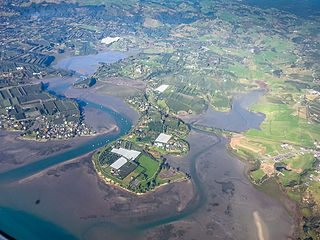
Katikati is a town in New Zealand located on the Uretara Stream near a tidal inlet towards the northern end of Tauranga Harbour, 28 kilometres south of Waihi and 40 kilometres northwest of Tauranga. State Highway 2 passes through the town; a bypass scheduled to have begun construction in 2008 is on hold.

<span class="mw-page-title-main">Te Puke</span> Town in the Bay of Plenty, New Zealand

Te Puke is a town located 18 kilometres southeast of Tauranga in the Western Bay of Plenty of New Zealand. It is particularly well known for the cultivation of Kiwifruit.

<span class="mw-page-title-main">Waihi Beach</span> Town in the Bay of Plenty, New Zealand

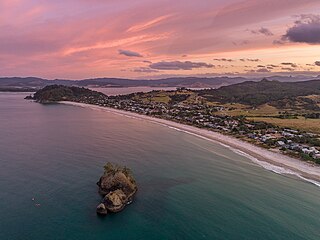
Waihi Beach is a coastal town at the western end of the Bay of Plenty in New Zealand's North Island. It lies 10 kilometres to the east of the town of Waihi, at the foot of the Coromandel Peninsula. The main beach is 10 kilometres long. The town had a permanent population of 2,760 as of June 2022.

<span class="mw-page-title-main">Ōmokoroa</span> Settlement in the Bay of Plenty, New Zealand

Ōmokoroa is a small urban area in the Western Bay of Plenty District of New Zealand. The suburb is considered part of Greater Tauranga, and is within the Coromandel electorate. Ōmokoroa began as a small rural holiday village, but is expanding to be a commuter town, with a 25-minute drive to Tauranga City.

<span class="mw-page-title-main">Ōrere Point</span> Rural settlement in Auckland Region, New Zealand

Ōrere Point is a rural township in the Auckland Region. It is located on the Hauraki Gulf just outside the Auckland metropolitan area. Facilities include a local store, playground, campground, picnic area, parking and limited mobility toilets. Activities include wild life watching, fishing and swimming.

<span class="mw-page-title-main">Tāneatua</span> Rural settlement in Bay of Plenty Region, New Zealand

Tāneatua is a small town in the Bay of Plenty region of New Zealand's North Island, 13 kilometres south of Whakatāne. State Highway 2 passes through the town on its route between Edgecumbe and Ōpōtiki. The small settlements of Ruatoki and Waimana are to the south and south-east of Tāneatua.

Marsden Bay is a locality and bay at the south head of Whangārei Harbour in Northland, New Zealand. The western side of Marsden Bay is a coastal community called One Tree Point, and the eastern side is the industrial development of Marsden Point. Ruakākā lies about 9 km to the south.

<span class="mw-page-title-main">Gisborne District</span> District and unitary region of New Zealand

Gisborne District or the Gisborne Region is a local government area of northeastern New Zealand. It is governed by Gisborne District Council, a unitary authority. It is named after its largest settlement, the city of Gisborne. The region is also commonly referred to as the East Coast.

<span class="mw-page-title-main">Whangapoua</span> Place in Waikato, New Zealand

Whangapoua is a small settlement of mostly holiday houses located on the Coromandel Peninsula of New Zealand. It is situated 25 minutes drive east over the Coromandel Range from Coromandel along the northeastern coastline encompassing popular white sand beaches New Chums Beach, Matarangi, Kuaotunu Beach and Otama Beach.

<span class="mw-page-title-main">Paengaroa</span> Town in the Bay of Plenty, New Zealand

Paengaroa is a village in the Bay of Plenty, New Zealand which lies 11 km from Te Puke, 35 km from Tauranga and 46.2 km from Rotorua.

<span class="mw-page-title-main">Tahawai</span> Rural community in the Bay of Plenty, New Zealand

Tahawai is a rural community in the Western Bay of Plenty District and Bay of Plenty Region of New Zealand's North Island. State Highway 2 runs through it. A peninsula on the eastern side of the area in Tauranga Harbour ends with the small settlements of Tuapiro Point, Ongare Point and Kauri Point, with a walkway between the latter two. A smaller peninsula further north ends at Tanners Point.

<span class="mw-page-title-main">Ongare Point</span> Rural settlement in the Bay of Plenty, New Zealand

Ongare Point is a rural settlement in the Western Bay of Plenty District and Bay of Plenty Region of New Zealand's North Island. It is on a headland on the eastern side of Tauranga Harbour, southeast of Katikati Entrance and opposite Matakana Island.

<span class="mw-page-title-main">Kauri Point</span> Rural settlement in the Bay of Plenty, New Zealand

Kauri Point is a rural settlement in the Western Bay of Plenty District and Bay of Plenty Region of New Zealand's North Island. It is on a headland on the eastern side of Tauranga Harbour, opposite Matakana Island.

<span class="mw-page-title-main">Fairview, Bay of Plenty</span> Rural settlement in the Bay of Plenty, New Zealand

Fairview or Fairview Estate is a rural settlement in the Western Bay of Plenty District and Bay of Plenty Region of New Zealand's North Island. It is about 5.5 km south of Katikati, and is marketed as a lifestyle subdivision.

<span class="mw-page-title-main">Plummers Point</span> Rural settlement in the Bay of Plenty, New Zealand

Plummers Point is a rural settlement in the Western Bay of Plenty District and Bay of Plenty Region of New Zealand's North Island. It is on a headland on the southern side of Tauranga Harbour, opposite Motuhoa Island, and between Mangawhai Bay and Te Puna Estuary. The East Coast Main Trunk forms its southern boundary.

<span class="mw-page-title-main">Te Puna West</span> Rural settlement in the Bay of Plenty, New Zealand

Te Puna West is a rural settlement in the Western Bay of Plenty District and Bay of Plenty Region of New Zealand's North Island. It is on a headland on the southern side of Tauranga Harbour, opposite Motuhoa Island, and on the eastern side of Te Puna Estuary, across from Plummers Point. The East Coast Main Trunk forms its southern boundary.

<span class="mw-page-title-main">Ōhiwa</span> Rural settlement in the Bay of Plenty, New Zealand

Ōhiwa is a rural settlement in the Ōpōtiki District and Bay of Plenty Region of New Zealand's North Island. It is on a headland on the eastern side of Ōhiwa Harbour, and on the western side of the Waiotahe River mouth.

References

  1. 1 2 "ArcGIS Web Application". statsnz.maps.arcgis.com. Retrieved 24 November 2022.
  2. 1 2 "Subnational population estimates (RC, SA2), by age and sex, at 30 June 1996-2022 (2022 boundaries)". Statistics New Zealand . Retrieved 25 October 2022. (regional councils); "Subnational population estimates (TA, SA2), by age and sex, at 30 June 1996-2022 (2022 boundaries)". Statistics New Zealand . Retrieved 25 October 2022. (territorial authorities); "Subnational population estimates (urban rural), by age and sex, at 30 June 1996-2022 (2022 boundaries)". Statistics New Zealand . Retrieved 25 October 2022. (urban areas)
  3. Harriss, Gavin (August 2022). Tanners Point, Bay of Plenty (Map). NZ Topo Map.
  4. "Tanners Point". Western Bay of Plenty District Council. Retrieved 27 November 2020.
  5. Rorke, Jinty (27 March 1995). "Western Bay of Plenty Street Names – Katikati – Farming Families". Bay of Plenty Times.
  6. "Personal Notes". Bay of Plenty Times. 25 May 1908.
  7. "Tauranga Harbour – Proposal for Reclamation". The New Zealand Herald. 17 August 1932.
  8. 2018 Census place summary: Tahawai
  9. 1 2 "Statistical area 1 dataset for 2018 Census". Statistics New Zealand. March 2020. 7013525.