Greerton

Last updated • 2 min readFrom Wikipedia, The Free Encyclopedia

Greerton
Greerton
Coordinates: 37°43′41″S176°07′52″E / 37.728°S 176.131°E / -37.728; 176.131
CountryNew Zealand
City Tauranga
Local authority Tauranga City Council
Electoral ward
  • Te Papa General Ward
  • Tauriko General Ward
Area
[1]
  Land421 ha (1,040 acres)
Population
 (June 2022) [2]
  Total4,530
Bethlehem Gate Pā Merivale
Tauriko
Pfeil oben.svg
Pfeil links.svgGreertonPfeil rechts.svg
Pfeil unten.svg
Poike
Pyes Pā

Greerton is a major suburb of Tauranga, the largest city in the Bay of Plenty region of New Zealand. Greerton is named after Lieutenant-Colonel Henry Harpur Greer, commander of the British forces during the Battle of Gate Pā. [3]

Contents

Demographics

Greerton covers 4.21 km2 (1.63 sq mi) [1] and had an estimated population of 4,530 as of June 2022, [2] with a population density of 1,076 people per km2.

Historical population
YearPop.±% p.a.
20063,696    
20133,735+0.15%
20184,128+2.02%
Source: [4]

Greerton had a population of 4,128 at the 2018 New Zealand census, an increase of 393 people (10.5%) since the 2013 census, and an increase of 432 people (11.7%) since the 2006 census. There were 1,671 households, comprising 1,926 males and 2,205 females, giving a sex ratio of 0.87 males per female, with 762 people (18.5%) aged under 15 years, 828 (20.1%) aged 15 to 29, 1,593 (38.6%) aged 30 to 64, and 945 (22.9%) aged 65 or older.

Ethnicities were 77.5% European/Pākehā, 20.2% Māori, 3.3% Pacific peoples, 11.0% Asian, and 1.8% other ethnicities. People may identify with more than one ethnicity.

The percentage of people born overseas was 19.9, compared with 27.1% nationally.

Although some people chose not to answer the census's question about religious affiliation, 49.6% had no religion, 31.4% were Christian, 1.5% had Māori religious beliefs, 2.8% were Hindu, 0.1% were Muslim, 0.8% were Buddhist and 4.9% had other religions.

Of those at least 15 years old, 402 (11.9%) people had a bachelor's or higher degree, and 843 (25.0%) people had no formal qualifications. 237 people (7.0%) earned over $70,000 compared to 17.2% nationally. The employment status of those at least 15 was that 1,488 (44.2%) people were employed full-time, 450 (13.4%) were part-time, and 135 (4.0%) were unemployed. [4]

Individual statistical areas
NameArea
(km2)
PopulationDensity
(per km2)
HouseholdsMedian ageMedian
income
Greerton South2.8169024625841.2 years$25,100 [5]
Greerton North1.403,4382,4561,41339.4 years$24,700 [6]
New Zealand37.4 years$31,800

History

It was originally a small village located several kilometres south of Tauranga but was swallowed up by urban development. A military village of 125 one acre lots, the Township of Greerton, was surveyed near Gate Pā. Military settlers were allowed a choice of one acre there or a quarter acre in Te Papa. Originally, very few settlers took up town sections in Greerton. [7]

In 1864 the Tauranga Campaign was fought in the neighbouring suburb of Gate Pā with Māori troops withdrawing through Greerton to Pyes Pa. [8] [9]

Culture

The Greerton community celebrates the cherry blossom festival in the third week of September every year. [10]

Education

Greerton has two co-educational state primary schools: Greerton Village School, [11] [12] with a roll of 353, [13] and Greenpark School, [14] with a roll of 677. [15]

Greerton is also zoned for Tauranga Intermediate, Tauranga Boys' College and Tauranga Girls' College. [16] [17]

Recreation

Tauranga Racecourse | Mārawaewae is situated on Cameron Road next to Tauranga Golf Course, at the southern end of Greerton Village.

Greerton also has several parks: Greerton Park, Liston Park, Moreland Fox Park, Pemberton Park and Yatton Park.

Related Research Articles

<span class="mw-page-title-main">Whakatāne</span> Town in Bay of Plenty Region, New Zealand

Whakatāne is a town located in the Bay of Plenty Region in the North Island of New Zealand, 90 kilometres (56 mi) east of Tauranga and 89 kilometres (55 mi) northeast of Rotorua. The town is situated at the mouth of the Whakatāne River. The Whakatāne District is the territorial authority that encompasses the town, covering an area to the south and west of the town, excluding the enclave of Kawerau District.

<span class="mw-page-title-main">Te Awamutu</span> Town in Waikato, New Zealand

Te Awamutu is a town in the Waikato region in the North Island of New Zealand. It is the council seat of the Waipa District and serves as a service town for the farming communities which surround it. Te Awamutu is located some 30 kilometres (19 mi) south of Hamilton on State Highway 3, one of the two main routes south from Auckland and Hamilton.

<span class="mw-page-title-main">Morrinsville</span> Town in Waikato, New Zealand

Morrinsville is a provincial town in the Waikato region of New Zealand's North Island, with an estimated population of 8,960 as of June 2023. The town is located at the northern base of the Pakaroa Range, and on the south-western fringe of the Hauraki Plains. Morrinsville is around 33 kilometres east of Hamilton and 22 kilometres west of Te Aroha. The town is bordered by the Piako River to the east and the Waitakaruru Stream to the south.

<span class="mw-page-title-main">Richmond, New Zealand</span> Town in Tasman District, New Zealand

Richmond is a town and the seat of the Tasman District Council in New Zealand. It lies 13 kilometres (8 mi) south of Nelson in the South Island, close to the southern extremity of Tasman Bay. The town, first settled by Europeans in 1842, was named in 1854 after the town of Richmond on Thames near London. The town has an estimated population of 19,200 as of June 2023.

<span class="mw-page-title-main">Te Puke</span> Town in the Bay of Plenty, New Zealand

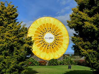
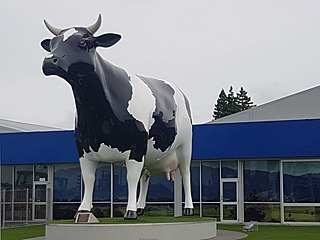
Te Puke is a town located 18 kilometres southeast of Tauranga in the Western Bay of Plenty of New Zealand. It is particularly well known for the cultivation of Kiwifruit.

<span class="mw-page-title-main">Papamoa</span> Suburb of Tauranga, New Zealand

Papamoa or Papamoa Beach is a suburb of Tauranga, located about 11 kilometres from the city centre. It is the largest residential suburb in Tauranga. It is bordered to the west by Arataki and Mount Maunganui, the east by the Kaituna River and to the south by State Highway 2.

<span class="mw-page-title-main">Gate Pa</span> Suburb of Tauranga, New Zealand

Gate Pa or Gate Pā is a suburb of Tauranga, in the Bay of Plenty Region of New Zealand's North Island.

<span class="mw-page-title-main">Ōmokoroa</span> Settlement in the Bay of Plenty, New Zealand

Ōmokoroa is a small urban area in the Western Bay of Plenty District of New Zealand. The suburb is considered part of Greater Tauranga, and is within the Coromandel electorate. Ōmokoroa began as a small rural holiday village, but is expanding to be a commuter town, with a 25-minute drive to Tauranga City.

Waitangirua is a suburb of Porirua City approximately 22km north of Wellington in New Zealand.

Onekawa is a suburb of the city of Napier, in the Hawke's Bay Region of the eastern North Island of New Zealand. Development of the suburb began in the late 1940s, after the land was acquired from then-Harbour Board.

Bethlehem is a suburb of Tauranga in New Zealand's North Island. Originally a small independent town, it has now been absorbed by Tauranga and comprises a number of subdivisions including Bethlehem Heights, Sterling Gate, La Cumbre, Saint Andrews, and Mayfield.

<span class="mw-page-title-main">Kaiti, New Zealand</span> Suburb of Gisborne, New Zealand

Kaiti is a suburb of the New Zealand city of Gisborne. It is located immediately to the east of the city centre, on the opposing bank of the Waimata River.

Te Hapara is a suburb of the New Zealand city of Gisborne. It is located in the northwest of the city. It contains one primary school, Te Hapara School, which is located in Mill Road.

Pyes Pa is a suburb of Tauranga, New Zealand.

<span class="mw-page-title-main">Tauranga South</span> Suburb of Tauranga, New Zealand

Tauranga South is a suburb of Tauranga, on New Zealand's North Island. It is located south-east of Judea, north-east of Gate Pa and south-west of Tauranga Central.

<span class="mw-page-title-main">Welcome Bay</span> Suburb of Tauranga, New Zealand

Welcome Bay is a suburb of Tauranga, New Zealand. It is located 7 kilometres (4.3 mi) from central Tauranga. Neighbouring suburbs include Hairini and Maungatapu. There are a number of schools in Welcome Bay, including three primary schools.

Riverdale is a suburb of Gisborne, in the Gisborne District of New Zealand's North Island.

<span class="mw-page-title-main">Maraekakaho</span> Settlement in Hawkes Bay Region, New Zealand

Maraekakaho is a rural settlement in the Hastings District and Hawke's Bay Region of New Zealand's North Island.

Omanu is a beach and suburb in Tauranga, in the Bay of Plenty Region of New Zealand's North Island.

Bellevue is a suburb of Tauranga, in the Bay of Plenty Region of New Zealand's North Island.

References

  1. 1 2 "ArcGIS Web Application". statsnz.maps.arcgis.com. Retrieved 20 December 2022.
  2. 1 2 "Population estimate tables - NZ.Stat". Statistics New Zealand . Retrieved 25 October 2022.
  3. McCauley, Debbie (2012). "Henry Harpur Greer (1821-1886)". Tauranga Memories: Tauranga Local History. Retrieved 14 June 2022.
  4. 1 2 "Statistical area 1 dataset for 2018 Census". Statistics New Zealand. March 2020. Greerton South (194700) and Greerton North (195200).
  5. 2018 Census place summary: Greerton South
  6. 2018 Census place summary: Greerton North
  7. McCauley, Debbie (2013). "Hynds Road, Tauranga" . Retrieved 14 June 2022.
  8. "Gate Pā - War in Tauranga | NZHistory, New Zealand history online". Nzhistory.net.nz. 25 June 2014. Retrieved 26 March 2017.
  9. "Tauranga City Council > Home". Tauranga.govt.nz. Retrieved 26 March 2017.
  10. "Rain no deterrent for Greerton Cherry Blossom Festival goers" . Retrieved 18 September 2019.
  11. "Greerton Village School Official School Website". greerton.school.nz.
  12. "Greerton Village School Ministry of Education School Profile". educationcounts.govt.nz. Ministry of Education.
  13. "Greerton Village School Education Review Office Report". ero.govt.nz. Education Review Office.
  14. "Greenpark School Ministry of Education School Profile". educationcounts.govt.nz. Ministry of Education.
  15. "Greenpark School Education Review Office Report". ero.govt.nz. Education Review Office.
  16. "Tauranga Boys College Website" . Retrieved 15 October 2019.
  17. "NZ Schools.tki.nz" . Retrieved 15 October 2019.