Omanu

Last updated

Omanu
Omanu
Coordinates: 37°39′35″S176°12′53″E / 37.659757°S 176.214844°E / -37.659757; 176.214844
CountryNew Zealand
City Tauranga
Local authority Tauranga City Council
Electoral wardMauao/Mount Maunganui General Ward
Area
[1]
  Land102 ha (252 acres)
Population
 (June 2022) [2]
  Total3,290
Mount Maunganui (Bay of Plenty)
Pfeil oben.svg
Pfeil links.svgOmanuPfeil rechts.svg
Pfeil unten.svg
Matapihi Arataki

Omanu is a beach and suburb in Tauranga, in the Bay of Plenty Region of New Zealand's North Island.

Contents

The white sandy beach is accessible via several public walkways through the dunes. It is a popular place to swim, surf and walk, [3] and hosts surf lifesaving competitions. [4]

A surf lifesaving club was established at Omanu in 1947 to patrol the beach. It is now the largest surf club in Bay of Plenty, [3] and has the largest children's nippers programme in New Zealand. [5]

Between July 2014 and December 2015, Omanu recorded the most burglaries of any suburb in Tauranga. Police say many of the thieves are opportunists. [6]

The club also patrolled Papamoa Beach until a new club was established there in 1990. [5]

A new club house was proposed in 2002 and completed in June 2006. [5]

Tauranga City Council monitors erosion at the beach regularly and replenishes sand every year. [7]

Demographics

Omanu Beach covers 1.02 km2 (0.39 sq mi) [1] and had an estimated population of 3,290 as of June 2022, [2] with a population density of 3,225 people per km2.

Historical population
YearPop.±% p.a.
20062,574    
20132,619+0.25%
20182,919+2.19%
Source: [8]

Omanu Beach had a population of 2,919 at the 2018 New Zealand census, an increase of 300 people (11.5%) since the 2013 census, and an increase of 345 people (13.4%) since the 2006 census. There were 1,104 households, comprising 1,371 males and 1,545 females, giving a sex ratio of 0.89 males per female. The median age was 40.2 years (compared with 37.4 years nationally), with 582 people (19.9%) aged under 15 years, 471 (16.1%) aged 15 to 29, 1,347 (46.1%) aged 30 to 64, and 519 (17.8%) aged 65 or older.

Ethnicities were 91.7% European/Pākehā, 10.9% Māori, 1.7% Pacific peoples, 3.0% Asian, and 3.5% other ethnicities. People may identify with more than one ethnicity.

The percentage of people born overseas was 19.9, compared with 27.1% nationally.

Although some people chose not to answer the census's question about religious affiliation, 58.0% had no religion, 31.7% were Christian, 0.2% had Māori religious beliefs, 0.2% were Hindu, 0.2% were Muslim, 0.3% were Buddhist and 2.4% had other religions.

Of those at least 15 years old, 615 (26.3%) people had a bachelor's or higher degree, and 345 (14.8%) people had no formal qualifications. The median income was $37,400, compared with $31,800 nationally. 531 people (22.7%) earned over $70,000 compared to 17.2% nationally. The employment status of those at least 15 was that 1,161 (49.7%) people were employed full-time, 405 (17.3%) were part-time, and 78 (3.3%) were unemployed. [8]

Education

Omanu School is a co-educational state primary school for Year 1 to 6 students, [9] [10] with a roll of 506 as of April 2023. [11]

Mount Maunganui Intermediate is a co-educational state intermediate school for Year 7 and 8 students, [12] [13] with a roll of 671. [14]

Mount Maunganui College is a co-educational state secondary school for Year 9 to 13 students, [15] established in 1958, [16] with a roll of 1784. [17]

Related Research Articles

<span class="mw-page-title-main">Whakatāne</span> Town in Bay of Plenty Region, New Zealand

Whakatāne is a town located in the Bay of Plenty Region in the North Island of New Zealand, 90 kilometres (56 mi) east of Tauranga and 89 kilometres (55 mi) northeast of Rotorua. The town is situated at the mouth of the Whakatāne River. The Whakatāne District is the territorial authority that encompasses the town, covering an area to the south and west of the town, excluding the enclave of Kawerau District.

<span class="mw-page-title-main">Ōpōtiki</span> Town in the Bay of Plenty, New Zealand

Ōpōtiki is a town in the eastern Bay of Plenty in the North Island of New Zealand. It houses the headquarters of the Ōpōtiki District Council, the mayor of Ōpōtiki and comes under the Bay of Plenty Regional Council.

<span class="mw-page-title-main">Te Puke</span> Town in the Bay of Plenty, New Zealand

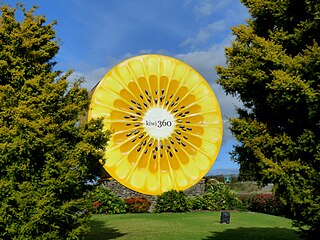
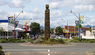
Te Puke is a town located 18 kilometres southeast of Tauranga in the Western Bay of Plenty of New Zealand. It is particularly well known for the cultivation of Kiwifruit.

<span class="mw-page-title-main">Matakana Island</span> Island in the Bay of Plenty, New Zealand

Matakana Island is located in the western Bay of Plenty in New Zealand's North Island. A long, flat barrier island, it is 20 kilometres (12 mi) in length but rarely more than 3 kilometres (1.9 mi) wide. The island has been continuously populated for centuries by Māori tribes that are mostly associated with Ngāi Te Rangi.

<span class="mw-page-title-main">Mount Maunganui</span> Suburb of Tauranga, New Zealand

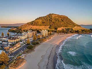
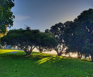
Mount Maunganui is a major residential, commercial and industrial suburb of Tauranga located on a peninsula to the north-east of Tauranga's city centre. It was an independent town from Tauranga until the completion of the Tauranga Harbour Bridge in 1988, which connects Mount Maunganui to Tauranga's central business district.

<span class="mw-page-title-main">Papamoa</span> Suburb of Tauranga, New Zealand

Papamoa or Papamoa Beach is a suburb of Tauranga, located about 11 kilometres from the city centre. It is the largest residential suburb in Tauranga. It is bordered to the west by Arataki and Mount Maunganui, the east by the Kaituna River and to the south by State Highway 2.

<span class="mw-page-title-main">Ōtaki, New Zealand</span> Settlement in Wellington Region, New Zealand

Ōtaki is a town in the Kāpiti Coast District of the North Island of New Zealand, situated half way between the capital city Wellington, 70 km (43 mi) to the southwest, and Palmerston North, 70 km (43 mi) to the northeast.

<span class="mw-page-title-main">Tītahi Bay</span> Suburb of Porirua

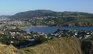
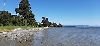
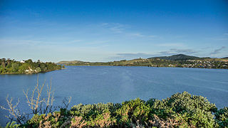
Tītahi Bay, a suburb of Porirua in the North Island of New Zealand, lies at the foot of a short peninsula on the west coast of the Porirua Harbour, to the north of Porirua city centre.

<span class="mw-page-title-main">Gate Pa</span> Suburb of Tauranga, New Zealand

Gate Pa or Gate Pā is a suburb of Tauranga, in the Bay of Plenty Region of New Zealand's North Island.

<span class="mw-page-title-main">Otūmoetai</span> Suburb of Tauranga, New Zealand

Otūmoetai is a suburb of Tauranga in the Bay of Plenty region of New Zealand.

<span class="mw-page-title-main">Kilbirnie, New Zealand</span> Suburb of Wellington City, New Zealand

Kilbirnie is a suburb of Wellington in New Zealand, 3 kilometres (1.9 mi) to the south-east of the city centre. Travellers can reach Kilbirnie from the Wellington central business district via the Mount Victoria Tunnel and Hataitai, or over Mount Victoria, or around the coast.

<span class="mw-page-title-main">Cannons Creek, New Zealand</span> Suburb of Porirua City near Wellington, New Zealand

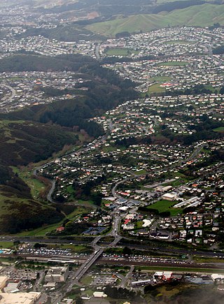
Cannons Creek is a suburb of Porirua City approximately 22km north of Wellington in New Zealand.

<span class="mw-page-title-main">Hutt Central</span> Central business district of Lower Hutt, New Zealand

Hutt Central, a suburb of the city of Lower Hutt in New Zealand, forms part of the urban area of greater Wellington. It includes the Lower Hutt CBD.

Greerton is a major suburb of Tauranga, the largest city in the Bay of Plenty region of New Zealand. Greerton is named after Lieutenant-Colonel Henry Harpur Greer, commander of the British forces during the Battle of Gate Pā.

<span class="mw-page-title-main">Tauranga South</span> Suburb of Tauranga, New Zealand

Tauranga South is a suburb of Tauranga, on New Zealand's North Island. It is located south-east of Judea, north-east of Gate Pa and south-west of Tauranga Central.

<span class="mw-page-title-main">Welcome Bay</span> Suburb of Tauranga, New Zealand

Welcome Bay is a suburb of Tauranga, New Zealand. It is located 7 kilometres (4.3 mi) from central Tauranga. Neighbouring suburbs include Hairini and Maungatapu. There are a number of schools in Welcome Bay, including three primary schools.

<span class="mw-page-title-main">Matapihi</span> Suburb of Tauranga, New Zealand

Matapihi is a suburb and peninsula of Tauranga in the Bay of Plenty region of New Zealand's North Island, surrounded on most sides by the Tauranga Harbour.

Ōwhata is a semi-rural suburb of Rotorua in the Bay of Plenty region of New Zealand's North Island.

<span class="mw-page-title-main">Western Heights, Rotorua</span> Suburb of Rotorua, New Zealand

Western Heights is a suburb of Rotorua in the Bay of Plenty Region of New Zealand's North Island.

Bellevue is a suburb of Tauranga, in the Bay of Plenty Region of New Zealand's North Island.

References

  1. 1 2 "ArcGIS Web Application". statsnz.maps.arcgis.com. Retrieved 19 December 2022.
  2. 1 2 "Population estimate tables - NZ.Stat". Statistics New Zealand . Retrieved 25 October 2022.
  3. 1 2 "Omanu Beach". theswimguide.org. Swim Guide Canada.
  4. Tauranga, David (25 February 2017). "Sea, sand, sweat & glory at Omanu Beach". Sun Media. sunlive.co.nz.
  5. 1 2 3 "About Us". omanubeach.co.nz. Omanu Beach Surf Lifesaving Club.
  6. Gillespie, Kiri (7 March 2016). "Special report: Tauranga's worst suburbs for burglaries revealed". New Zealand Media and Entertainment. Bay of Plenty Times.
  7. Houghton, Caitlin (8 March 2020). "Keeping our beaches sandy". Sun Media. sunlive.co.nz.
  8. 1 2 "Statistical area 1 dataset for 2018 Census". Statistics New Zealand. March 2020. Omanu Beach (194300). 2018 Census place summary: Omanu Beach
  9. "Omanu School Official School Website". omanu.school.nz.
  10. "Omanu School Ministry of Education School Profile". educationcounts.govt.nz. Ministry of Education.
  11. "Omanu School Education Review Office Report". ero.govt.nz. Education Review Office.
  12. "Mount Maunganui Intermediate Official School Website". mtint.school.nz.
  13. "Mount Maunganui Intermediate Ministry of Education School Profile". educationcounts.govt.nz. Ministry of Education.
  14. "Mount Maunganui Intermediate Education Review Office Report". ero.govt.nz. Education Review Office.
  15. "Ministry of Education School Profile". educationcounts.govt.nz. Ministry of Education.
  16. "Official School Website". mmc.school.nz.
  17. "Education Review Office Report". ero.govt.nz. Education Review Office.