Transport in New Zealand has always faced many challenges, given the country's mountainous topography and a relatively small population, which is located mostly near its long coastline. Before Europeans arrived, Māori either walked or used watercraft on rivers and along the coasts. European shipping and railways revolutionised the transport of goods and people, before themselves being overtaken by road and air transport, which are now the dominant forms. Bulk freight still continues to be transported by coastal shipping and by rail, and there are attempts to (re)introduce public transport as a major transport mode in the larger population centres.

A roundabout, a rotary and a traffic circle are types of circular intersection or junction in which road traffic is permitted to flow in one direction around a central island, and priority is typically given to traffic already in the junction.

An intersection or an at-grade junction is a junction where two or more roads converge, diverge, meet or cross at the same height, as opposed to an interchange, which uses bridges or tunnels to separate different roads. Major intersections are often delineated by gores and may be classified by road segments, traffic controls and lane design.

The A27 is a major road in England. It runs from its junction with the A36 at Whiteparish in the county of Wiltshire, follows the south coast of Hampshire and West Sussex, and terminates at Pevensey in East Sussex.

The Auckland Harbour Bridge is an eight-lane motorway bridge over the Waitematā Harbour in Auckland, New Zealand. It joins St Marys Bay on the Auckland city side with Northcote on the North Shore side. It is part of State Highway 1 and the Auckland Northern Motorway. The bridge is operated by the NZ Transport Agency (NZTA). It is the second-longest road bridge in New Zealand, and the longest in the North Island.

In civil engineering, grade separation is a method of aligning a junction of two or more surface transport axes at different heights (grades) so that they will not disrupt the traffic flow on other transit routes when they cross each other. The composition of such transport axes does not have to be uniform; it can consist of a mixture of roads, footpaths, railways, canals, or airport runways. Bridges, tunnels, or a combination of both can be built at a junction to achieve the needed grade separation.

Māngere Bridge, officially also called the Manukau Harbour Crossing, is a dual motorway bridge over the Manukau Harbour in south-western Auckland, New Zealand, crossing between the suburb also known as Māngere Bridge and the suburb of Onehunga.

The Northern Busway is a segregated busway that runs along the eastern side of the Northern Motorway, part of State Highway 1, in the north of Auckland, New Zealand, linking the North Shore with the northern end of the Auckland Harbour Bridge. As of May 2022, the busway consists of two-way lanes running between Albany Station and Akoranga Station, and from Akoranga Station a southbound-only lane that joins the Harbour Bridge approaches just south of the Onewa Road on-ramp system. The busway previously ended at Constellation before an extension to Albany was constructed in 2022.

The Auckland Northern Motorway in the Auckland Region of New Zealand links Central Auckland and Warkworth in the former Rodney District via the Hibiscus Coast and North Shore. It is part of State Highway 1.

State Highway 2 runs north–south through eastern parts of the North Island of New Zealand from the outskirts of Auckland to Wellington. It runs through Tauranga, Gisborne, Napier, Hastings and Masterton. It is the second-longest highway in the North Island, after State Highway 1, which runs the length of both of the country's main islands.

The Second Harbour Crossing is the name given to the proposed second transport link across the Waitematā Harbour in Auckland, New Zealand. Planners have also referred to new links across the harbour as the Additional Waitematā Harbour Crossing (AWHC) or the Waitematā Harbour Connections.
The Tauranga Eastern Link (TEL) is a four lane motorway in the Bay of Plenty region in New Zealand, covering 23 km from Te Maunga junction in Tauranga to Paengaroa. It was officially opened on 30 July 2015. It replaced a section of State Highway 2, improving access to Tauranga from the east and south. It became the main route for trucks heading to the Port of Tauranga from Rotorua and the eastern Bay of Plenty, and connected the Central Plateau forestry industry with the port to facilitate lumber export.
The Tauranga Harbour Bridge refers to two bridges that carry Te Awanui Drive over the Tauranga Harbour. Te Awanui Drive is part of an expressway that connects Tauranga CBD to Mount Maunganui. On the Tauranga CBD side, Te Awanui Drive connects to Takitimu Drive, which crosses the Chapel Street Viaduct before running along the edge of the Waikareao Estuary. On the Mount Maunganui side, Te Awanui Drive connects to Hewletts Road, which runs through an industrial area towards Maunganui Road.

The Southern Transport Investment Program is a road and rail transport plan for the northern outskirts of Hobart instituted in 2007 by the Tasmanian state government. It outlines most prominently an extensive upgrade of the Midland Highway, including the Brighton Bypass, the Bagdad Bypass and the replacement of the Bridgewater Bridge. The plan also outlines the construction of the Brighton Transport Hub and various rail alignment improvements to the Main North/South Line.

The Onehunga Harbour Road Bridge is a walking and cycling bridge over Onehunga Harbour Road, a heavily trafficked road at the southwestern edge of Onehunga, New Zealand. The bridge provides easy and safe access from Onehunga to both the Waikaraka Cycleway running west–east, and Old Mangere Bridge to the south, which in turn links over the Mangere Inlet mouth of the Manukau Harbour. The bridge is 3.5m wide, and distinguished by its sweeping, curved structure.
WSP New Zealand Ltd is a global engineering professional services consulting firm based in New Zealand and owned by Canadian multinational WSP Global. Until October 2019 it traded as WSP Opus.

State Highway 29 (SH 29) is a New Zealand state highway that travels over the Kaimai Ranges linking the Bay of Plenty and Waikato regions. For most of its length, SH 29 is a two-lane single carriageway with occasional passing lanes and slow vehicle bays. 5 km of it near its eastern terminus is part of the Takitimu Drive Toll Road.
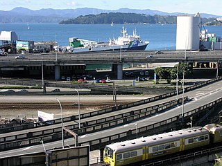
State Highway 58 (SH 58) is a New Zealand state highway in the Wellington Region linking the Hutt Valley to Porirua City.

On 29 January 2020, the New Zealand Upgrade Programme was announced by Prime Minister Jacinda Ardern. The programme is a $12 billion infrastructure package to improve roads, rail, hospitals and schools around the country, of which $8 billion has been allocated and the other $4 billion is part of the infrastructure section of the 2020 budget.

