Tauriko

Last updated

Tauriko
Tauriko
Country New Zealand
City Tauranga
Electoral wardOtumoetai/Pyes Pa
Population
 (2018) [1]
  Total177
Bethlehem Gate Pa
Pfeil oben.svg
Pfeil links.svgTaurikoPfeil rechts.svg
Pfeil unten.svg
Greerton
Pyes Pa

Tauriko is a suburb of Tauranga, in the Bay of Plenty Region of New Zealand's North Island.

Contents

According to Place Names of New Zealand by A. W. Reed and Peter Dowling, "Tauriko" is not a Māori name—the suburb was originally named Taurico after the Tauranga Rimu Company, with the spelling apparently altered to give the semblance of a Māori name. [2]

Demographics

Historical population
YearPop.±% p.a.
2006195    
2013216+1.47%
2018177−3.90%
Source: [1]

Tauriko had a population of 177 at the 2018 New Zealand census, a decrease of 39 people (−18.1%) since the 2013 census, and a decrease of 18 people (−9.2%) since the 2006 census. There were 60 households. There were 96 males and 81 females, giving a sex ratio of 1.19 males per female. The median age was 37.6 years (compared with 37.4 years nationally), with 33 people (18.6%) aged under 15 years, 39 (22.0%) aged 15 to 29, 99 (55.9%) aged 30 to 64, and 9 (5.1%) aged 65 or older.

Ethnicities were 91.5% European/Pākehā, 18.6% Māori, 1.7% Pacific peoples and 1.7% Asian (totals add to more than 100% since people could identify with multiple ethnicities).

The proportion of people born overseas was 10.2%, compared with 27.1% nationally.

Although some people objected to giving their religion, 59.3% had no religion, 33.9% were Christian, 1.7% were Hindu and 1.7% had other religions.

Of those at least 15 years old, 12 (8.3%) people had a bachelor or higher degree, and 24 (16.7%) people had no formal qualifications. The median income was $38,200, compared with $31,800 nationally. The employment status of those at least 15 was that 84 (58.3%) people were employed full-time, 27 (18.8%) were part-time, and 3 (2.1%) were unemployed. [1]

Education

Tauriko School is a co-educational state primary school for Year 1 to 8 students, [3] with a roll of 270 as of July 2022. [4]

Related Research Articles

<span class="mw-page-title-main">Papamoa</span> Suburb of Tauranga in New Zealand

Papamoa or Papamoa Beach is a suburb of Tauranga, located about 11 kilometres from the city centre. It is the largest residential suburb in Tauranga. It is bordered to the west by Arataki and Mount Maunganui, the east by the Kaituna River and to the south by State Highway 2.

<span class="mw-page-title-main">Gate Pa</span> Suburb of Tauranga in New Zealand

Gate Pa or Gate Pā is a suburb of Tauranga, in the Bay of Plenty Region of New Zealand's North Island.

<span class="mw-page-title-main">Ōmokoroa</span> Place in Bay of Plenty, New Zealand

Ōmokoroa is a small urban area in the Western Bay of Plenty District of New Zealand. The suburb is considered part of Greater Tauranga, and is within the Coromandel electorate. Ōmokoroa began as a small rural holiday village, but is expanding to be a commuter town, with a 25-minute drive to Tauranga City.

Otūmoetai is a suburb of the city of Tauranga in the Bay of Plenty region of New Zealand.

Maraenui is a suburb of the city of Napier, in the Hawke's Bay region of New Zealand's eastern North Island. The New Zealand Ministry for Culture and Heritage gives a translation of "great marae" for Maraenui.

<span class="mw-page-title-main">Ahuriri</span> Suburb of Napier in New Zealand

Ahuriri is a suburb of the city of Napier, in the Hawke's Bay region of New Zealand's eastern North Island.

Pyes Pa is a suburb of Tauranga, New Zealand.

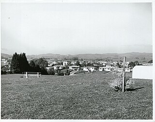
Greerton is a major suburb of Tauranga, the largest city in the Bay of Plenty region of New Zealand. Greerton is named after Lieutenant-Colonel Henry Harpur Greer, commander of the British forces during the Battle of Gate Pā.

Tauranga South is a suburb of Tauranga, on New Zealand's North Island. It is located south-east of Judea, north-east of Gate Pa and south-west of Tauranga Central.

Welcome Bay is a suburb of Tauranga, New Zealand. It is located 7 kilometres (4.3 mi) from central Tauranga. Neighbouring suburbs include Hairini and Maungatapu. There are a number of schools in Welcome Bay, including three primary schools.

Hairini is a suburb of Tauranga in the Bay of Plenty region of New Zealand's North Island.

Maungatapu is a suburb and peninsula of Tauranga in the Bay of Plenty region of New Zealand's North Island. It is north-east of Hairini and south-east of Matapihi.

Matapihi is a suburb and peninsula of Tauranga in the Bay of Plenty region of New Zealand's North Island, surrounded on most sides by the Tauranga Harbour.

Judea is a suburb of Tauranga in the Bay of Plenty region of New Zealand's North Island. It is located on State Highway 2, east of Bethlehem.

<span class="mw-page-title-main">Kawaha Point</span> Suburb of Rotorua Lakes in New Zealand

Kawaha Point is a suburb of Rotorua in the Bay of Plenty Region of New Zealand's North Island.

<span class="mw-page-title-main">Tauranga Central</span> Suburb of Tauranga in New Zealand

Tauranga Central is a suburb and the central business district of Tauranga, in the Bay of Plenty Region of New Zealand's North Island.

Omanu is a beach and suburb in Mount Maunganui, Tauranga, in the Bay of Plenty Region of New Zealand's North Island.

Bellevue is a suburb of Tauranga, in the Bay of Plenty Region of New Zealand's North Island.

Poike or Windermere is a suburb of Tauranga, in the Bay of Plenty Region of New Zealand's North Island.

Merivale or Parkvale is a suburb of Tauranga, in the Bay of Plenty Region of New Zealand's North Island.

References

  1. 1 2 3 "Statistical area 1 dataset for 2018 Census". Statistics New Zealand. March 2020. Tauriko (194500). 2018 Census place summary: Tauriko
  2. "Tauriko (Locality)". New Zealand Gazetteer. New Zealand Geographic Board. Retrieved 30 October 2022.
  3. "Ministry of Education School Profile". educationcounts.govt.nz. Ministry of Education.
  4. "Education Review Office Report". ero.govt.nz. Education Review Office.

Coordinates: 37°44′28″S176°05′46″E / 37.741°S 176.096°E / -37.741; 176.096