Brookfield, New Zealand

Last updated

Brookfield
Brookfield, New Zealand
Coordinates: 37°41′25″S176°08′08″E / 37.690325°S 176.135607°E / -37.690325; 176.135607
CountryNew Zealand
City Tauranga
Local authority Tauranga City Council
Electoral ward
  • Matua-Otūmoetai General Ward
  • Bethlehem General Ward
Area
[1]
  Land237 ha (586 acres)
Population
 (June 2022) [2]
  Total6,400
Bellevue Otūmoetai
Bethlehem
Pfeil oben.svg
Pfeil links.svgBrookfieldPfeil rechts.svg
Pfeil unten.svg
(Waikareao Estuary)
Judea

Brookfield is a suburb of Tauranga, in the Bay of Plenty Region of New Zealand's North Island.

Contents

Demographics

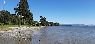
Brookfield covers 2.37 km2 (0.92 sq mi) [1] and had an estimated population of 6,400 as of June 2022, [2] with a population density of 2,700 people per km2.

Historical population
YearPop.±% p.a.
20064,950    
20135,148+0.56%
20185,754+2.25%
Source: [3]

Brookfield had a population of 5,754 at the 2018 New Zealand census, an increase of 606 people (11.8%) since the 2013 census, and an increase of 804 people (16.2%) since the 2006 census. There were 2,094 households, comprising 2,814 males and 2,940 females, giving a sex ratio of 0.96 males per female, with 1,329 people (23.1%) aged under 15 years, 1,143 (19.9%) aged 15 to 29, 2,448 (42.5%) aged 30 to 64, and 831 (14.4%) aged 65 or older.

Ethnicities were 79.0% European/Pākehā, 21.5% Māori, 3.3% Pacific peoples, 8.5% Asian, and 1.9% other ethnicities. People may identify with more than one ethnicity.

The percentage of people born overseas was 20.5, compared with 27.1% nationally.

Although some people chose not to answer the census's question about religious affiliation, 52.2% had no religion, 33.5% were Christian, 2.2% had Māori religious beliefs, 0.8% were Hindu, 0.5% were Muslim, 0.4% were Buddhist and 3.6% had other religions.

Of those at least 15 years old, 849 (19.2%) people had a bachelor's or higher degree, and 762 (17.2%) people had no formal qualifications. 519 people (11.7%) earned over $70,000 compared to 17.2% nationally. The employment status of those at least 15 was that 2,262 (51.1%) people were employed full-time, 654 (14.8%) were part-time, and 198 (4.5%) were unemployed. [3]

Individual statistical areas
NameArea
(km2)
PopulationDensity
(per km2)
HouseholdsMedian ageMedian
income
Brookfield West1.322,9312,2201,08334.2 years$31,100 [4]
Brookfield East1.052,8232,6891,01135.1 years$30,600 [5]
New Zealand37.4 years$31,800

Education

Brookfield School is a co-educational state primary school for Year 1 to 6 students, [6] [7] with a roll of 276 as of April 2023. [8]

Related Research Articles

<span class="mw-page-title-main">Tokomaru Bay</span> Town in the North Island of New Zealand

Tokomaru Bay is a small beachside community located on the isolated East Coast of New Zealand's North Island. It is 91 km north of Gisborne, on State Highway 35, and close to Mount Hikurangi. The district was originally known as Toka-a-Namu, which refers to the abundance of sandflies. Over the years the name was altered to Tokomaru Bay.

<span class="mw-page-title-main">Stoke, New Zealand</span> Suburb of Nelson, New Zealand

Stoke is a suburb of Nelson in New Zealand, located between Richmond and Tāhunanui. Stoke was named by William Songer, the personal servant of Arthur Wakefield, after his birthplace Stoke-by-Nayland in Suffolk.

<span class="mw-page-title-main">Reporoa</span> Rural settlement in Waikato Region, New Zealand

Reporoa is a rural community in Rotorua Lakes within the Waikato region of New Zealand's North Island.

<span class="mw-page-title-main">Otūmoetai</span> Suburb of Tauranga, New Zealand

Otūmoetai is a suburb of the city of Tauranga in the Bay of Plenty region of New Zealand.

Onekawa is a suburb of the city of Napier, in the Hawke's Bay Region of the eastern North Island of New Zealand. Development of the suburb began in the late 1940s, after the land was acquired from then-Harbour Board.

Mangapapa is a suburb of the New Zealand city of Gisborne. It is located in the north of the city. Whataupoko lies to the southeast and Te Hapara to the south, separated from Mangapapa by the Taruheru River.

Te Hapara is a suburb of the New Zealand city of Gisborne. It is located in the northwest of the city. It contains one primary school, Te Hapara School, which is located in Mill Road.

Gonville is a residential suburb of Whanganui, New Zealand. It is under the local governance of the Whanganui District Council.

Ōwhata is a semi-rural suburb of Rotorua in the Bay of Plenty region of New Zealand's North Island.

Waitahanui is a village in the Taupō District, Waikato region, New Zealand. The village is on the eastern shore of Lake Taupō, 14 km (9 mi) south of the district seat of Taupō.

Hexton is a village and rural area in the Gisborne District of New Zealand's North Island. It is located north-west of Gisborne City, and includes the settlements of Makauri and Waerengaahika.

Riverdale is a suburb of Gisborne, in the Gisborne District of New Zealand's North Island.

Tamatea is a suburb in the west of the city of Napier, in the Hawke's Bay Region of New Zealand's eastern North Island.

<span class="mw-page-title-main">Glenholme, Rotorua</span> Suburb of Rotorua, New Zealand

Glenholme is a suburb of Rotorua in the Bay of Plenty Region of New Zealand's North Island.

Mangakakahi is a suburb of Rotorua in the Bay of Plenty Region of New Zealand's North Island.

Springfield is a suburb of Rotorua in the Bay of Plenty Region of New Zealand's North Island.

Arataki is a neighbourhood of Mount Maunganui Tauranga, in the Bay of Plenty Region of New Zealand's North Island.

Matua is a suburb of Tauranga, in the Bay of Plenty Region of New Zealand's North Island.

Whanganui East is a suburb of Whanganui, in the Whanganui District and Manawatū-Whanganui region of New Zealand's North Island.

<span class="mw-page-title-main">Castlecliff</span> Suburb of Whanganui

Castlecliff is a suburb of Whanganui, in the Whanganui District and Manawatū-Whanganui region of New Zealand's North Island. The name was given by the Harbour Board, on the suggestion of the future Prime Minister, John Ballance, when it established the township on what were described as "barren sandhills" in 1882. Many of the streets were named after Harbour Board members. The northern harbour breakwater extended 900 ft (270 m) by 1885. The freezing works was built in 1891.

References

  1. 1 2 "ArcGIS Web Application". statsnz.maps.arcgis.com. Retrieved 16 December 2022.
  2. 1 2 "Population estimate tables - NZ.Stat". Statistics New Zealand . Retrieved 25 October 2022.
  3. 1 2 "Statistical area 1 dataset for 2018 Census". Statistics New Zealand. March 2020. Brookfield West (193400) and Brookfield East (193600).
  4. 2018 Census place summary: Brookfield West
  5. 2018 Census place summary: Brookfield East
  6. "Official School Website". brookfield.school.nz.
  7. "Ministry of Education School Profile". educationcounts.govt.nz. Ministry of Education.
  8. "Education Review Office Report". ero.govt.nz. Education Review Office. Archived from the original on 30 January 2019. Retrieved 12 March 2020.