
Western Bay of Plenty District is a territorial authority within the Bay of Plenty Region of New Zealand. The district envelops Tauranga City by land, and includes Matakana Island, at the entrance to Tauranga Harbour.

Maketu is a small town on the Bay of Plenty Coast in New Zealand.
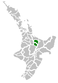
Oropi is a rural settlement located in the Bay of Plenty region of the North Island of New Zealand. It is located 20 kilometres south of Tauranga and 43 kilometres north of Rotorua. It has been suggested that the word Oropi is the Māori language equivalent of Europe. This is derived from the 1860s when government forces were based in the area at the time of the Battle of Gate Pā.

Ōmokoroa is a small urban area in the Western Bay of Plenty District of New Zealand. The suburb is considered part of Greater Tauranga, and is within the Coromandel electorate. Ōmokoroa began as a small rural holiday village, but is expanding to be a commuter town, with a 25-minute drive to Tauranga City.
Rotorua Lakes District or Rotorua District is a territorial authority district in the North Island of New Zealand. It has one urban area of significant size, the city of Rotorua. The district is governed by Rotorua Lakes Council, which is headquartered in Rotorua and is headed by a mayor. The district falls within two regional council areas, with the majority of the area and Rotorua city in the Bay of Plenty region and the rest in the Waikato region. Steve Chadwick has been the mayor of Rotorua since the 2013 local elections.

Galatea is a settlement in the Whakatāne District in the Bay of Plenty region of the North Island of New Zealand.

Pukehina is a beach and township located in the Western Bay of Plenty District and Bay of Plenty Region of New Zealand's North Island. It consists of a white sandy beach, an estuary, farms and several homes. The area is popular with surfing, windsurfing and kite surfing. There is a campground located at the south-eastern end of the beach, and a boat ramp at the estuary.
Waioeka is a rural community in the Ōpōtiki District and Bay of Plenty Region of New Zealand's North Island.

Whakatāne District is a territorial authority district in the North Island of New Zealand. The Whakatāne District Council is headquartered in the largest town, Whakatāne. The district falls within the Bay of Plenty region. Judy Turner has been the mayor of Whakatāne since the 2019 local elections.
Merivale or Parkvale is a suburb of Tauranga, in the Bay of Plenty Region of New Zealand's North Island.
Aongatete is a settlement and rural community in the Western Bay of Plenty District and Bay of Plenty Region of New Zealand's North Island. It is located on State Highway 2, south of Katikati and north-west of Omokoroa. The landscape consists of a long valley descending into the Tauranga Harbour.
Pahoia is a waterfront settlement in the Western Bay of Plenty District and Bay of Plenty Region of New Zealand's North Island.

Tahawai is a rural community in the Western Bay of Plenty District and Bay of Plenty Region of New Zealand's North Island. State Highway 2 runs through it. A peninsula on the eastern side of the area in Tauranga Harbour ends with the small settlements of Tuapiro Point, Ongare Point and Kauri Point, with a walkway between the latter two. A smaller peninsula further north ends at Tanners Point.
Minden is a rural community in the Western Bay of Plenty District and Bay of Plenty Region of New Zealand's North Island. The peak that the area is named after was named after the 1759 Battle of Minden in Prussia by a soldier stationed in Tauranga in 1866 after the Tauranga campaign.
Kopurererua is a rural community in the upper valley of the Kopurererua Stream in the Western Bay of Plenty District and Bay of Plenty Region of New Zealand's North Island. The lower Kopurererua valley is in Tauranga.
Otawa is a rural area in the Western Bay of Plenty District and Bay of Plenty Region of New Zealand's North Island. The Otawa Scenic Reserve has several walking tracks varying between 30 minutes and four hours return. The tracks are described as advanced. The peak of Otawa is 565 metres.

Ngongotahā Valley is a valley formed by the Ngongotahā Stream west of Rotorua, in New Zealand. Springs on the stream were landscaped in 1939 and promoted as Paradise Valley Springs, and the main road into the valley is Paradise Valley Road. Mount Ngongotahā has a peak at 757 metres. A gondala / luge ride operates on the side of the mountain. The springs are still operating, and now include a wildlife park.
Sunnybrook is a western suburb of Rotorua in the Bay of Plenty Region of New Zealand's North Island.
Pomare is a south-western suburb of Rotorua in the Bay of Plenty Region of New Zealand's North Island. Rotorua International Stadium is on the eastern side of Pomare.
Manawahe is a rural area south of Matatā within the Whakatāne District and Bay of Plenty region of New Zealand's North Island. It is based in hills to the west of the Rangitaiki plain.


