Related Research Articles

Whakatāne is a town located in the Bay of Plenty Region in the North Island of New Zealand, 90 kilometres (56 mi) east of Tauranga and 89 kilometres (55 mi) northeast of Rotorua. The town is situated at the mouth of the Whakatāne River. The Whakatāne District is the territorial authority that encompasses the town, covering an area to the south and west of the town, excluding the enclave of Kawerau District.

Katikati is a town in New Zealand located on the Uretara Stream near a tidal inlet towards the northern end of Tauranga Harbour, 28 kilometres south of Waihi and 40 kilometres northwest of Tauranga. State Highway 2 passes through the town; a bypass scheduled to have begun construction in 2008 is on hold.

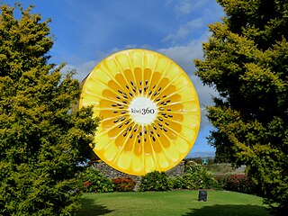
Te Puke is a town located 18 kilometres southeast of Tauranga in the Western Bay of Plenty of New Zealand. It is particularly well known for the cultivation of Kiwifruit.

Mōtītī Island is an island in the Bay of Plenty, off the coast of New Zealand's North Island. It is 11 kilometres (6.8 mi) north-east of Papamoa Beach on the mainland and 22 kilometres (14 mi) north-east of Tauranga. There were 18 homes occupied by 27 people on the island in the 2006 census.

Matakana Island is located in the western Bay of Plenty in New Zealand's North Island. A long, flat barrier island, it is 20 kilometres (12 mi) in length but rarely more than 3 kilometres (1.9 mi) wide. The island has been continuously populated for centuries by Māori tribes that are mostly associated with Ngāi Te Rangi.

Murupara is a town in the Whakatāne District and Bay of Plenty Region of New Zealand's North Island. The town is in an isolated part of the region between the Kaingaroa Forest and Te Urewera protected area, on the banks of the Rangitaiki River, 65 kilometres southeast of Rotorua. Indigenous Māori also make up over 90% of the population.

Ngāi Te Rangi or Ngāiterangi is a Māori iwi, based in Tauranga, New Zealand. Its rohe extends to Mayor Island / Tuhua and Bowentown in the north, to the Kaimai Range in the west, south of Te Puke and to Maketu in the east.

Ngāti Awa is a Māori iwi (tribe) centred in the eastern Bay of Plenty Region of New Zealand. It is made of 22 hapū (subtribes), with 15,258 people claiming affiliation to the iwi in 2006. The Ngāti Awa people are primarily located in towns on the Rangitaiki Plain, including Whakatāne, Kawerau, Edgecumbe, Te Teko and Matatā. Two urban hapū also exist in Auckland and Wellington.

Ngāti Ranginui is a Māori iwi (tribe) in Bay of Plenty, New Zealand. Its rohe extends from Waihi in the north, to the Kaimai Range in the west, to south of Te Puke in the south, and to Tauranga in the east. The rohe does not extend offshore to Matakana Island or Mayor Island / Tuhua.

Ngāti Pūkenga is a Māori iwi centred in Tauranga in the Bay of Plenty region of New Zealand. Its rohe extends to Mayor Island / Tuhua and Waihi in the north, to the Kaimai Range in the west, south of Te Puke and to Maketu in the east, and it has tribal holdings in Whangarei, Hauraki and Maketu.
The Bay of Plenty Times is the regional daily paper for the Bay of Plenty area, including Tauranga, in the North Island of New Zealand.

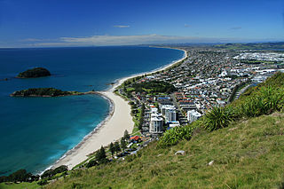
Tauranga is a coastal city in the Bay of Plenty Region and the fifth-most populous city of New Zealand, with an urban population of 161,800, or roughly 3% of the national population. It was settled by Māori late in the 13th century, colonised by Europeans in the early 19th century, and was constituted as a city in 1963.

Te Puna is a rural community near Tauranga in the Bay of Plenty region of New Zealand's North Island. It is located on State Highway 2, north of Bethlehem and south of Katikati.
Matahi is a rural valley in the Whakatāne District and Bay of Plenty Region of New Zealand's North Island.

Welcome Bay is a suburb of Tauranga, New Zealand. It is located 7 kilometres (4.3 mi) from central Tauranga. Neighbouring suburbs include Hairini and Maungatapu. There are a number of schools in Welcome Bay, including three primary schools.
Otamarakau is a beach and community in the Western Bay of Plenty District and Bay of Plenty Region of New Zealand's North Island, just south of Pukehina.

On 29 January 2020, the New Zealand Upgrade Programme was announced by Prime Minister Jacinda Ardern. The programme is a $12 billion infrastructure package to improve roads, rail, hospitals and schools around the country, of which $8 billion has been allocated and the other $4 billion is part of the infrastructure section of the 2020 budget.
Waiohau or Waiōhau is a rural valley in the Whakatāne District and Bay of Plenty region of New Zealand's North Island, north of Murupara and south of Lake Matahina.
Poroporo is a rural community in the Whakatāne District and Bay of Plenty Region of New Zealand's North Island. It is located south-west of Whakatāne, inland from the settlement.

Motuhoa Island is in the western Bay of Plenty of New Zealand's North Island, in Tauranga Harbour, over 2 km (1.2 mi) long, up to 35 m (115 ft) high and about 1.25 km (0.78 mi) southeast of Ōmokoroa, with 5 km (3.1 mi) of low cliff, which on the north is up to 8 m (26 ft) high, with almost no vegetation. A boat ramp is near the east tip of the island, on the north shore. For the 2018 census, the island had a population too small to record. Shore skinks live on the beaches.
References
- ↑ Staff reporter (3 February 2020). "Delays on SH2 between Katikati and Tauranga". New Zealand Media and Entertainment. Bay of Plenty Times.
- ↑ Kelway, Sam (10 June 2019). "Tauranga couple appeal for information after at least 1000 avocados stolen from their orchard". Television New Zealand. 1 News.
- ↑ Liddle, Rosalie (8 April 2017). "Memorial pou raised in Whakamārama". Sun Media. Sun Live.
- ↑ Moorfield, John. "whakamārama". maoridictionary.co.nz. Te Aka Online Māori Dictionary.
- ↑ Liddle, Rosalie (5 May 2019). "Anything goes at Atrium Gallery". Sun Media. Sun Live.
- ↑ Liddle, Rosalie (31 August 2019). "Steampunk art at Atrium Gallery". Sun Media. Sun Live.
- ↑ Staff reporter (5 July 2019). "Man missing on rural outskirts of Tauranga found dead". stuff.co.nz.
- ↑ Liddle, Rosalie (23 September 2019). "Police pursuit ends in capture". Sun Media. Sun Live.
- ↑ Fleming, Caroline (29 January 2020). "Family's frantic search for missing Tauranga man Julian Varley". New Zealand Media and Entertainment. Bay of Plenty Times.
- ↑ Staff reporter (15 May 2020). "Police reveal new details in case of missing Tauranga man Julian Varley". New Zealand Media and Entertainment. Bay of Plenty Times.
- ↑ "Bark processing plant fire in Whakamarama". Sun Media. Sun Live. 25 February 2020.
- ↑ "Large Whakamarama bark fire sends smoke across Tauranga city". New Zealand Media and Entertainment. Bay of Plenty Times. 31 March 2020.
- ↑ Conchie, Sandra (5 March 2020). "Te Puna fire guts garage and rental home". New Zealand Media and Entertainment. Bay of Plenty Times.
- ↑ "Large scrub fire in Whakamarama". Sun Media. Sun Live. 12 April 2020.
- ↑ Staff writer (9 April 2020). "Tauranga school girl delighted Easter Bunny and Tooth Fairy deemed essential by PM". Television New Zealand. 1 News.
- ↑ "Tooth fairy and Easter Bunny are 'essential workers,'". Washington Post . 6 April 2020.
- ↑ "Jacinda Ardern: Easter Bunny "Essential Worker"". New York Times . 6 April 2020.
- ↑ "New Zealand PM adds 2 crucial figures to list of essential workers: The Tooth Fairy and Easter Bunny". CNN. 6 April 2020.
- ↑ "Jacinda Ardern: 'Tooth Fairy and Easter bunny are essential workers'". BBC News . 6 April 2020.
- 1 2 Demause, Neil (12 April 2020). "Mainstream media favors Easter Bunny news over global lessons of pandemic". Salon .
- ↑ "Te Kāhui Māngai directory". tkm.govt.nz. Te Puni Kōkiri.
- ↑ "Māori Maps". maorimaps.com. Te Potiki National Trust.
- ↑ "Marae Announcements" (Excel). growregions.govt.nz. Provincial Growth Fund. 9 October 2020.
- ↑ "Whakamarama School Ministry of Education School Profile". educationcounts.govt.nz. Ministry of Education.
- ↑ "Whakamarama School Education Review Office Report". ero.govt.nz. Education Review Office.