Te Puna | |
|---|---|
Town | |
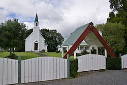 St Joseph's Church | |
 | |
| Coordinates: 37°41′45″S176°04′22″E / 37.695823°S 176.072806°E | |
| Country | New Zealand |
| Region | Bay of Plenty |
| Territorial authority | Western Bay of Plenty District |
| Ward | Kaimai |
| Electorates | |
| Government | |
| • Territorial authority | Western Bay of Plenty District Council |
| • Regional council | Bay of Plenty Regional Council |
| Area | |
| • Total | 24.71 km2 (9.54 sq mi) |
| Population (June 2023) [2] | |
| • Total | 3,710 |
| • Density | 150/km2 (390/sq mi) |
Te Puna is a rural community near Tauranga in the Bay of Plenty region of New Zealand's North Island. It is located on State Highway 2, north of Bethlehem and south of Katikati.
Contents
The local Te Puna Quarry has been redeveloped by volunteers into a park. [3]
Former National Party leader Todd Muller was raised in Te Puna in the 1970s, where his parents started a kiwifruit orchard. [4] He attended Te Puna Primary School. [5] He entered parliament at the 2014 general election as the MP for Bay of Plenty, and was National Party leader and the Leader of the Opposition from 22 May to 14 July 2020. [6]