Waitakaruru | |
---|---|
Locality | |
Coordinates: 37°14′S175°23′E / 37.233°S 175.383°E Coordinates: 37°14′S175°23′E / 37.233°S 175.383°E | |
Country | New Zealand |
Region | Waikato region |
District | Hauraki District |
Ward | Plains Ward |
Electorates | |
Government | |
• Territorial Authority | Hauraki District Council |
• Regional council | Waikato Regional Council |
Area | |
• Total | 23.14 km2 (8.93 sq mi) |
Population (2018 Census) [2] | |
• Total | 243 |
• Density | 11/km2 (27/sq mi) |
Time zone | UTC+12 (NZST) |
• Summer (DST) | UTC+13 (NZDT) |
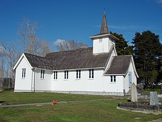
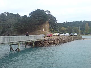
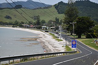
Waitakaruru is a rural community in the Hauraki District and Waikato region of New Zealand's North Island. It is situated at the mouth of Waitakaruru River [3]
Waitakaruru is in an SA1 statistical area which covers 23.14 km2 (8.93 sq mi). [1] The SA1 area is part of the larger Hauraki Plains North statistical area.
Year | Pop. | ±% p.a. |
---|---|---|
2006 | 237 | — |
2013 | 222 | −0.93% |
2018 | 243 | +1.82% |
Source: [2] |
The SA1 area had a population of 243 at the 2018 New Zealand census, an increase of 21 people (9.5%) since the 2013 census, and an increase of 6 people (2.5%) since the 2006 census. There were 105 households, comprising 132 males and 111 females, giving a sex ratio of 1.19 males per female. The median age was 41.8 years (compared with 37.4 years nationally), with 48 people (19.8%) aged under 15 years, 42 (17.3%) aged 15 to 29, 114 (46.9%) aged 30 to 64, and 39 (16.0%) aged 65 or older.
Ethnicities were 85.2% European/Pākehā, 28.4% Māori, 4.9% Pacific peoples, and 4.9% Asian. People may identify with more than one ethnicity.
Although some people chose not to answer the census's question about religious affiliation, 56.8% had no religion, 23.5% were Christian, 3.7% had Māori religious beliefs, 1.2% were Buddhist and 4.9% had other religions.
Of those at least 15 years old, 21 (10.8%) people had a bachelor's or higher degree, and 66 (33.8%) people had no formal qualifications. The median income was $27,100, compared with $31,800 nationally. 21 people (10.8%) earned over $70,000 compared to 17.2% nationally. The employment status of those at least 15 was that 90 (46.2%) people were employed full-time, 24 (12.3%) were part-time, and 6 (3.1%) were unemployed. [2]
Hauraki Plains North statistical area, which also includes Pipiroa, covers 178.74 km2 (69.01 sq mi) [1] and had an estimated population of 1,300 as of June 2022, [4] with a population density of 7.3 people per km2.
Year | Pop. | ±% p.a. |
---|---|---|
2006 | 1,089 | — |
2013 | 1,098 | +0.12% |
2018 | 1,155 | +1.02% |
Source: [5] |
Hauraki Plains North had a population of 1,155 at the 2018 New Zealand census, an increase of 57 people (5.2%) since the 2013 census, and an increase of 66 people (6.1%) since the 2006 census. There were 447 households, comprising 603 males and 552 females, giving a sex ratio of 1.09 males per female. The median age was 40.7 years (compared with 37.4 years nationally), with 234 people (20.3%) aged under 15 years, 213 (18.4%) aged 15 to 29, 519 (44.9%) aged 30 to 64, and 189 (16.4%) aged 65 or older.
Ethnicities were 89.4% European/Pākehā, 17.1% Māori, 3.6% Pacific peoples, 2.9% Asian, and 2.1% other ethnicities. People may identify with more than one ethnicity.
The percentage of people born overseas was 10.6, compared with 27.1% nationally.
Although some people chose not to answer the census's question about religious affiliation, 56.6% had no religion, 29.6% were Christian, 1.0% had Māori religious beliefs, 0.5% were Buddhist and 2.1% had other religions.
Of those at least 15 years old, 93 (10.1%) people had a bachelor's or higher degree, and 231 (25.1%) people had no formal qualifications. The median income was $33,600, compared with $31,800 nationally. 138 people (15.0%) earned over $70,000 compared to 17.2% nationally. The employment status of those at least 15 was that 462 (50.2%) people were employed full-time, 168 (18.2%) were part-time, and 24 (2.6%) were unemployed. [5]
Waitakaruru School is a co-educational state primary school, [6] with a roll of 100 as of February 2023. [7] [8]
Hauraki District is a territorial authority within the Hauraki region of New Zealand. The seat of the council is at Paeroa.
Cape Runaway is the eastern extremity of the Bay of Plenty in New Zealand's North Island. It is located 157 kilometres northeast off Whakatāne and 65 kilometres west of East Cape.
Colville, a small town in the north of the Coromandel Peninsula in the North Island of New Zealand, lies 26 kilometres north of Coromandel in Colville Bay on the Hauraki Gulf, and is the northernmost town of any note on the peninsula. North of Colville, 28 kilometres of rough road lead to the small settlement of Port Jackson, close to the peninsula's northwesternmost point, Cape Colville and 20 km to Port Charles on the northeastern side.
Ngatea is a small town on the Hauraki Plains in the North Island of New Zealand. It is located 18 kilometres southwest of Thames and 70 kilometres southeast of Auckland. Ngatea lies on the Piako River, eight kilometres south of its outflow into the Firth of Thames.
Clevedon, previously known as Wairoa South, is a rural town in Auckland, New Zealand, located in the Franklin ward, one of the thirteen administrative divisions of Auckland city. The town is governed by the Auckland Council. The town is the centre of an administrative ward of Franklin which takes in much of the largely rural area to the east of the urban heart of the city.
Turua is a small village community on the banks of the Waihou River in the Hauraki Plains in the North Island of New Zealand. It is located close to the mouth of the river, 9 kilometres south of the Firth of Thames and 12 km south of Thames. It is connected by road to SH 25 in the north and SH 2 to the south.
Kaharoa is a rural area of New Zealand approximately 20 km from Rotorua and 45 km from Tauranga on the North Island. At its highest point the area is approx. 500m above sea level, with some areas able to see towards the coastline of the eastern Bay of Plenty.
Galatea is a settlement in the Whakatāne District in the Bay of Plenty region of the North Island of New Zealand.
Matatoki is a locality on the Hauraki Plains of New Zealand. It lies on State Highway 26, south east of Thames and north of Paeroa. The Matatoki Stream runs from the Coromandel Range through the area to join the Waihou River.
Kennedy Bay is a locality in the north eastern Coromandel Peninsula of New Zealand. The Harataunga and Omoho Streams flow from the Coromandel Range past the settlement and into the bay to the east.
Maromaku is a locality in the Northland Region of the North Island of New Zealand. Kawakawa is north, and Towai is southeast. State Highway 1 runs past Maromaku to the north, and the North Auckland Line runs through it.
One Tree Hill is a suburb of Auckland, New Zealand. The residential part of the suburb is located to the east and south-east of Maungakiekie / One Tree Hill, from which it takes its name, with the volcanic peak located within the suburb's boundaries.
Waikeria is a rural community in the Otorohanga District and Waikato region of New Zealand's North Island.
Hexton is a village and rural area in the Gisborne District of New Zealand's North Island. It is located north-west of Gisborne City, and includes the settlements of Makauri and Waerengaahika.
Pukeatua is a rural farming community in Waipa District and Waikato region of New Zealand's North Island. It is situated at the south-western foot of the Pukeatua hill, of the Maungatautari mountain range.
Marotiri is a rural community in the Taupō District and Waikato region of New Zealand's North Island. State Highway 32 runs through it.
Pipiroa is a rural community in the Hauraki District and Waikato region of New Zealand's North Island.
Kerepehi is a rural community in the Hauraki District and Waikato region of New Zealand's North Island. The alternative spelling Kerepeehi was in use until 1933.
Rural Waiheke comprises the eastern and southern parts of Waiheke Island in the Hauraki Gulf near Auckland, in New Zealand. Apart from small settlements at Ōmiha and Orapiu, the area south and east of Onetangi is mostly private farmland. Waiheke Island Aerodrome is approximately in the centre of the island.
Kawakawa Bay is an east coast bay and settlement in the Franklin area of New Zealand's Auckland Region.