A dosa is a thin savory pancake in South Indian cuisine made from a fermented batter of ground black lentils and rice. Dosas are served hot, often with chutney and sambar. Dosa is a signature dish in South India and Sri Lanka, and is popularly served in their respective restaurants around the world.

Sambar is a lentil-based vegetable stew, cooked with pigeon pea and tamarind broth. It is popular in South Indian, Sri Lankan and Maldivian cuisines. The stew has been adapted into Burmese cuisine as a popular accompaniment to Burmese curries.

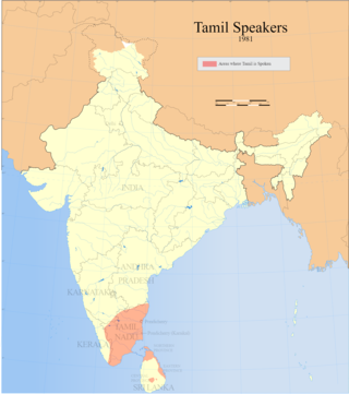
Tamil cuisine is a culinary style originating in the southern Indian state of Tamil Nadu and other countries of South Asia like Sri Lanka. Meats, along with rice, legumes, and lentils, are also popular. Dairy products and tamarind are used to provide sour flavors. On special occasions, traditional Tamil dishes are served in a traditional manner, using banana leaves in place of utensils. After eating, the banana leaves are then used as a secondary food for cattle. A typical breakfast meal consists of idli or dosa with chutney. Lunch includes rice, sambar, curd, kuzhambu, and rasam.

Dindigul, also spelt Thindukkal, is a city in the Indian state of Tamil Nadu. It is the administrative headquarters of the Dindigul district. Dindigul is located 420 km (260 mi) southwest from the state capital, Chennai, 100 km (62 mi) away from Tiruchirappalli, 66 km (41 mi) away from Madurai and 72 km away from the Tex City of Karur. The city is known for its locks and biryani. Parts of Dindigul Districts like Palani, Oddanchatram, Vedasandur, Nilakottai, Kodaikanal, Natham, Athoor.

Idiyappam, also known as string hopper, indiappa, noolputtu, noolappam, or ottu shavige, is a string hopper dish originating from the Indian state of Kerala and Tamilnadu. It consists of rice flour pressed into noodles, laid into a flat disc-like shape and steamed. The dish also spread to Southeast Asia, where it is called putu mayam in Malaysia and Singapore, and putu mayang in Indonesia.

Tiruchirappalli District is one of the 38 districts, located along the Kaveri River, in Tamil Nadu, India. The headquarters of the district is the city of Tiruchirappalli.

Karur District is one of the 38 districts in the Indian state of Tamil Nadu. The main town in Karur District is the city of Karur, which is also the district headquarters. The district has a population of 1,064,493 with a sex-ratio of 1,015 females for every 1,000 males, according to 2011 census.
V.S.K.Valasai is a city in Dindigul district in the Indian state of Tamil Nadu.

Aravakurichi is a panchayat town and a Taluk headquarters in Karur district in the state of Tamil Nadu, India. Aravakurichi is well known in Tamil Nadu as a major market for Moringa oleifera vegetable. Aravakurichi is the headquarters of Aravakurichi taluk which consists of 40 revenue Villages.
Kalavai is a panchayat town in Ranipet district in the Indian state of Tamil Nadu. The main occupation represented in the area is farming. The town has a pond and a lake after rainy season. Villagers use the lake water and palar river for irrigation. Corporation Bank, State Bank Of India and Indian Bank are the banks that have branches in the locality. The secondary occupation is garment outlets. One government higher secondary school is also located in a nearby village.

Manjampatti Valley is a 110.9 km2 (42.8 sq mi) protected area in the eastern end of Indira Gandhi Wildlife Sanctuary and National Park (IGWS&NP) in Tirupur District, Tamil Nadu, South India. It is a pristine drainage basin of shola and montane rainforest with high biodiversity recently threatened by illegal land clearing and cultivation.
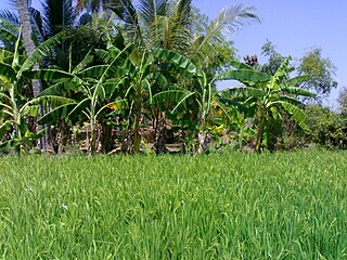
Athiyur is a village in the Kumbakonam taluk of Thanjavur district, Tamil Nadu India. It is located 44 km north of the district headquarters in Thanjavur. Agriculture is the basis of the economy. Almost every job and/or occupation is in some way or another agriculturally related.
Kadambankulam is a small village in the Radhapuram taluk of Tirunelveli District, Tamil Nadu in southern India. It is seven kilometers from the larger town of Valliyur. Kadambankulam, a hamlet in the extreme south of Vallioor, covers an area of 30 km2. As the major occupation of the villagers is agriculture, around 60% of the area is covered by agricultural land. Kadambankulam enjoys a tropical climate with an average temperature of 31˚C. It has an average annual rainfall of 150 cm, receiving rain both from the Southwest Monsoon and the Northeast Monsoon. Kadambankulam has a population of around 6,000, out of which 3,100 are men and 2,900 are women. Everyone in this village is a member of Ayyavazhi, a monistic belief system closely linked with Hinduism. Kadambankulam is the only known village where all the people belong to the same religion and live as a single community.
Elangakurichy is a traditional village in Tiruchirappalli district, in the Indian state of Tamil Nadu, and it is located near Vaiyampatty, Manapparai and Tovarankurichchi. It is located almost at the geographic centre of the state, at a distance of 57 kilometres south-west of Tiruchirappalli and 53 kilometres north-east of Dindigul on national highway NH 45.

Iluppaiyur or Eluppaiyur is a small village in Sathanur Panchayat in Tiruchirappalli District in Tamil Nadu, India. This village belongs to Thinnanur Post and Musiri Taluk. Most of the people in this village belongs to the Arunattu Vellalar caste. Iluppaiyur village is located 4 km from Karattampatti and approximately 30 km distance from Trichy. The main economy is based on agriculture. Main agriculture product is Rice.The major source of irrigation is Wells. The population of Iluppaiyur is around 500. Presently, around 300 voters dwell in this village. Musiri Panchayat Union Elementary School Iluppaiyur is located here with strength around 60.

Maramadakki is a village in the Aranthangi revenue block of Pudukkottai district, Tamil Nadu, India.
Nakkasalem is a village in the Perambalur district in the state of Tamil Nadu, India.

Vedal, pronounced as Vaedaal is a village in the Cheyyur taluk of the Chengalpattu district of Tamil Nadu, India. It is located 105 kilometres (65 mi) away from Chennai and 45 kilometres (28 mi) away from Pondicherry on the Tamil Nadu East Coast Road ECR. Vedal is situated about 10 kilometres (6.2 mi) far from the Bay of Bengal coast.
Madichel is a village in Vilavancode taluk, Kanniyakumari district, Tamil Nadu, India. The village is near Kuzhithurai, a historical seaport where merchants came from across the Arabian sea in ancient times.
Endiyur is a village panchayat located in Tindivanam, in the Villupuram district of Tamil-Nadu, India. The pin code of Endiyur is 604 001 and the telephone STD code is 04147. The native language of the village is Tamil. The village is connected to nearby places through SH-134. The nearest railway station is Tindivanam which is 5 km from the village. Puducherry is 32.8 km from Endiyur. The village has a grand Draupadi Amman temple in the center of the village and the villagers celebrate 7 to 10 days of temple festival in the month of May or June every year including theemidhi thiruvizha.


