Prahova County is a county (județ) of Romania, in the historical region Muntenia, with the capital city at Ploiești.

The Ialomița is a river of Southern Romania. It rises from the Bucegi Mountains in the Carpathians. It discharges into the Borcea branch of the Danube in Giurgeni. It is 417 km (259 mi) long, and its basin area is 10,350 km2 (4,000 sq mi). Its average discharge at the mouth is 45 m3/s (1,600 cu ft/s). Ialomița County takes its name from this river.
The Prahova is a river of Southern Romania, which rises from the Bucegi Mountains, in the Southern Carpathians. It is a left tributary of the Ialomița. It flows into the Ialomița in Dridu Snagov. The upper reach of the river, upstream of the confluence with the river Azuga is sometimes called the Prahovița.

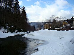
Prahova Valley is the valley where the Prahova river makes its way between the Bucegi and the Baiu Mountains, in the Carpathian Mountains, Romania. It is a tourist region, situated about 100 km (62 mi) north of the capital city of Bucharest.
Valea Seacă may refer to several places in Romania:
The Teleajen is a left tributary of the river Prahova in southern Romania. Its source is at 1,754 m (5,755 ft) elevation in the Ciucaș Mountains, north of Roșu Peak and the locality of Cheia. Upstream from its confluence with the Gropșoarele in Cheia, it is also called Berea or Cheița. It flows through the Cheia hollow, by the towns of Vălenii de Munte and Boldești-Scăeni and the city of Ploiești. It discharges into the Prahova near Palanca. Its length is 122 km (76 mi) and its basin size is 1,656 km2 (639 sq mi).
The Limbășel is a right tributary of the river Azuga in Romania. Its source is in the Baiu Mountains, near Predeal. It flows into the Azuga east of the town Azuga. Its length is 8 km (5.0 mi) and its basin size is 14 km2 (5.4 sq mi).
The Bărzăuța is a right tributary of the river Uz in Romania. It discharges into the Uz near Valea Uzului. Its length is 26 km (16 mi) and its basin size is 156 km2 (60 sq mi).

The Doftana is a left tributary of the river Prahova in Romania. It discharges into the Prahova in Bănești near Câmpina. It flows through the villages Trăisteni, Teșila, Seciuri, Brebu Mânăstirei, Doftana and the city Câmpina. Its length is 51 km (32 mi) and its basin size is 410 km2 (160 sq mi). The upper reach of the river, upstream of the confluence with the Urlățelu is also called Predeluș or Doftănița.
The Valea Cerbului is a right tributary of the river Prahova in Romania. It source is in the Bucegi Mountains. It flows into the Prahova in Bușteni. Its length is 7 km (4.3 mi) and its basin size is 26 km2 (10 sq mi).
The Izvorul Dorului is a right tributary of the river Prahova in Romania. It discharges into the Prahova in Sinaia. Its length is 16 km (9.9 mi) and its basin size is 33 km2 (13 sq mi).
The Bistra is a river in south-western Romania, in the Banat. It is a right tributary of the river Timiș. Its valley delimits the Țarcu Mountains to the south from the Poiana Ruscă mountains to the north. Its name is derived from a Slavic word meaning "fast-flowing".

The Olteț is a right tributary of the river Olt in Romania. It discharges into the Olt in Fălcoiu. Its total length is 185 km (115 mi), and its drainage basin area is 2,663 km2 (1,028 sq mi).
The Cricovul Dulce or Cricov is a left tributary of the river Ialomița in Romania. It discharges into the Ialomița near Podu Văleni. It flows through the towns and villages Valea Lungă-Cricov, Iedera de Jos, Moreni, Ion Luca Caragiale, Vlădeni, Băltița, Hăbud and Crivățu. Its length is 80 km (50 mi) and its basin size is 579 km2 (224 sq mi). Part of the water from the river Prahova is diverted towards the Cricovul Dulce by the canal Iazul Morilor Prahova.
The Bistra Mărului is a left tributary of the river Bistra in Romania. It discharges into the Bistra in Oțelu Roșu. Its length is 35 km (22 mi) and its basin size is 293 km2 (113 sq mi).
The Drajna is a left tributary of the river Teleajen in Romania. It discharges into the Teleajen in Piatra. It flows through the villages Slon, Valea Lespezii, Cerașu, Valea Borului, Podurile, Drajna, Pițigoi and Drajna de Jos. Its length is 25 km (16 mi) and its basin size is 106 km2 (41 sq mi).
The Vărbilău is a right tributary of the river Teleajen in Romania. It discharges into the Teleajen in Dumbrăvești. It flows through the villages Târșoreni, Scurtești, Ștefești, Aluniș, Livadea, Vărbilău, Poiana Vărbilău, Coțofenești and Dumbrăvești. Its length is 37 km (23 mi) and its basin size is 217 km2 (84 sq mi).
Pârâul Roșu may refer to the following rivers in Romania:
Cășăria River may refer to:
Valea Mărului may refer to several places in Romania: