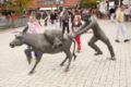
History
From the 8th century, the area around the Soester plain was under the Merovingian dynasty. The name “Sassendorf” indicates that it was a Saxon settlement. Mention was made of salt springs in the area appear in the 10th century, and were noted by the ambassador of the Caliphate of Cordoba to the court of Emperor Otto the Great in 973. Along with the surrounding area, the village was under the control of the Archbishopric of Cologne from at least the 12th century; however exploitation of the salt springs was the right of free peasant families in the area. From the 19th century, the brine produced in the area was used for bathing and medicinal purposes, and the first therapy center or spa was opened in 1852. Commercial salt production faced declining yields, and was largely discontinued in 1934, and completely discontinued by 1952. The village was renamed from “Sassendorf” to Bad Sassendorf officially in 1906.
From February 15, 1944, to April 4–5, 1945, inmates of the Neuengamme concentration camp used as the Eisenbahnbaubrigade 11 repaired rail tracks at the railway station Soest and between Bad Sassendorf and Soest. They slept in freight train waggons on the track between Bad Sassendorf and Soest. After an air raid end-February 1945 the inmates slept in a nearby farm. At the cemetery Bad Sassendorf a memorial plaque is installed on the burying place of the dead. [3]

Porta Westfalica is a town in the district of Minden-Lübbecke, in North Rhine-Westphalia, Germany.

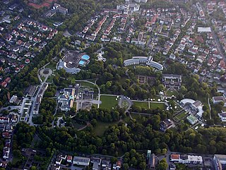
Soest is a city in North Rhine-Westphalia, Germany. It is the capital of the Soest district.

Winterberg is a town in the Hochsauerland district of North Rhine-Westphalia, central Germany and a major winter sport resort of the Wintersport Arena Sauerland.

Willich is a town in the district of Viersen, in North Rhine-Westphalia, Germany. It is 20 km west of Düsseldorf, 14 km north of Mönchengladbach, 10 km south of Krefeld, about 30 kilometres east of the border with the Netherlands and 45 km east of Roermond.

Bocholt is a city in the north-west of North Rhine-Westphalia, Germany, part of the district Borken. It is situated 4 km south of the border with the Netherlands. Suderwick is part of Bocholt and is situated at the border annex to Dinxperlo.

Horn-Bad Meinberg is a German city in the Lippe district in the north-east of North Rhine-Westphalia on the edge of the Teutoburg forest. The district Bad Meinberg is a spa resort. It has 17,263 inhabitants (2019). It was formed in 1970 by merging various other municipalities that had grown together, including Bad Meinberg and Horn - the new entity's original name was Bad Meinberg-Horn, before taking its present name.

Bad Salzuflen is a town and thermal spa resort in the Lippe district of North Rhine-Westphalia, Germany. At the end of 2013, it had 52,121 inhabitants.

Lippstadt is a town in North Rhine-Westphalia, Germany. It is the largest town within the district of Soest. Lippstadt is situated about 60 kilometres east of Dortmund, 40 kilometres south of Bielefeld and 30 kilometres west of Paderborn.

Werl is a town located in the district of Soest in North Rhine-Westphalia, Germany.

Salzkotten is a town in the district of Paderborn, in North Rhine-Westphalia, Germany. The name Salzkotten is based in the former salt production, which gave Salzkotten its raison d'être. Salt was found in the salty springs around the town.
Bad Oeynhausen is a spa town on the southern edge of the Wiehengebirge in the district of Minden-Lübbecke in the East-Westphalia-Lippe region of North Rhine-Westphalia, Germany. The closest larger towns are Bielefeld and Hanover.

Warstein is a municipality with town status in the district of Soest, in North Rhine-Westphalia, Germany. It is located at the north end of Sauerland.
Waltrop is a town in the district of Recklinghausen, in North Rhine-Westphalia, Germany. It is situated on the Datteln-Hamm Canal, approximately 15 km east of Recklinghausen and 15 km north-west of Dortmund.

Erwitte is a town in the district of Soest, in North Rhine-Westphalia, Germany.

Rüthen is a town in the district of Soest, in North Rhine-Westphalia, Germany.

Anröchte is a municipality in the district of Soest, in North Rhine-Westphalia, Germany.

Ense is a municipality in the district of Soest, in North Rhine-Westphalia, Germany.
Lippetal is a municipality in the district of Soest, in North Rhine-Westphalia, Germany.

Möhnesee is a municipality in the district of Soest, in North Rhine-Westphalia, Germany.

Welver is a municipality in the district of Soest, in North Rhine-Westphalia, Germany.
This page is based on this
Wikipedia article Text is available under the
CC BY-SA 4.0 license; additional terms may apply.
Images, videos and audio are available under their respective licenses.