
Udaipur district is one of the 50 districts of Rajasthan state in western India. The historic city of Udaipur is the administrative headquarters of the district. The district is part of the Mewar region of Rajasthan.
Sri Ganganagar district is the northernmost district of Rajasthan state of India.

Pratapgarh district is the 33rd district of Rajasthan, created on 26 January 2008. It is a part of Udaipur Division and has been carved out from the erstwhile tehsils of Chittorgarh, Udaipur and Banswara districts. Pratapgarh town is the administrative headquarters of the district.

Anupgarh district is a new north-west district of Rajasthan state in India. It was established on 7 August 2023 after curving it out of Sri Ganganagar District.
Bidhwan is a village and administrative unit with a democratically elected panchayat samiti in the Loharu, Siwani Tehsil of Bhiwani District under Bhiwani-Mahendragarh Lok Sabha constituency and Hisar Division of Haryana state, India.
Girwa is a tehsil of Udaipur district, Rajasthan, India. The administrative headquarter of the tehsil is located in the City of Udaipur.

Kotra is a tehsil of Udaipur district in Rajasthan, India, consisting of 262 revenue villages and 31 panchayats. The tehsil is bordered to the north by Pali and Sirohi districts, to the east by Gogunda and Jhadol tehsils, and to the south by Gujarat state. The tehsil headquarter is located in the village of Kotra, southwest of the Udaipur at a distance of 57 km and 120 km by road.
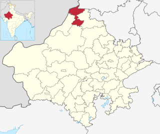
Bargaon is a census town in the Girwa tehsil of Udaipur district, Rajasthan, India. It is situated on the Udaipur-Gogunda highway, around 4 kilometres (2.5 mi) from the city centre, 2 kilometres (1.2 mi) from Bhuwana and around 387 kilometres (240 mi) from the state capital at Jaipur. It has Dungla Tehsil towards East, Bhopalsagar Tehsil towards North, Mavli Tehsil towards North and Bhadesar Tehsil towards East.
Semari is a tehsil of Salumbar district in Rajasthan, India. The administrative headquarter of the tehsil is located in the town of Semari.

Jhadol tehsil is an administrative sub-division of Udaipur district in Rajasthan, India. Jhadol tehsil was formerly called Phalasia tehsil. The tehsil consists of 283 revenue villages and 45 panchayats. The tehsil headquarter is located in the village of Jhadol, southwest of the district headquarters, Udaipur.

Gogunda is a tehsil of Udaipur district in Rajasthan, India. The tehsil consists of 232 revenue villages, 45 panchayats, and 1 census town. The tehsil headquarter is located in the town of Gogunda.

Kherwara is a tehsil of Udaipur district in Rajasthan, India. The tehsil consists of 195 revenue villages and 1 census town. The tehsil headquarter is located in the town of Kherwara Chhaoni. The tehsil is part of the Kherwara panchayat samiti (block).

Lasadiya is a tehsil of Salumbar district in Rajasthan, India.The tehsil consists of 114 revenue villages which are organized in 19 gram panchayats The tehsil headquarter is located in the village of Lasadiya. The boundaries of Lasadiya tehsil are conterminous with those of Lasadiya panchayat samiti.

Mavli is a tehsil of Udaipur district in Rajasthan, India.The tehsil consists of 179 revenue villages which are organized in 42 gram panchayats and one town (Mavli). The tehsil headquarter is located in the town of Mavli. The boundaries of Mavli tehsil are conterminous with those of Mavli panchayat samiti.
Bhindar is a tehsil of Udaipur district in Rajasthan, India. The tehsil headquarter is located in the town of Bhinder.
Kanor is a tehsil of Udaipur district in Rajasthan, India. As of April 2019, it is the 15th tehsil of Udaipur district and the youngest one, having been formed in 2018.
Vallabhnagar is a tehsil of Udaipur district in Rajasthan, India.

Salumbar is a tehsil of Salumbar district in Rajasthan, India.The tehsil consists of 268 revenue villages which are organized in 46 gram panchayats and one town. The tehsil headquarter is located in the town of Salumbar.

Rishabhdeo is a tehsil of Udaipur district in Rajasthan, India.The tehsil consists of 125 revenue villages and one town. The tehsil headquarter is located in the town of Rishabhdeo.
Sarada is a tehsil of Salumbar district in Rajasthan, India. It consists of 152 villages and 3 towns. The tehsil headquarter is located in the village of Sarada.

