Alangudi is a municipality in the Pudukkottai district of the Indian state of Tamil Nadu, that serves as the headquarters for Alangudi taluk, one of the 11 taluks in Pudukkottai district. The town has been ruled, at different times, by the Cholas, Mutharaiyars, Early Pandyas, Thondaimans, and the British. It is situated about 395 kilometres (245 mi) southwest of Chennai and about 75 kilometres (47 mi) southeast of Tiruchirappalli. Tamil Nadu's first women Asiad Santhi Soundarajan is from Alangudi municipality.

Belonia is a town and municipal council in South Tripura district, Tripura, India. It is also the headquarters of South Tripura District. It is linked with Agartala by National Highway 108A from Belonia to Jolaibari and via National Highway 8 from Jolaibari to Agartala. Belonia lies on the border with Bangladesh.

Bihpuria is a small town in Lakhimpur district in the state of Assam, India. Bihpuria is located at 27.03°N 93.90°E.
Jogendranagar is a census town in West Tripura district in the Indian state of Tripura.

Kamalpur is a town and a Nagar Panchayat in Dhalai District in the Indian state of Tripura. Around 93 km from the state capital Agartala. Kamalpur is the largest Sub-divisional town in Dhalai District.

Lilong (Thoubal) is a town with Municipal Council in Thoubal District in the Indian state of Manipur.

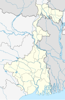
Manikpur is a census town in Sankrail CD Block of Howrah Sadar subdivision in Howrah district in the Indian state of West Bengal. It is a part of Kolkata Urban Agglomeration.

Mayang Imphal is a town and municipal council in Imphal West district in the Indian state of Manipur. Pin code of Mayang Imphal is 795132.

Naoriya Pakhanglakpa is a census town in Imphal West district in the Indian state of Manipur.

Sabroom is a town and a nagar panchayat on South Tripura district in the Indian state of Tripura. Sabroom is located in the banks of the Feni River, which separates India and Bangladesh. Most of the people speak in Noakhailla, a dialect of the Bengali language.

Serpur is a census town in Samserganj CD Block in Jangipur subdivision of Murshidabad district in the Indian state of West Bengal.

Teliamura is a town and a nagar panchayat in Khowai district in the Indian state of Tripura. It is on the National Highway No.08 of India. It is also the headquarters of the recently included sub-division of Teliamura. It is 45 km from Agartala, Capital of Tripura, 35 km from Khowai and 42 km from Ambassa.

Tentulkuli is a census town in Domjur CD Block of Howrah Sadar subdivision in Howrah district in the Indian state of West Bengal. It is close to Salap and also a part of Kolkata Urban Agglomeration.

Bhuvanagiri is a Taluka in the Cuddalore district of the Indian state of Tamil Nadu. It is the birthplace of a South Indian saint, Sri Raghavendra Swami and is close to Maruthur, the birthplace of Saint Ramalinga Adigalar.

Nainital Cantonment is a cantonment town in Nainital district in the Indian state of Uttarakhand, close to the hill station of Nainital. Established in the year 1878, today the Nainital Cantonment is a Class IV cantonment. Current CEO of cantonment board is Koli Akash Santosh.

Pratapgarh is a census town in West Tripura district in the Indian state of Tripura.

Sikanderpur is a town and a nagar panchayat in Kannauj district in the Indian state of Uttar Pradesh.

Kailashahar is a municipal council city, the headquarters of the Unakoti district in the Indian state of Tripura.

Gandhigram is a town in Tripura, India. located around 10 km from city centre Agartala. It comes under Sadar district. It has an old age home called Sandhyoneer.

Santirbazar is a town and Municipal Council in South Tripura district, Tripura, India. It is linked with Agartala by National Highway 8 via Udaipur and Bishramganj Upto Subroom.


